34.7 miles
Foyle
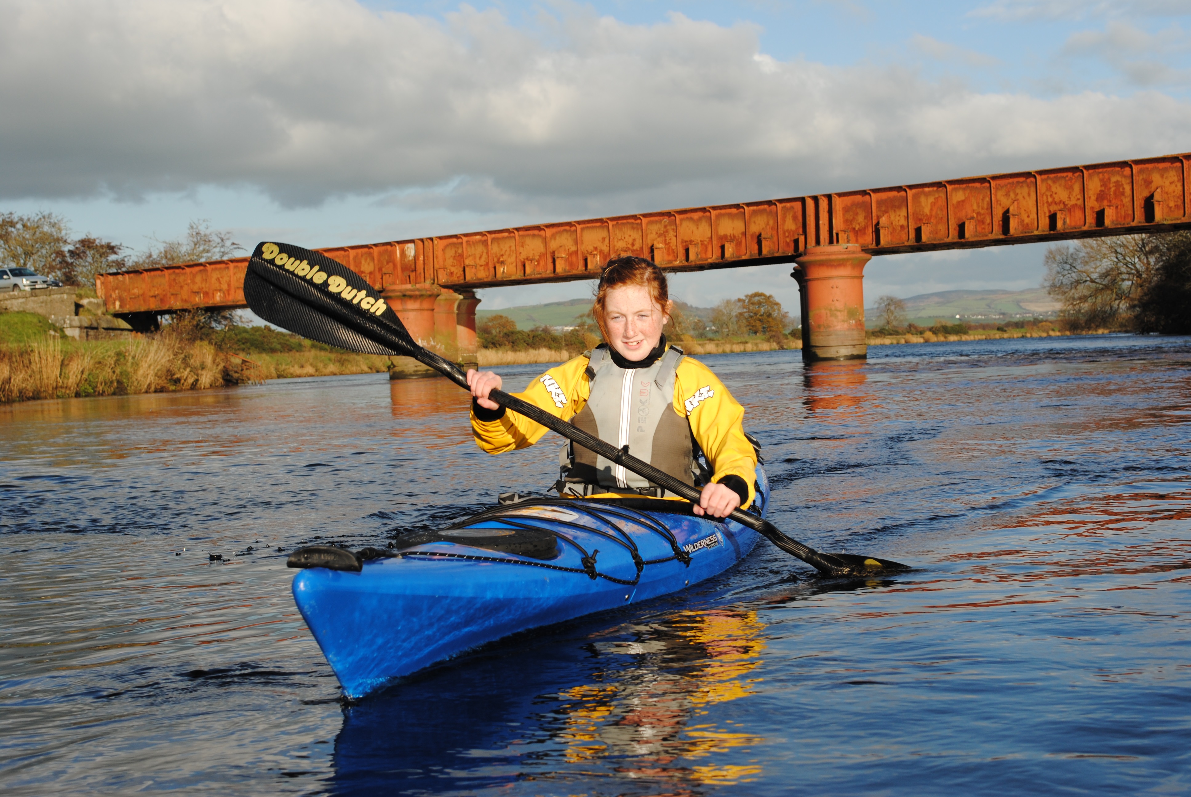
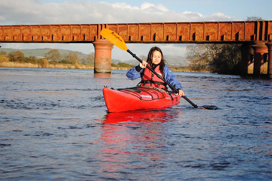
Stretching almost 33 miles from the start of the River Foyle to the Atlantic Ocean, the Foyle Canoe Trail dips in and out of both Northern Ireland and the Republic of Ireland. From Lifford, this unique trail runs through rural countryside, the historic city of Derry~Londonderry, along Lough Foyle’s varied coastline to the bustling seaside town of Moville. Paddlers will enjoy a mix of water conditions, from flat water to sea lough and - since the trail is tidal - the river section can even be paddled upstream!
This river and sea canoe trail offers varied paddling opportunities for a wide range of abilities. Running through the centre of Derry~Londonderry, the trail gives paddlers the opportunity to explore the city’s wealth of attractions, hospitality and entertainment. The city is quite majestic when viewed from the river. Paddlers will gain a unique perspective of Gothic buildings, vast bridges, and riverside trains and can avail of secure tie-up at the Foyle Marina pontoon, right in the heart of the city (prior arrangement necessary).
The River Foyle is tidal along its entire length - from Lifford to Culmore Point where it spills into the vast sea lough of Lough Foyle. The river ranges from 50 to 900m in width with some remarkably shallow stretches at various points. It offers a selection of camping opportunities and some excellent chances to explore this unfrequented part of Ireland. At places such as ‘the islands’ (on the upper stretch) look out for kingfishers, sand martins, otters and even sometimes seals. On the broader parts of the river, huge flocks of whooper swans, herds of geese, drifts of waders and rafts of duck can be seen in the winter months.
Downstream of the city is Lough Foyle, which is approximately 111 square miles in size with an average depth of 5m. The trail runs up the west coast of the lough along the Inishowen Peninsula, a key element of the Wild Atlantic Way, offering an attractive mix of woods, sandy beaches, wavecut platforms and streams. The eastern side of the lough is very shallow, with a lot of it drying out at low water.
From the northern end of the lough, seasoned canoeists can link up with the North Coast Sea Kayak Trail, which begins at Magilligan Point only 4.7 km from Moville (with an additional 0.7 miles paddle across the Narrows at Greencastle, taking care to avoid the regular car ferry). The East Inishowen Sea Kayak Trail also follows the peninsula, concluding at Malin Head.
This trail guide has been designed by canoeists for canoeists. It provides practical information including official access points, campsites and tidal details. Please see CanoeNI.com for more information.
Please note: Lough Foyle is an important shellfish fishery - primarily mussels and oysters. In places, oysters are cultivated in cages on trestles along the shore. These are submerged at high water and should not be disturbed. Watch out for mussel boats manoeuvring - they will turn sharply when fishing.
- Access Egress Points Full details can be found at http://www.canoeni.com/canoe-trails/foyle/
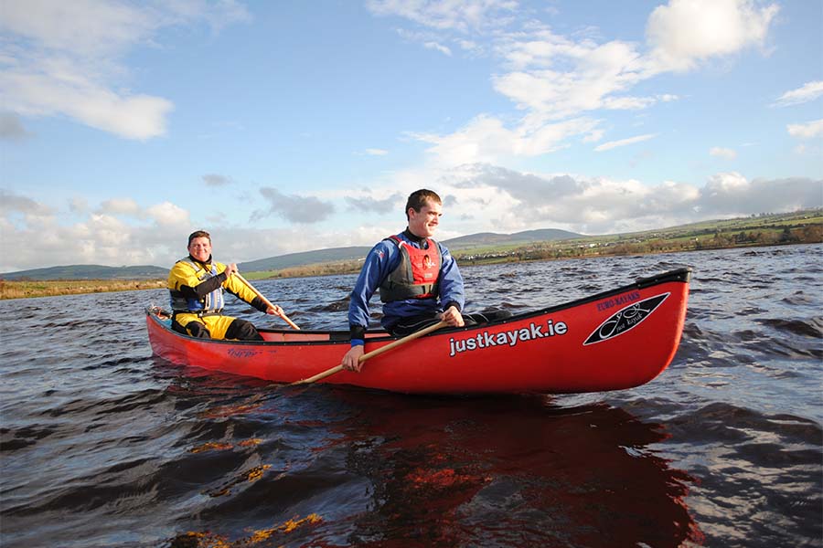
- Suitable For Paddlers can use kayaks or open canoes on the Foyle Canoe Trail. It is even possible to erect a sail on certain sections to take advantage of a following wind. The 33 mile Foyle Canoe Trail offers paddling on a wide, tidal river that runs into Lough Foyle. The river runs through beautiful countryside teeming with wildlife and laden with history! There are no weirs or other obstructions but watch out for drying ground as the tide drops!
- Safety Canoeing is an adventure sport and as such should be treated with respect. If you are new to the sport, it is advisable to join an organized club or take some lessons with a canoeing provider, both options will offer expert coaching. Full details can be found at www.canoeni.com