2.1 miles
Linear
Moderate
Ballymacormick Point
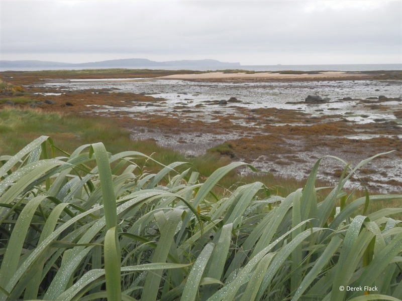
This rocky outcrop along the shores of Belfast Lough, on the west side of Groomsport is covered in gorse and shrubs, good for rough walking, and for spotting birds, flowers and foxes.
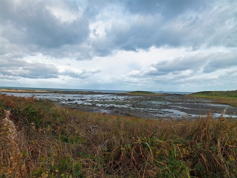
Ballymacormick is just on the edge of Belfast Lough, so there are interesting views north and west.
TRAIL INFORMATION
The National Trust acquired Ballymacormick Point in 1952 to save this breathtaking section of coastline from being developed.
Since then, its importance for nature conservation has being recognised through designation as an Area of Special Scientific Interest. It also forms part of the Outer Ards Special Protection Area, recognising its importance on a European scale.
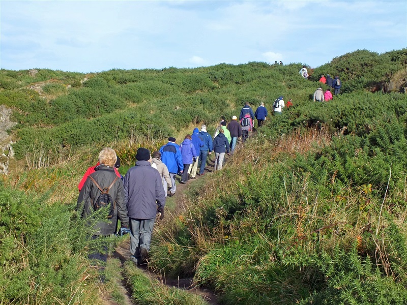
Ballymacormick Point can be accessed from either Groomsport Harbour or Ballyholme Bay, by following the North Down Coastal Path/Ulster Way. There are stunning views across Belfast Lough to Carrickfergus and as far as the Mull of Galloway on a clear day.
The informal path meanders around the coastline around Ballymacormick Point through flower-rich grasslands and gorse scrub.
Visitors will see plenty of birds throughout the year. The coastline supports a range of waterbirds including brent geese which come here in winter from their breeding grounds in Arctic Canada. Both shelduck and oystercatcher breed and you may even catch a glimpse of a seal hauled out on the rocks.
The National Trust also owns Cockle Island within Groomsport Harbour. This important seabird colony is home to three species of tern, including nationally important numbers of Sandwich and Arctic terns. Cameras on Cockle Island beam live footage of breeding seabirds into the Cockle Row Seabird Centre in Groomsport. This a joint project between National Trust, North Down Borough Council and British Trust for Ornithology. For opening hours, contact: (028) 9127 0069.
For more information on Ballymacormick Point, contact the National Trust on (028) 4278 7769.
TRAIL INFORMATION
The National Trust acquired Ballymacormick Point in 1952 to save this breathtaking section of coastline from being developed.
Since then, its importance for nature conservation has being recognised through designation as an Area of Special Scientific Interest. It also forms part of the Outer Ards Special Protection Area, recognising its importance on a European scale.
Ballymacormick Point can be accessed from either Groomsport Harbour or Ballyholme Bay, by following the North Down Coastal Path/Ulster Way. There are stunning views across Belfast Lough to Carrickfergus and as far as the Mull of Galloway on a clear day.
The informal path meanders around the coastline around Ballymacormick Point through flower-rich grasslands and gorse scrub.
Visitors will see plenty of birds throughout the year. The coastline supports a range of waterbirds including brent geese which come here in winter from their breeding grounds in Arctic Canada. Both shelduck and oystercatcher breed and you may even catch a glimpse of a seal hauled out on the rocks.
The National Trust also owns Cockle Island within Groomsport Harbour. This important seabird colony is home to three species of tern, including nationally important numbers of Sandwich and Arctic terns. Cameras on Cockle Island beam live footage of breeding seabirds into the Cockle Row Seabird Centre in Groomsport. This a joint project between National Trust, North Down Borough Council and British Trust for Ornithology. For opening hours, contact: (028) 9127 0069.
For more information on Ballymacormick Point, contact the National Trust on (028) 4278 7769.
GETTING TO THE START
- Point of Interest Ballymacormick Point, Groomsport
- Facilities There are no shops or toilet facilities on site. There are a number of shops, cafes restaurants and toilet facilities in Groomsport.
- Dog Policy Dogs must be kept under close control
- Accessibility Information
Accessibility Grade: Grade 4 Terrain: Rocky Coastal Path, and footpath Toilet Facility: No Signage: No - Getting to the Start The route can be started from either end of the route, at Banks Car Park at Ballyholme Bay or from Groomsport.
- Public Transport Translink – journeyplanner.translink.co.uk
- Level of Difficulty
 Moderate TRAIL GRADE DISCLAIMER
 The trail grades shown on OutmoreNI.com and WalkNI.com are based on desk-based assessments of available trail information. The categories—Easy, Moderate, Strenuous, and Very Strenuous—follow the Sustainable Trails Development Guide grading system.
These grades are provided as a general guide to help users choose trails that may be suitable for them. They are not a substitute for official, on-site grading or safety information provided by the relevant land manager, which may differ from the information on these websites.
Outdoor activities involve inherent risks, including the risk of injury, death, property damage, and other hazards. By using information from OutmoreNI.com and WalkNI.com, you acknowledge that you do so at your own risk. OutmoreNI.com and WalkNI.com accept no responsibility or liability for any loss, injury, or damage arising from the use of this information.
Conditions on trails can change, and the actual environment may differ from what is described online. Users should always exercise their own judgment, take appropriate precautions, and remain responsible for their own safety and conduct at all times.
All information provided on OutmoreNI.com and WalkNI.com is intended as a guide only and should be used alongside your own experience, awareness, and careful decision-making.
Moderately challenging trails of varying widths with some short, steep climbs and descents. The surface may vary throughout, be slippery and uneven in places. Expect there to be obstacles like exposed roots, narrow gates, stiles and long sets of steps.
Outdoor clothing and sturdy footwear are recommended.