1 miles
Loop
Moderate
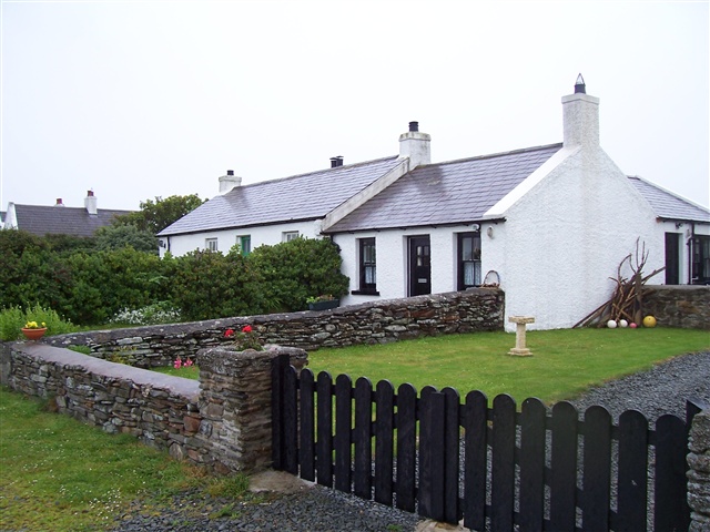
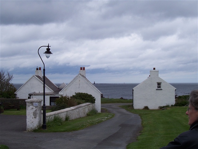
Kearney
The beauty of the rugged coastline, simple character of the dwellings and unspoilt, timeless character of the village makes Kearney truly special.
TRAIL INFORMATION
The shoreline trail is linear and can be taken in either direction. The degree of difficulty is moderate with uneven surfaces. The terrain is made up of grass, dirt, sand and rocky shoreline. The two-miles of coastline beyond the village, including cliffs, a low rocky foreshore, a small pocket of salt marsh, sandy beaches
GETTING TO THE START
- Point of Interest Unspoilt beauty, Mary Ann Donnan Room
- Facilities Information room, car park, and public toilets.
- Accessibility Information
Accessibility Grade: Grade 3 Terrain: Rocky shoreline Toilet Facility: No Signage: No - Getting to the Start Kearney is on the coast directly east of Portaferry. From the west and south the ferry is needed leaving from Strangford village. From the north the A20 or A2 south will get you to the small lanes taking you to Kearny.
- Public Transport Translink – journeyplanner.translink.co.uk
- Level of Difficulty
 Moderate TRAIL GRADE DISCLAIMER
 The trail grades shown on OutmoreNI.com and WalkNI.com are based on desk-based assessments of available trail information. The categories—Easy, Moderate, Strenuous, and Very Strenuous—follow the Sustainable Trails Development Guide grading system.
These grades are provided as a general guide to help users choose trails that may be suitable for them. They are not a substitute for official, on-site grading or safety information provided by the relevant land manager, which may differ from the information on these websites.
Outdoor activities involve inherent risks, including the risk of injury, death, property damage, and other hazards. By using information from OutmoreNI.com and WalkNI.com, you acknowledge that you do so at your own risk. OutmoreNI.com and WalkNI.com accept no responsibility or liability for any loss, injury, or damage arising from the use of this information.
Conditions on trails can change, and the actual environment may differ from what is described online. Users should always exercise their own judgment, take appropriate precautions, and remain responsible for their own safety and conduct at all times.
All information provided on OutmoreNI.com and WalkNI.com is intended as a guide only and should be used alongside your own experience, awareness, and careful decision-making.
Moderately challenging trails of varying widths with some short, steep climbs and descents. The surface may vary throughout, be slippery and uneven in places. Expect there to be obstacles like exposed roots, narrow gates, stiles and long sets of steps.
Outdoor clothing and sturdy footwear are recommended.