1.5 miles
Loop
Easy
Mount Stewart - Red Trail
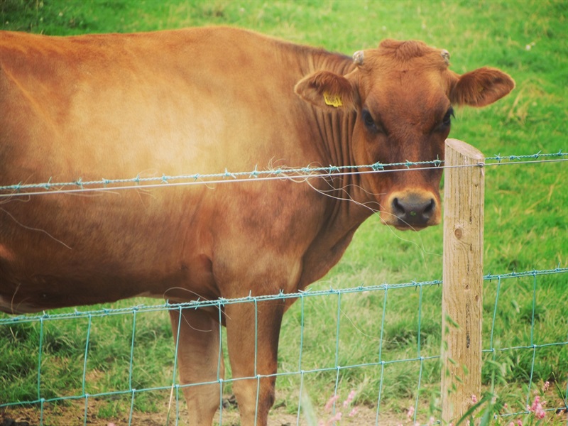
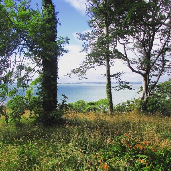
Welcome to the Red Trail on the Mount Stewart estate. Mount Stewart gardens were acquired by National Trust in 1957, with the house following in 1977; the wider estate was acquired in 2014, bringing the total area to just under 1000 acres. The first areas that have been opened to visitors incorporates the Red, Blue, and Yellow Trails. The Red trail is the main circular walk, and loops through a mixture of woodland and farmland. There are a number of points of interest along the walk, including working farmland, the ruins of a folly, and water features. Red squirrels may be seen in the trees, or running along the ground to get into a tree. The best times to walk the red trail are early in the morning or late afternoon, especially in Autumn.
TRAIL INFORMATION
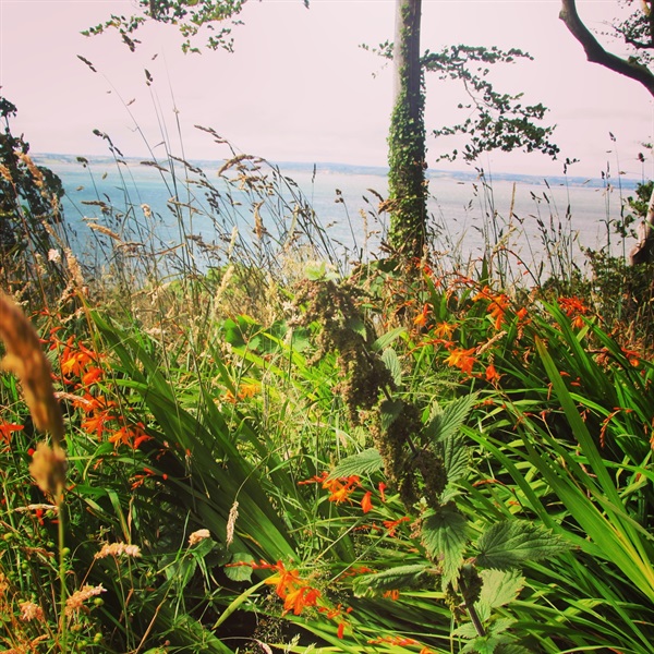
Starting at the Trail Head (Grid Reference: J556694), walk until the path forks in two. A finger post will show two possible Red Trails. To go up to the Temple of the Winds, take the left-hand stone trail route; this is a steep 470m hill climb to the Temple, and a steep descent on the other side. The view from the top is worth the climb. In spring, there are small clusters of bluebells on the top of the hill; there are blue, white and pink varieties present there. To stay on a level path, take the right-most grassed route; you will be avoiding the Temple of the Winds on this route. This 400m long route has a wide array of plants, including primroses. Both routes will converge at the bottom of the hill, and will continue to a small stone bridge. On both routes, red squirrels may be seen in the trees, or running along the ground to get into a tree. Common spotted orchids are present in a patch of grass beside a blue gate before the stone bridge.
As indicated on finger post, continue on the stone trail to the left and continue on the trail until the meadow for approx. 500m. Along this trail, you will be walking through woodland, with an open glade part way along. During summer months, the glade and along the sunny edge of the burn (stream) is alive with butterflies.
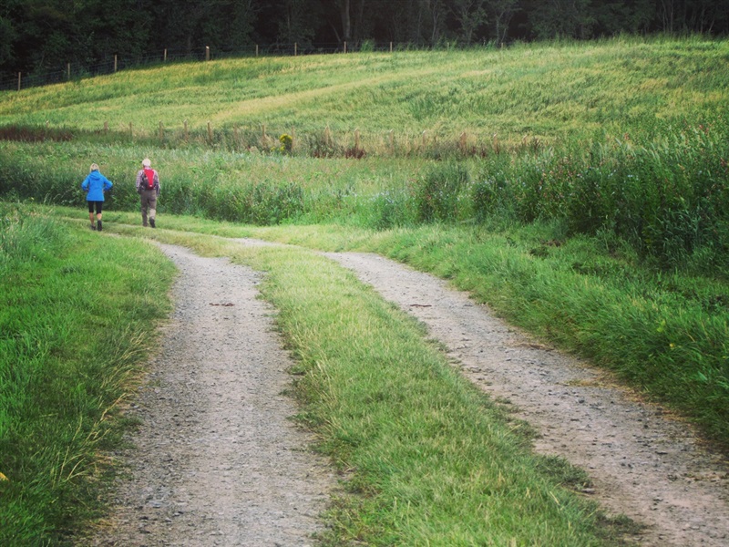
As you pass out of the woodland and through the gateway, follow the cut grass path through the meadow until you come to a wooden gate. During summer, you may see butterflies, such as Ringlets, Small Whites, and Meadow Browns, flying around the flowers. Other invertebrates, like moths, bees and beetles, may also be seen in this area. Buzzards may be seen flying over the hills year-round, along with various different bird species during the year.
After passing through the wooden gate follow the farm lane which turns to the left. (At this point you can take an optional side path to the right into the Glen woodland and up to the ruins of a folly building as indicated on finger posts). Continue on the farm lane for about 500m, until you get to a wooden pedestrian gate and an agricultural gate with the old piggery buildings on your right.
As indicated on the fingerposts, go through the wooden gate, and follow the woodchip trail for approx. 100m to the top of the hill. This is moderately steep and the path winds its way up into ‘New Hill’, there are two steps. In May/June, the hill is covered in Bluebells.
At the top of the hill, turn right on the wood chip trail and continue down the hill for approx. 350m. The hill is very gradual, and becomes very steep just before re-joining the main stone trail just above the trail head.
Turn right when you join the stone trail, and continue for 100m until you reach the Trail Head (end of the trail.)
A short 0.7 mile yellow trail and longer 2.2 mile blue trail are also sign posted should you wish to take an alternative route.
Please note trails are uneven and steep in places; they may be muddy at certain times of the year. Further information and trail maps are available at the trail head booth.
TRAIL INFORMATION
Starting at the Trail Head (Grid Reference: J556694), walk until the path forks in two. A finger post will show two possible Red Trails. To go up to the Temple of the Winds, take the left-hand stone trail route; this is a steep 470m hill climb to the Temple, and a steep descent on the other side. The view from the top is worth the climb. In spring, there are small clusters of bluebells on the top of the hill; there are blue, white and pink varieties present there. To stay on a level path, take the right-most grassed route; you will be avoiding the Temple of the Winds on this route. This 400m long route has a wide array of plants, including primroses. Both routes will converge at the bottom of the hill, and will continue to a small stone bridge. On both routes, red squirrels may be seen in the trees, or running along the ground to get into a tree. Common spotted orchids are present in a patch of grass beside a blue gate before the stone bridge.
As indicated on finger post, continue on the stone trail to the left and continue on the trail until the meadow for approx. 500m. Along this trail, you will be walking through woodland, with an open glade part way along. During summer months, the glade and along the sunny edge of the burn (stream) is alive with butterflies.
As you pass out of the woodland and through the gateway, follow the cut grass path through the meadow until you come to a wooden gate. During summer, you may see butterflies, such as Ringlets, Small Whites, and Meadow Browns, flying around the flowers. Other invertebrates, like moths, bees and beetles, may also be seen in this area. Buzzards may be seen flying over the hills year-round, along with various different bird species during the year.
After passing through the wooden gate follow the farm lane which turns to the left. (At this point you can take an optional side path to the right into the Glen woodland and up to the ruins of a folly building as indicated on finger posts). Continue on the farm lane for about 500m, until you get to a wooden pedestrian gate and an agricultural gate with the old piggery buildings on your right.
As indicated on the fingerposts, go through the wooden gate, and follow the woodchip trail for approx. 100m to the top of the hill. This is moderately steep and the path winds its way up into ‘New Hill’, there are two steps. In May/June, the hill is covered in Bluebells.
At the top of the hill, turn right on the wood chip trail and continue down the hill for approx. 350m. The hill is very gradual, and becomes very steep just before re-joining the main stone trail just above the trail head.
Turn right when you join the stone trail, and continue for 100m until you reach the Trail Head (end of the trail.)
A short 0.7 mile yellow trail and longer 2.2 mile blue trail are also sign posted should you wish to take an alternative route.
Please note trails are uneven and steep in places; they may be muddy at certain times of the year. Further information and trail maps are available at the trail head booth.
GETTING TO THE START
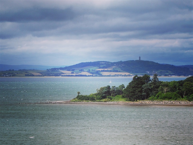
- Point of Interest Temple of the Winds. working farmland, the ruins of a folly and water features
- Facilities Toilets located in the reception area, courtyard, and car park. Gift shop, wi-fi, ice cream shop, tea room, garden shop and baby-changing facilities available. Maps and Braille House guides are available from reception. Sensory Garden Trail The following facilities are available for users with limited mobility: – Café (wheelchair accessible) – Disabled toilets – Disabled parking – Wheelchair available – Mobility vehicle available
- Dog Policy Dogs must be kept on leads
- Accessibility Information
Accessibility Grade: Grade 4 Terrain: woodland floor and gravel Toilet Facility: No Signage: No - Getting to the Start 15 miles SE of Belfast on Newtownards-Portaferry Road, A20 5 miles SE of Newtownards.
- Public Transport Translink – journeyplanner.translink.co.uk
- Level of Difficulty
 Easy TRAIL GRADE DISCLAIMER
 The trail grades shown on OutmoreNI.com and WalkNI.com are based on desk-based assessments of available trail information. The categories—Easy, Moderate, Strenuous, and Very Strenuous—follow the Sustainable Trails Development Guide grading system.
These grades are provided as a general guide to help users choose trails that may be suitable for them. They are not a substitute for official, on-site grading or safety information provided by the relevant land manager, which may differ from the information on these websites.
Outdoor activities involve inherent risks, including the risk of injury, death, property damage, and other hazards. By using information from OutmoreNI.com and WalkNI.com, you acknowledge that you do so at your own risk. OutmoreNI.com and WalkNI.com accept no responsibility or liability for any loss, injury, or damage arising from the use of this information.
Conditions on trails can change, and the actual environment may differ from what is described online. Users should always exercise their own judgment, take appropriate precautions, and remain responsible for their own safety and conduct at all times.
All information provided on OutmoreNI.com and WalkNI.com is intended as a guide only and should be used alongside your own experience, awareness, and careful decision-making.
Relatively flat or gently rolling trails with a mostly smooth surface. You might come across some obstacles like bridges, gates and steps.
Normal clothing and footwear can be worn.