3.9 miles
Loop
Moderate
Redburn Country Park
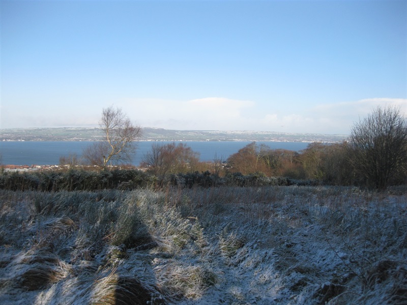
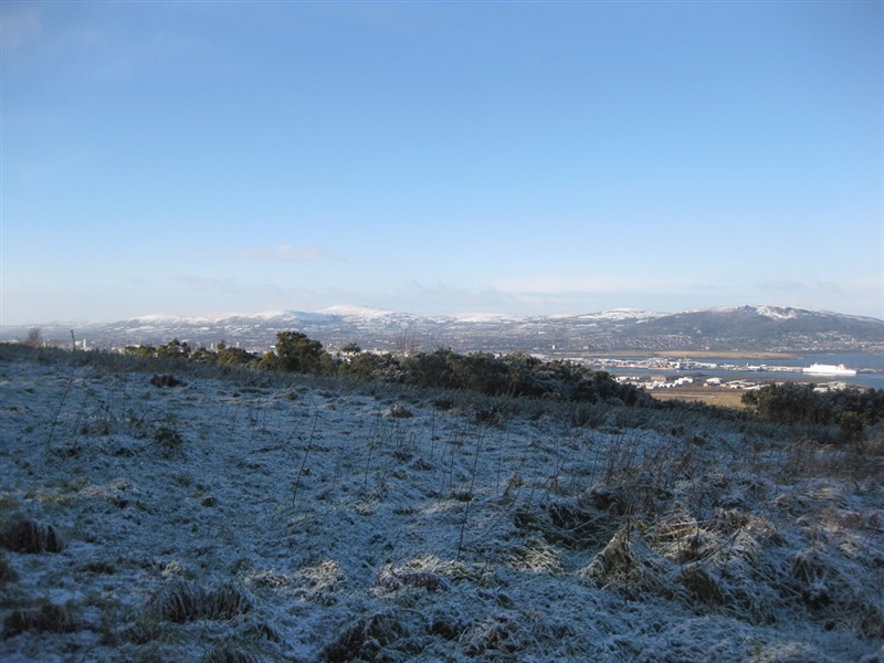
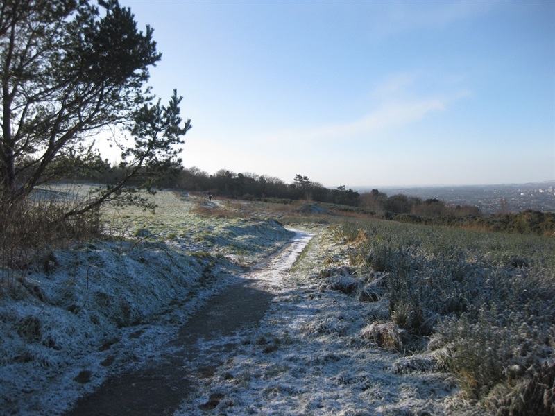
A variety of walks are available in Redburn. All walks start from the main car park. Those who do venture to the top are rewarded with amazing views over Belfast Lough.
TRAIL INFORMATION
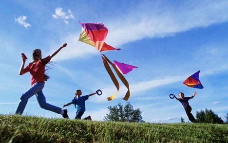
The beauty and variety of the mixed woodland, the compact distances and ever-changing woodland species make this a wonderful place to explore on foot. Whether you are a serious rambler, trail runner or simply want to take a short stroll, follow the woodland paths and enjoy the wildlife on the way. Journey to the hilltop and enjoy the panoramic viewpoint. At the top visitors are rewarded with breathtaking views from Belfast Lough to the south Antrim hills. This area is excellent for bird watching, plane spotting, kite flying or exploring the woodland and grassland habitats.
For those with an equestrian interest, the woodland trails can be enjoyed on horseback, creating your own unique experience. Recommended bridle paths are marked to ensure you get the best routes through the Park. Permits to use the bridle paths can be obtained from Crawfordsburn Country Park.
TRAIL INFORMATION
The beauty and variety of the mixed woodland, the compact distances and ever-changing woodland species make this a wonderful place to explore on foot. Whether you are a serious rambler, trail runner or simply want to take a short stroll, follow the woodland paths and enjoy the wildlife on the way. Journey to the hilltop and enjoy the panoramic viewpoint. At the top visitors are rewarded with breathtaking views from Belfast Lough to the south Antrim hills. This area is excellent for bird watching, plane spotting, kite flying or exploring the woodland and grassland habitats.
For those with an equestrian interest, the woodland trails can be enjoyed on horseback, creating your own unique experience. Recommended bridle paths are marked to ensure you get the best routes through the Park. Permits to use the bridle paths can be obtained from Crawfordsburn Country Park.
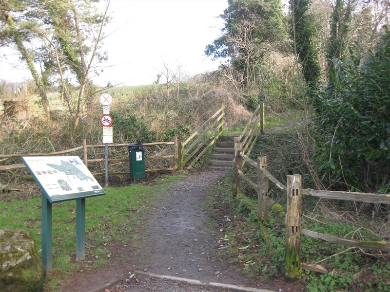
GETTING TO THE START
- Point of Interest Amazing views of Belfast Lough
- Facilities Carpark
- Dog Policy Dogs should be under control. Please clean up after your dog.
- Accessibility Information
Accessibility Grade: Grade 5 Terrain: Off road paths Toilet Facility: No Signage: No - Getting to the Start Follow the A2 from Belfast to Bangor. Redburn Country Park is signposted from the junction at Palace Barricks.
- Public Transport Translink – journeyplanner.translink.co.uk
- Level of Difficulty
 Moderate TRAIL GRADE DISCLAIMER
 The trail grades shown on OutmoreNI.com and WalkNI.com are based on desk-based assessments of available trail information. The categories—Easy, Moderate, Strenuous, and Very Strenuous—follow the Sustainable Trails Development Guide grading system.
These grades are provided as a general guide to help users choose trails that may be suitable for them. They are not a substitute for official, on-site grading or safety information provided by the relevant land manager, which may differ from the information on these websites.
Outdoor activities involve inherent risks, including the risk of injury, death, property damage, and other hazards. By using information from OutmoreNI.com and WalkNI.com, you acknowledge that you do so at your own risk. OutmoreNI.com and WalkNI.com accept no responsibility or liability for any loss, injury, or damage arising from the use of this information.
Conditions on trails can change, and the actual environment may differ from what is described online. Users should always exercise their own judgment, take appropriate precautions, and remain responsible for their own safety and conduct at all times.
All information provided on OutmoreNI.com and WalkNI.com is intended as a guide only and should be used alongside your own experience, awareness, and careful decision-making.
Moderately challenging trails of varying widths with some short, steep climbs and descents. The surface may vary throughout, be slippery and uneven in places. Expect there to be obstacles like exposed roots, narrow gates, stiles and long sets of steps.
Outdoor clothing and sturdy footwear are recommended.