0.9 miles
Loop
Moderate
Ardress House - Ladies Mile
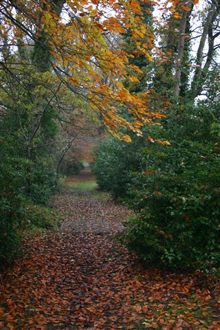
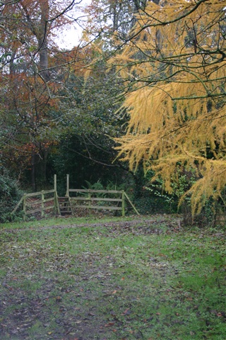
The short Ladies Mile Walk is a circular, relatively flat, beautiful woodland walk. The degree of difficulty is easy to moderate. Some small bridges and stiles have to be traversed.
TRAIL INFORMATION
The short Ladies Mile Walk is a circular, relatively flat, tranquil woodland walk around the perimeter of Ardress House. The house is in sight more or less for all of the walk and has some delightful views.
* Please note that National Trust entrance pricing applies for this walk. *
GETTING TO THE START
- Point of Interest Ardress House (seasonal tours), woodlands, orchards
- Facilities Car parking, house tours and toilets open seasonally (17 March-30 September).Picnic tables throughout the property.Programme of events. The following facilities are available for users with limited mobility: – Disabled toilets – (when house is open – seasonal)
- Dog Policy Dogs are not allowed in the farmyard. Dogs must be kept on leads
- Accessibility Information
Accessibility Grade: Grade 4 Terrain: unsurfaced paths, muddy in place Toilet Facility: No Signage: No - Getting to the Start Exit 13 off the M1 south, follow the brown signs for 3 miles
- Public Transport Translink – journeyplanner.translink.co.uk
- Level of Difficulty
 Moderate TRAIL GRADE DISCLAIMER
 The trail grades shown on OutmoreNI.com and WalkNI.com are based on desk-based assessments of available trail information. The categories—Easy, Moderate, Strenuous, and Very Strenuous—follow the Sustainable Trails Development Guide grading system.
These grades are provided as a general guide to help users choose trails that may be suitable for them. They are not a substitute for official, on-site grading or safety information provided by the relevant land manager, which may differ from the information on these websites.
Outdoor activities involve inherent risks, including the risk of injury, death, property damage, and other hazards. By using information from OutmoreNI.com and WalkNI.com, you acknowledge that you do so at your own risk. OutmoreNI.com and WalkNI.com accept no responsibility or liability for any loss, injury, or damage arising from the use of this information.
Conditions on trails can change, and the actual environment may differ from what is described online. Users should always exercise their own judgment, take appropriate precautions, and remain responsible for their own safety and conduct at all times.
All information provided on OutmoreNI.com and WalkNI.com is intended as a guide only and should be used alongside your own experience, awareness, and careful decision-making.
Moderately challenging trails of varying widths with some short, steep climbs and descents. The surface may vary throughout, be slippery and uneven in places. Expect there to be obstacles like exposed roots, narrow gates, stiles and long sets of steps.
Outdoor clothing and sturdy footwear are recommended.