2.9 miles
Loop
Moderate
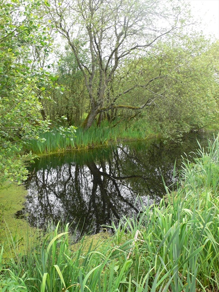
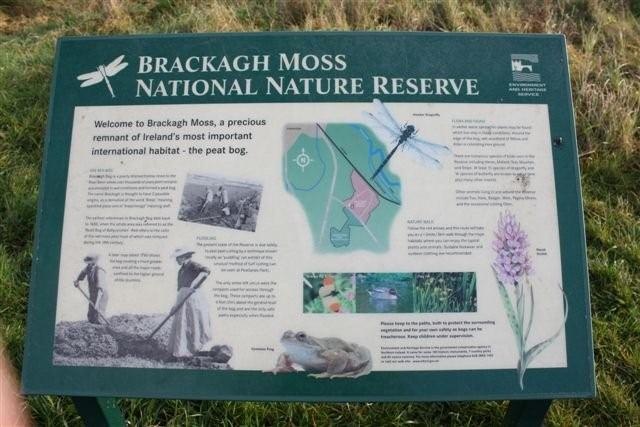
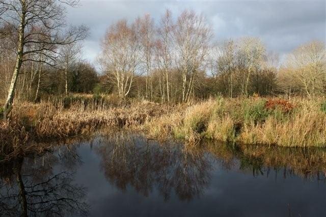
Brackagh Bog
The trail is on ramparts through an extensive area of low lying peat. The site is very natural and unspoilt.
TRAIL INFORMATION
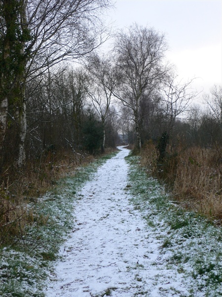
The walk starts at the entrance ot the Nature Reserve. Follow the red waymarkers around the site in a circuit. The last 100m are along a minor road back to the start.
TRAIL INFORMATION
The walk starts at the entrance ot the Nature Reserve. Follow the red waymarkers around the site in a circuit. The last 100m are along a minor road back to the start.
- Point of Interest A natural site, lots of wildlife - birds, dragonfly, butterflies
- Facilities Toilets, refreshments and accomodation in Portadown
- Dog Policy Must be kept under control at all times
- Public Transport Translink – journeyplanner.translink.co.uk
- Level of Difficulty
 Moderate TRAIL GRADE DISCLAIMER
 The trail grades shown on OutmoreNI.com and WalkNI.com are based on desk-based assessments of available trail information. The categories—Easy, Moderate, Strenuous, and Very Strenuous—follow the Sustainable Trails Development Guide grading system.
These grades are provided as a general guide to help users choose trails that may be suitable for them. They are not a substitute for official, on-site grading or safety information provided by the relevant land manager, which may differ from the information on these websites.
Outdoor activities involve inherent risks, including the risk of injury, death, property damage, and other hazards. By using information from OutmoreNI.com and WalkNI.com, you acknowledge that you do so at your own risk. OutmoreNI.com and WalkNI.com accept no responsibility or liability for any loss, injury, or damage arising from the use of this information.
Conditions on trails can change, and the actual environment may differ from what is described online. Users should always exercise their own judgment, take appropriate precautions, and remain responsible for their own safety and conduct at all times.
All information provided on OutmoreNI.com and WalkNI.com is intended as a guide only and should be used alongside your own experience, awareness, and careful decision-making.
Moderately challenging trails of varying widths with some short, steep climbs and descents. The surface may vary throughout, be slippery and uneven in places. Expect there to be obstacles like exposed roots, narrow gates, stiles and long sets of steps.
Outdoor clothing and sturdy footwear are recommended.