1.3 miles
Loop
Moderate
Cairn Wood/ Ballysallagh
The wood offers a choice of 3 walks from the car park through the mixed woodland. A popular site for local dog walkers.
TRAIL INFORMATION
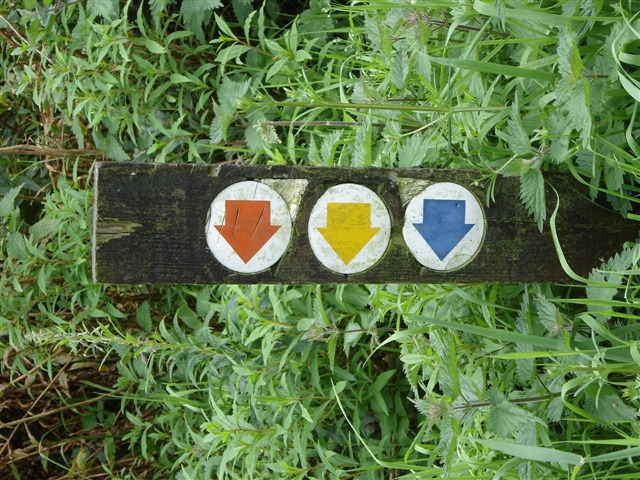
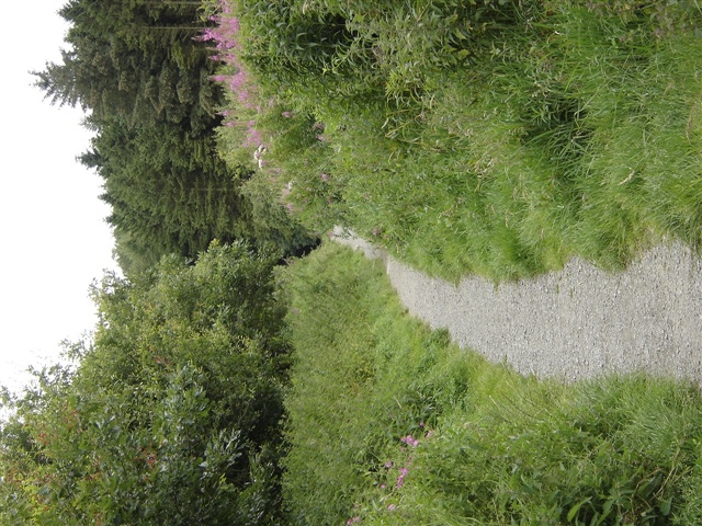
From the car park follow the waymarkers (choice of 3 routes) through the forest and woodland. The walking on forest roads (unsurfaced) is steep in places.
Rising to an altitude of 200m the woodland was once an outlier of the Clandeboye Estate and is important locally not only for its conservation value but also as a landscape feature in North Down.
The tree cover in the Forest Nature Reserve is mainly beech, with some oak, birch, alder, rowan and holly many of which are of scrub character. A few conifers occur, mostly Scots pine.
Open areas are predominantly grass/rush complex with bramble and at the highest elevations there is heathland with bilberry growing extensively.
There is a wide range of small song birds and many of the more common raptors frequent the area. Red squirrels are resident in the forest and may be seen in the wooded areas near the adjacent hill fort.
These walks are situated in a working forest environment and may be subject to diversion and closure from time to time.
Up to date information is available on the Forest Service web site.
TRAIL INFORMATION
From the car park follow the waymarkers (choice of 3 routes) through the forest and woodland. The walking on forest roads (unsurfaced) is steep in places.
Rising to an altitude of 200m the woodland was once an outlier of the Clandeboye Estate and is important locally not only for its conservation value but also as a landscape feature in North Down.
The tree cover in the Forest Nature Reserve is mainly beech, with some oak, birch, alder, rowan and holly many of which are of scrub character. A few conifers occur, mostly Scots pine.
Open areas are predominantly grass/rush complex with bramble and at the highest elevations there is heathland with bilberry growing extensively.
There is a wide range of small song birds and many of the more common raptors frequent the area. Red squirrels are resident in the forest and may be seen in the wooded areas near the adjacent hill fort.
These walks are situated in a working forest environment and may be subject to diversion and closure from time to time.
Up to date information is available on the Forest Service web site.
GETTING TO THE START
- Point of Interest Permanent orienteering course, conservation woodland with native broadleaves, red squirrels resident
- Facilities Car parking and picnic facilities
- Dog Policy Dogs must be kept under control and should not be allowed to foul on footpaths. Please use the dog foul bins provided at the trail head.
- Getting to the Start From Holywood: Take the Church Road to its junction with B170. Turn left onto the Ballymiscaw Road. At the end of the road turn right onto Whinney Hill. At the next junction turn left onto Craigantlet Road for approximately 0.75 mile to the forest car park.
- Public Transport Translink – journeyplanner.translink.co.uk
- Level of Difficulty
 Moderate TRAIL GRADE DISCLAIMER
 The trail grades shown on OutmoreNI.com and WalkNI.com are based on desk-based assessments of available trail information. The categories—Easy, Moderate, Strenuous, and Very Strenuous—follow the Sustainable Trails Development Guide grading system.
These grades are provided as a general guide to help users choose trails that may be suitable for them. They are not a substitute for official, on-site grading or safety information provided by the relevant land manager, which may differ from the information on these websites.
Outdoor activities involve inherent risks, including the risk of injury, death, property damage, and other hazards. By using information from OutmoreNI.com and WalkNI.com, you acknowledge that you do so at your own risk. OutmoreNI.com and WalkNI.com accept no responsibility or liability for any loss, injury, or damage arising from the use of this information.
Conditions on trails can change, and the actual environment may differ from what is described online. Users should always exercise their own judgment, take appropriate precautions, and remain responsible for their own safety and conduct at all times.
All information provided on OutmoreNI.com and WalkNI.com is intended as a guide only and should be used alongside your own experience, awareness, and careful decision-making.
Moderately challenging trails of varying widths with some short, steep climbs and descents. The surface may vary throughout, be slippery and uneven in places. Expect there to be obstacles like exposed roots, narrow gates, stiles and long sets of steps.
Outdoor clothing and sturdy footwear are recommended.