DISTANCE

3.8 miles

ROUTE TYPE

Loop

TRAIL GRADE

Strenuous

Cave Hill Country Park

Antrim

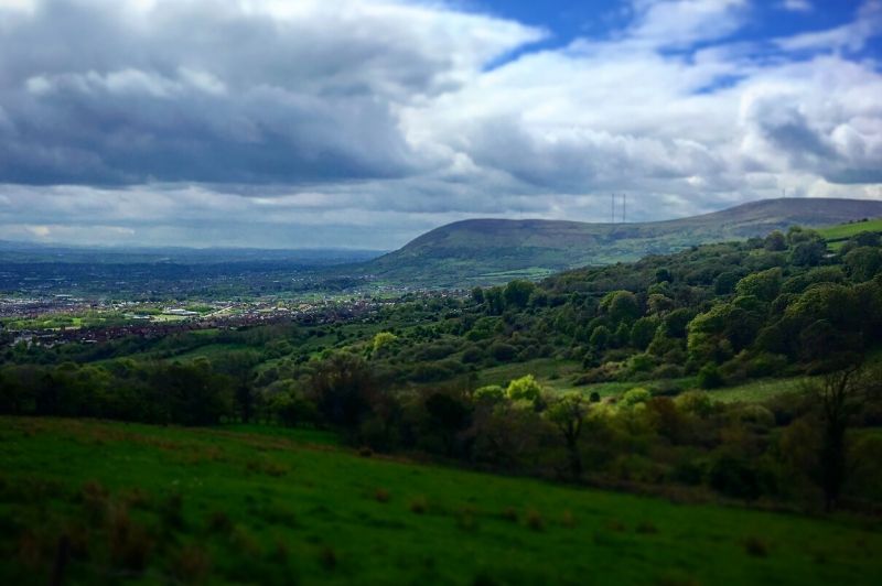
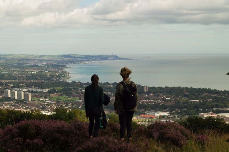
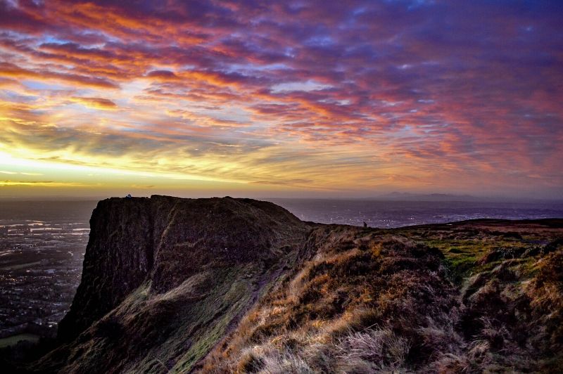
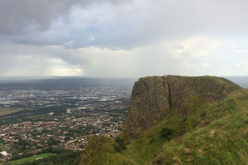
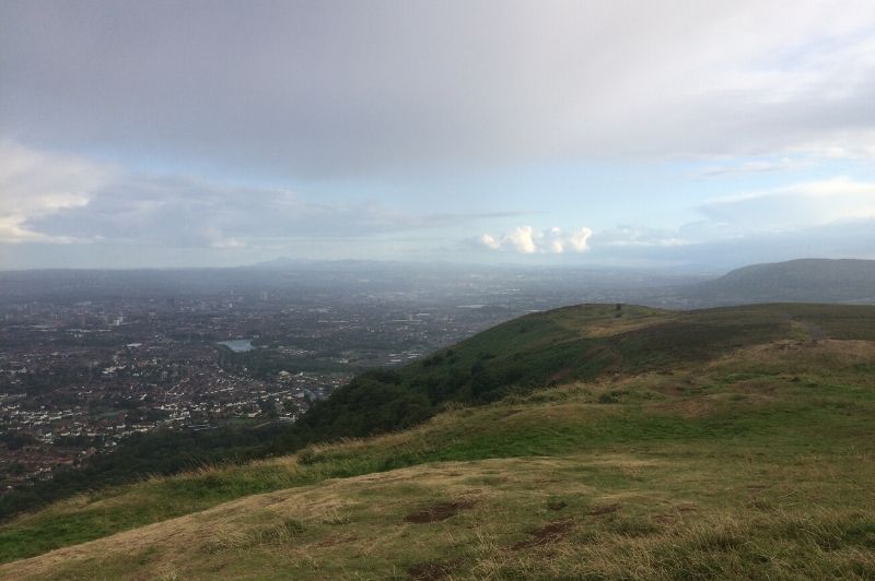
The Cave Hill Trail is a challenging route, over unsurfaced paths, past the caves to McArt’s Fort, and crossing moorland, heath and meadows. You will discover much of what the park has to offer from archaeological sites and wildlife to panoramic views.

DISTANCE

3.8 miles

ROUTE TYPE

Loop

OS MAP

Sheet 15 + Belfast Street Finder

GRID REFERENCE

J330791

COUNTY

Antrim

NEAREST TOWN

Antrim Road, Belfast

LANDSCAPE

Mountain, Urban

LEVEL OF DIFFICULTY

Strenuous

TERRAIN

Steep climb, unsurfaced paths

ON/OFF PUBLIC ROAD

null

DIFFICULTY

null

TRAIL INFORMATION

*This trail has reopened* This is a challenging circular route walked anti-clockwise beginning at Belfast Castle and following the green way marked arrows. It can, however, be joined from Bellevue car park, Upper Hightown Road or Upper Cavehill Road.Begin at the interpretative panel in the car park just before the entrance to Belfast Castle. Climb up the path on your left until you reach the first junction. Turn right. Follow this path through the woodland, keeping to the left of any of the junctions you come to. This path leads up through the trees, climbing on to an open seating area. Stop here to admire the fabulous views over the city and Belfast Lough.Continuing on, you come to the Devil’s Punchbowl with the first cave in front of you. Keep on the path to the right of the cave and you will skirt the plateau on a gentle ascent. The path turns left onto the cliff top at the junction with Hazelwood. Continue to ascend the plateau towards McArts Fort. Pause again to take in the magnificent views.The trail continues on a wide gravel path heading south with views over Lagan Valley. Follow this towards the Upper Hightown Road. Along the way on the left you will pass a path which provides a short cut past the limestone quarry. At the bottom of these steps turn right to join the main castle drive. Continuing on the Cavehill trail turn left at the dog-leg near the waterfall and follow the lane along the perimeter.The takes you to the Upper Cavehill Road entrance, re-enter the site using the entrance on the left and follow the path into the woodland. At the junction take the path on the right and you will return to the main drive to Belfast Castle. Follow this to back to the walking trailhead.Getting to McArt’s Fort from other access pointsFrom the Back Drive at Belfast Castle head downhill in the direction of Gray’s Lane. Follow the path on the left. Turn left at the first junction and continue uphill. At the next Junction turn right and follow the Cavehill Trail.From Gray’s Lane follow the paths on the Estate Trail to a natural spring known as the Volunteers’ Well. Take the paths on the left to join the Cavehill Trail uphill until you reach the main climb to the Devil’s Punchbowl. From here follow the Cavehill Trail.From Belfast Zoo car park and Hazelwood follow the paths on the right hand side and ascend the hill emerging at the edge of the plateau. Follow the path uphill across the top of the cliff.From Upper Hightown Road follow the lane to waterfall and at the fork you will join the trail.From the Horseshoe Bend descend the path in the field below the Origin sculpture and join the paths in Carr’s Glen uphill to the Cavehill Trail.

GETTING TO THE START

Car parking at Belfast Castle, Zoo (Hazelwood), Upper Cavehill Road and Upper Hightown Road.
  • Point of Interest
    Belfast Castle, McArts Fort
  • Facilities
    Belfast Castle is open to the public. The Cellar Restaurant offers a variety of menus from morning coffee to full meals. The second floor of the Castle plays host to the Cave Hill Visitor Centre with exciting displays on the history, folklore, wildlife and geology of Cave Hill Country park and the story of Belfast Castle. The following facilities are available for users with limited mobility: – Café (wheelchair accessible) – 12pm – 3pm Mon – Sat – Disabled toilets – Disabled parking.
  • Accessibility Information
    Accessibility Grade: Grade 5
    Terrain: Steep climb, unsurfaced paths
    Toilet Facility: No
    Signage: No
  • Getting to the Start
    Car parking at Belfast Castle, Zoo (Hazelwood), Upper Cavehill Road and Upper Hightown Road.
  • Public Transport
  • Level of Difficulty
    Strenuous

    Physically demanding, narrow trails with steep climbs and descents over short and long distances. Expect the surface to be uneven and changeable throughout with natural surfaces like grass, exposed rock and trodden earth. The surface may change suddenly and be unstable in places. There will be slippery sections when wet and large, frequent obstacles like exposed roots, large boulders, overgrown sections, uneven stiles and long stretches of uneven steps.

    Outdoor clothing and sturdy footwear are recommended.

GALLERY

DOWNLOADS & PUBLICATIONS


Subscribe to our Newsletter

Subscribe and be the first to hear about new outdoor trails and places or find inspiration to help you plan days out.

No spam. Easy unsubscribe links are provided in every email.

Keep in touch with us

This website has been produced by

Privacy Policy | Cookie Policy | Disclaimer

© 2026 | Outmore NI. All rights reserved. Website designed & developed by SugarProjects