1.2 miles
Loop
Easy
Christie Park & Somerset
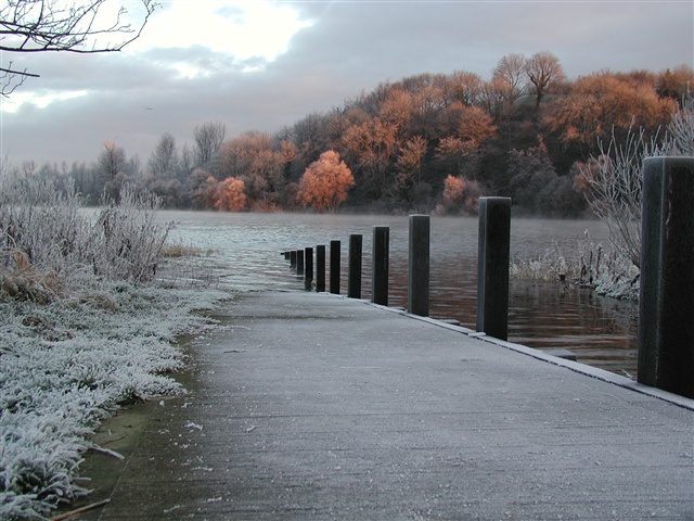
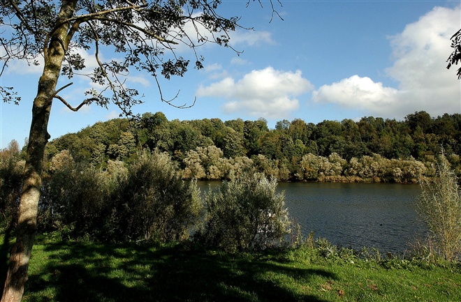
Pleasant riverside walk along surfaced footpaths, starting in the centre of Coleraine and finishing close to The Cutts area and opposite the historic Mountsandel Fort. The walk passes through two Council parks, both with different habitats that are managed in entirely different ways.
TRAIL INFORMATION
The starting point for this walk is the car park in Christie Park. Follow the riverside pathway towards the new bridge (away from the town centre old bridge). Having passed under the new bridge, take the path to the left and proceed along this narrow riverside pathway until reaching the Somerset Riverside Park car park, opposite Mountsandel Fort.
Take time along the route to enjoy the views over the Bann and study the interpretation panels provided. Having reached the car park walkers have the option of crossing the road and further enjoying a variety of walks within Somerset Forest.
GETTING TO THE START
- Point of Interest Mountsandel Fort, visible across the river
- Facilities Toilets (disabled) available in in the car park on the Strand Road. Refreshments available in Coleraine. The following facilities are available for users with limited mobility: – Disabled toilets with RADAR key – Disabled parking.
- Dog Policy Dogs must be kept on leads
- Accessibility Information
Accessibility Grade: Grade 3 Terrain: Riverside surfaced pathways Toilet Facility: No Signage: No - Getting to the Start The start point for this walk is Christie Park Car park in Coleraine, accessed via the A29 (Strand Road).
- Public Transport Translink – journeyplanner.translink.co.uk
- Level of Difficulty
 Easy TRAIL GRADE DISCLAIMER
 The trail grades shown on OutmoreNI.com and WalkNI.com are based on desk-based assessments of available trail information. The categories—Easy, Moderate, Strenuous, and Very Strenuous—follow the Sustainable Trails Development Guide grading system.
These grades are provided as a general guide to help users choose trails that may be suitable for them. They are not a substitute for official, on-site grading or safety information provided by the relevant land manager, which may differ from the information on these websites.
Outdoor activities involve inherent risks, including the risk of injury, death, property damage, and other hazards. By using information from OutmoreNI.com and WalkNI.com, you acknowledge that you do so at your own risk. OutmoreNI.com and WalkNI.com accept no responsibility or liability for any loss, injury, or damage arising from the use of this information.
Conditions on trails can change, and the actual environment may differ from what is described online. Users should always exercise their own judgment, take appropriate precautions, and remain responsible for their own safety and conduct at all times.
All information provided on OutmoreNI.com and WalkNI.com is intended as a guide only and should be used alongside your own experience, awareness, and careful decision-making.
Relatively flat or gently rolling trails with a mostly smooth surface. You might come across some obstacles like bridges, gates and steps.
Normal clothing and footwear can be worn.