6.5 miles
Linear
Strenuous
Clandeboye Way – Helen’s Bay to Whitespots Country Park
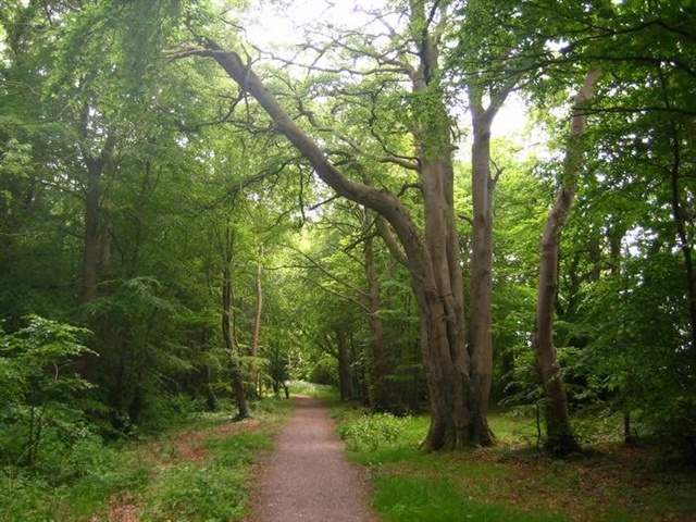
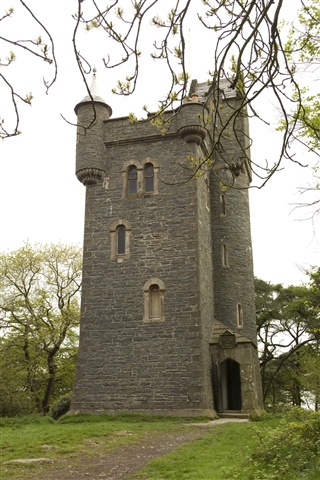
The Clandeboye Way is a great off road walk through a variety of landscapes with lots to see along the way. Of historical interest is Helen's Tower and the old Leadmines at Whitespots Country Park. The path leads through old laneways, some farm tracks and woodland paths.
Please note - this walk involves crossing the main Bangor to Belfast dual carriageway.
TRAIL INFORMATION
The walk starts from Helen’s Bay Railway Station. Take the underpass beneath the railway line to Clandeboye Avenue. Turn left onto this old laneway. Keep walking until you come across a gate leading onto a metalled path.
Continue along this for approximately a mile until passing under another bridge at Ballyrobert Road. After this bridge you will reach the main Belfast to Bangor dual carriageway.
Cross the dual carriage way and turn left, walk for a few metres and look for a small path on your right - this leads back onto Clandebye Avenue.
After approximately 1 mile the path leaves the Avenue and continues along a farm lane to Ballysallagh Road.
From here the path circles round Blackwood Golf Course eventually exiting on the Crawfordsburn Road near Ballyleidy Sawmill.
Turn right and cross the road. At the corner re enter Clandeboye Estate to your left at the back of the Sawmill. This leads uphill to Helen’s Tower for scenic views of the Co Down landscape on a good day.
From here the walk continues for another 10-15 minutes to an old metal stile. This leads into Whitespots Country Park. Continuing through the park past the leadmines will eventually lead to the Somme Heritage Centre and a large car park. This is the end of the walk.
From here either retrace you steps back to Helen’s Bay or catch a bus on the main Bangor to Newtownards Road.
GETTING TO THE START
- Point of Interest Clandeboye Estate, Helens Tower, Leadmines
- Facilities There is a car park at the start and finish although parking is limited at the railway station in Helens Bay. Toilets and refreshements can only be found at the start and finish of the walk in Helen’s Bay and in the Somme Heritage Centre (beside Whitespots Country Park). The Somme Centre has limited opening hours so it is worth phoning beforehand - 028 9182 3202. The following facilities are available for users with limited mobility: – Disabled toilets – At Helen’s Bay Car Park – Disabled parking.
- Dog Policy Dogs must be kept under close control
- Accessibility Information
Accessibility Grade: Grade 5 Terrain: Laneways, tracks, woodland paths Toilet Facility: No Signage: No - Getting to the Start The walk starts from the car park at Helen’s Bay Railway Station. Take the underpass beneath the railway line to start in Clandeboye Avenue.
- Public Transport Translink – journeyplanner.translink.co.uk
- Level of Difficulty
 Strenuous TRAIL GRADE DISCLAIMER
 The trail grades shown on OutmoreNI.com and WalkNI.com are based on desk-based assessments of available trail information. The categories—Easy, Moderate, Strenuous, and Very Strenuous—follow the Sustainable Trails Development Guide grading system.
These grades are provided as a general guide to help users choose trails that may be suitable for them. They are not a substitute for official, on-site grading or safety information provided by the relevant land manager, which may differ from the information on these websites.
Outdoor activities involve inherent risks, including the risk of injury, death, property damage, and other hazards. By using information from OutmoreNI.com and WalkNI.com, you acknowledge that you do so at your own risk. OutmoreNI.com and WalkNI.com accept no responsibility or liability for any loss, injury, or damage arising from the use of this information.
Conditions on trails can change, and the actual environment may differ from what is described online. Users should always exercise their own judgment, take appropriate precautions, and remain responsible for their own safety and conduct at all times.
All information provided on OutmoreNI.com and WalkNI.com is intended as a guide only and should be used alongside your own experience, awareness, and careful decision-making.
Physically demanding, narrow trails with steep climbs and descents over short and long distances. Expect the surface to be uneven and changeable throughout with natural surfaces like grass, exposed rock and trodden earth. The surface may change suddenly and be unstable in places. There will be slippery sections when wet and large, frequent obstacles like exposed roots, large boulders, overgrown sections, uneven stiles and long stretches of uneven steps.
Outdoor clothing and sturdy footwear are recommended.