4 miles
Loop

Strenuous
Divis Ridge Trail

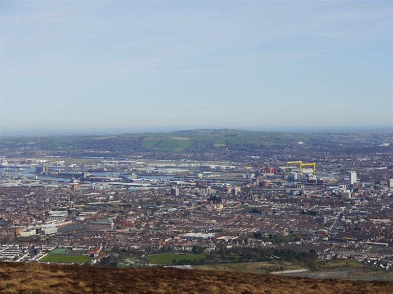
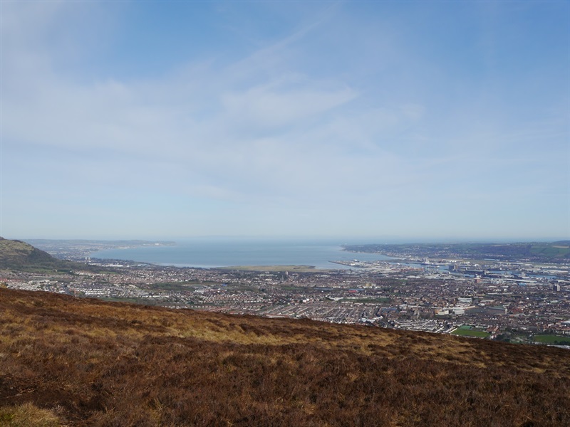
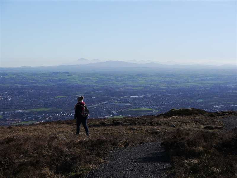
View the city of Belfast from a different perspective, from above! The Divis Ridge Trail allows the walkers to enjoy 180 degree views across the city and further afield including the Antrim Plateau to the north, Scotland to the east and the Mourne Mountains to the south.
TRAIL INFORMATION
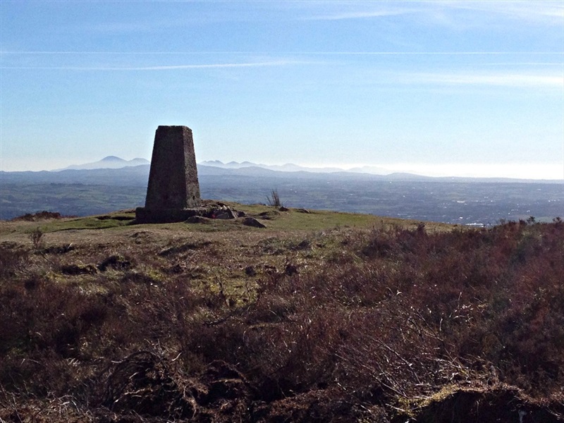
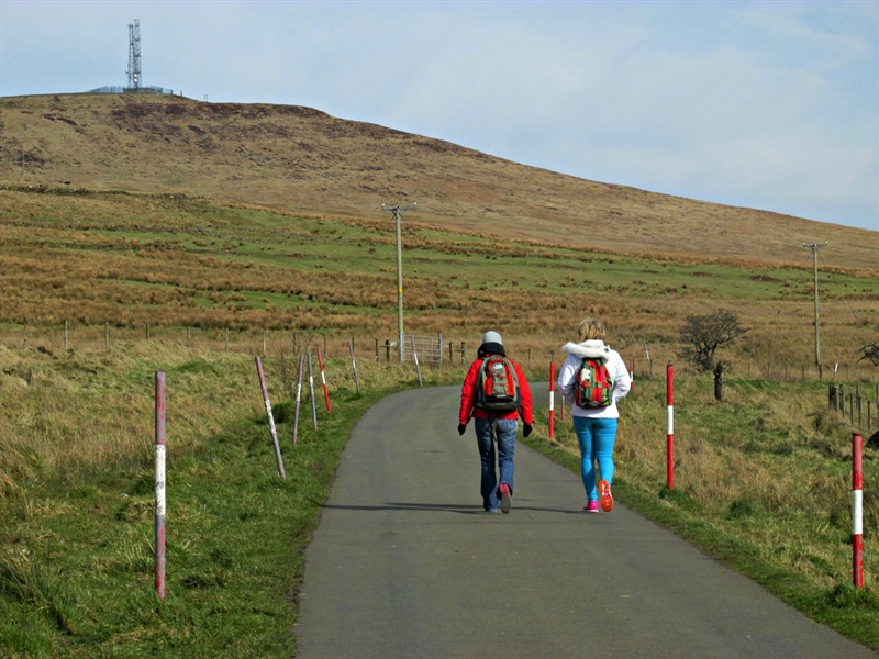
From the car park at the Long Barn, (Note National Trust car park pricing applies for this car park however there is an alternative free car park on Divis Rd 0.5 miles from the Long Barn which can also be used by walkers), follow the trail towards the Divis transmitter masts. Bear right onto a section of boardwalk, shortly before reaching the lower mast. The boardwalk ends, turn right onto the gravel path, leading towards the summit of Black Mountain, the summit of which is marked by a trig point. From here you can experience exhilarating views across the city and beyond. Continue to follow the gravel path as it winds its way along the ridge towards Black Hill. The path leaves the ridge before reaching Black Hill and continues to weave its way back towards the Long Barn, crossing a couple of stiles and the Collin River along the way. Turn left when you reach the access road to return to the Long Barn.
TRAIL INFORMATION
From the car park at the Long Barn, (Note National Trust car park pricing applies for this car park however there is an alternative free car park on Divis Rd 0.5 miles from the Long Barn which can also be used by walkers), follow the trail towards the Divis transmitter masts. Bear right onto a section of boardwalk, shortly before reaching the lower mast. The boardwalk ends, turn right onto the gravel path, leading towards the summit of Black Mountain, the summit of which is marked by a trig point. From here you can experience exhilarating views across the city and beyond. Continue to follow the gravel path as it winds its way along the ridge towards Black Hill. The path leaves the ridge before reaching Black Hill and continues to weave its way back towards the Long Barn, crossing a couple of stiles and the Collin River along the way. Turn left when you reach the access road to return to the Long Barn.
GETTING TO THE START
- Point of Interest Divis Mountain
- Facilities Divis Coffee BarnFree parkingToilet facilitiesAn open site with free access. Charge for guided tours onlyMobility parking spacesMobility toilet facilitiesWheelchair-accessible kissing gates to mountain. The following facilities are available for users with limited mobility: – Café (wheelchair accessible) – Disabled parking – Disabled toilets with RADAR key – Visitors Centre
- Dog Policy Dogs to be kept under control
- Accessibility Information
Accessibility Grade: Grade 5 Terrain: Gravel path with rough sections Toilet Facility: No Signage: No - Getting to the Start Minor road off the B38 Upper Springfield Road, off the A55 Outer Ring
- Public Transport Translink – journeyplanner.translink.co.uk
- Trail Grade Strenuous TRAIL GRADE DISCLAIMER
The trail grades shown on OutmoreNI.com and WalkNI.com are based on desk-based assessments of available trail information. The categories—Easy, Moderate, Strenuous, and Very Strenuous—follow the Sustainable Trails Development Guide grading system.
These grades are provided as a general guide to help users choose trails that may be suitable for them. They are not a substitute for official, on-site grading or safety information provided by the relevant land manager, which may differ from the information on these websites.
Outdoor activities involve inherent risks, including the risk of injury, death, property damage, and other hazards. By using information from OutmoreNI.com and WalkNI.com, you acknowledge that you do so at your own risk. OutmoreNI.com and WalkNI.com accept no responsibility or liability for any loss, injury, or damage arising from the use of this information.
Conditions on trails can change, and the actual environment may differ from what is described online. Users should always exercise their own judgment, take appropriate precautions, and remain responsible for their own safety and conduct at all times.
All information provided on OutmoreNI.com and WalkNI.com is intended as a guide only and should be used alongside your own experience, awareness, and careful decision-making.
Challenging routes typically on rough and uneven terrain, with steep and sustained climbs and descents and frequent. Expect man-made and natural obstacles that are unavoidable such as large boulders, exposed tree roots and irregular steps. A high level of fitness and self-reliance is recommended.