4.3 miles
Loop
Easy
Drumee
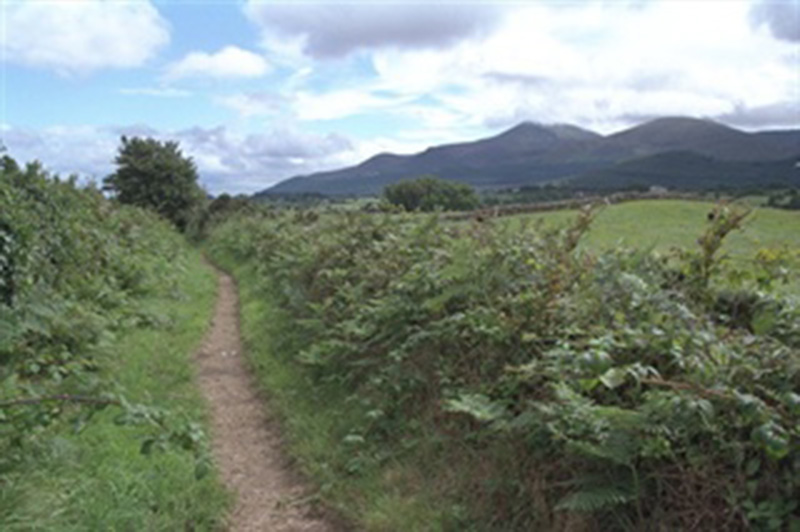
This network of paths formed part of an intricate transport system connecting the settlements of Castlewellan, Annsborough, Maghera, Dundrum, Bryansford and Newcastle. These laneways offered the shortest, easiest routes for horse and cart; for example, transporting coal from Dundrum to Castlewellan; so avoiding the steep hill at Ardnabannon. Nowadays these routes offer peaceful country walks away from busy main roads.
TRAIL INFORMATION
From the car park walk towards the Circular Road which leads away from Castlewellan. This road becomes the Drumee Road which heads south towards the town of Newcastle. Walk past the first public footpath sign, and where the road veers to the right take the lane signposted straight ahead.
Continue until a public footpath sign indicates another path to the left, take this route. Follow the path which turns sharply to the right after a short distance. Continue straight on until the path reaches a junction. Take the way marked route to the left.
After a long straight stretch the lane turns sharp left and then right before reaching the Carnacavill Road. At the road turn left and walk towards a crossroads where you see a signpost indicating ‘Maghera Old Church and Round Tower’, follow this sign onto the Carrigs Road. A short distance later you will see another sign directing you up a driveway to the church and round tower.
On leaving the church turn left and walk along the Carrigs Road for a few hundred yards, then take the right turn onto the Church Hill Road.
Half way along this road turn right as directed by the signposted on to the lane known as Smiley’s Loanan. Take this path and follow it until it reaches the Carnacavill Road once more.
At the road turn left, this leads to the main Castlewellan to Newcastle Road. Turn right at this point and follow the grass verge back towards Castlewellan. Continue as far as Drumee Cemetery where you see signs pointing right and straight on towards Castlewellan.
Follow the grassy lane towards Castlewellan until it reaches the Drumee Road. Retrace your steps along the Drumee Road returning to the car park at the Upper Square.
GETTING TO THE START
- Point of Interest Mourne Mountains, Maghera Old Church and Round Tower
- Facilities There are numerous public houses in Castlewellan; some of which serve food. There are also a few cafes and restaurants to choose from.
- Getting to the Start Car park, Upper Square, Castlewellan, almost opposite the entrance to Castlewellan Forest Park.
- Public Transport Translink – journeyplanner.translink.co.uk
- Level of Difficulty
 Easy
EasyRelatively flat or gently rolling trails with a mostly smooth surface. You might come across some obstacles like bridges, gates and steps.
Normal clothing and footwear can be worn.