3.4 miles
Loop
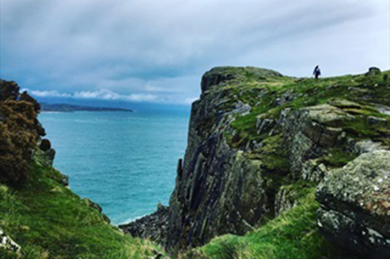
Fairhead Loch Na Crannóige Walk
Enjoy breath-taking views from the cliff edge of Fairhead on this ruggedly beautiful, wild and remote walk. Expect stunning coastal views towards Ballycastle and Rathlin Island and look down on the picturesque Murlough Bay. You’ll also pass historic loughs and open green farmland on one of the many walk options which are guaranteed to invigorate the senses.
TRAIL INFORMATION
Includes stunning cliff top views as well as beautiful vistas overlooking Murlough Bay. The route returns via farm tracks and open land before reaching the hamlet of Coolanlough. A National Trust Carpark is situated at the hamlet or ‘Clachan’ of Coolanlough along the blue/green route should you wish to use this (see map for details). From here follow minor roads keeping right at the junction to return to Fairhead Car Park and the start of the walk.
Please be aware that sections of this walk are situated near a cliff edge and due care must be taken particularly during windy conditions and in poor visibility. Weather conditions along the coast can change very quickly - so be prepared. Although the walk is waymarked it is advised that you equip yourself with a map. The walking route passes through areas of open land and working farmland. Livestock may be present and ground conditions are often uneven, wet and mucky underfoot and as such walking boots are strongly recommended.
The iconic cliffs of Fairhead or Benmore tower above the famous Sea of Moyle where mythology states the Children of Lir, were put under an evil spell transforming them into swans to spend 900 years in exile from humanity. The great cliffs of Fairhead are composed of a rock called dolerite. This igneous rock was born out of volcanic activity some 60 million years ago. The upper half of the cliff is formed of gigantic columns which are up to 12 metres in diameter, some of which are separated from the rest of the cliff but still stand, despite their precarious nature.
This walk begins at the farm car park (£3 per car) clearly signposted off the Fairhead Rd. The trailhead panel in the car park will offer you a number of route choices with loops from 1.5 – 3.4 miles. Be sure to take time to read the hidden interpretation information at each waymarker pointing out important sites of historic and geological interest along the way.
GETTING TO THE START
- Point of Interest Views over Murlough Bay and towards Rathlin
- Facilities Numerous toilet facilities, cafés and shops are situated in Ballycastle 5 miles away.
- Dog Policy Dogs are not allowed. Please be aware of the presence of working farm dogs on the blue and turquoise routes.
- Getting to the Start From Ballycastle, follow the A2, turning left at the junction onto Torr Rd, turn left again onto Fairhead Rd. The sign for Fairhead Car Park is clearly signed along this road on the left directing you to the access road to the farm where the car park is situated. Parking is £3.
- Public Transport Translink – journeyplanner.translink.co.uk