2.3 miles
Loop
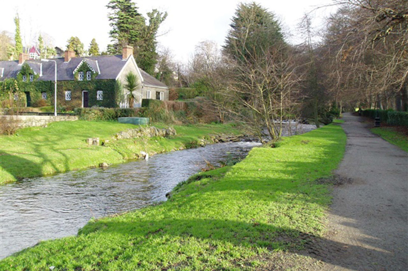
Fairy Glen - circular walk
The Fairy Glen in Rostrevor provides the start of a pleasant walk with varied scenery from gentle riverside to scenic parkland and woodland. The Fairy Glen is on the left immediately after the bridge beside the entrance to Kilbroney Park.
TRAIL INFORMATION
The walk starts in the village, on the Kilkeel side of the bridge and follows the Kilbroney River upstream for half a mile. The path follows the east bank of the river until reaching Forestbrook.
Before the bridge at Forestbrook road, turn right. Follow the path for approx. 50 metres and turn left. Pass the stile. The path runs in the field adjacent to the river and then alongside the back of the houses (the line of the path is visible on the ground).
The path runs in the fields for approx. 800m. Then on the left, use the brown wooden stile (not the 1st green metal stile). Follow the path until you reach Newtown Road. Turn right (be careful, this is a public road). After approx. 150m, take the first road to the right. Go up until you reach a gate across.
You are now entering Rostrevor Forest. Follow the road keeping to your right. After approx. 1.5 km you'll be reaching the entrance to the Caravan Park. Go through heading toward Kilbroney Cafe. At the cafe, go down through the park to return where you started at the bridge. Enjoy the views over Carlingford Lough.
GETTING TO THE START
- Point of Interest Scenic vews over Carlingford Lough
- Facilities Toilets, accomodation and refreshments are available in Rostrevor. There is a café in Kilbroney Park with accessible toilets facilities. The following facilities are available for users with limited mobility: – Café (wheelchair accessible) – Shop (wheelchair accessible) – Disabled toilets
- Dog Policy Dogs must be kept under close control
- Accessibility Information
Accessibility Grade: Grade 5 Terrain: Off road paths and country road Toilet Facility: No Signage: No - Getting to the Start Rostrevor is located on the A2 between Newry and Kilkeel. From the centre of the village, go down Bridge street. The Fairy Glen is immediately after the bridge beside the entrance to Kilbroney Park. Buses run from Newry to Rostrevor and from Kilkeel to Rostrevor. Please contact Ulsterbus for further details.
- Public Transport Translink – journeyplanner.translink.co.uk