0.5 miles
Loop
Easy
Fardross Forest River Trail
One of two walking trails to choose from in Fardross Forest
TRAIL INFORMATION
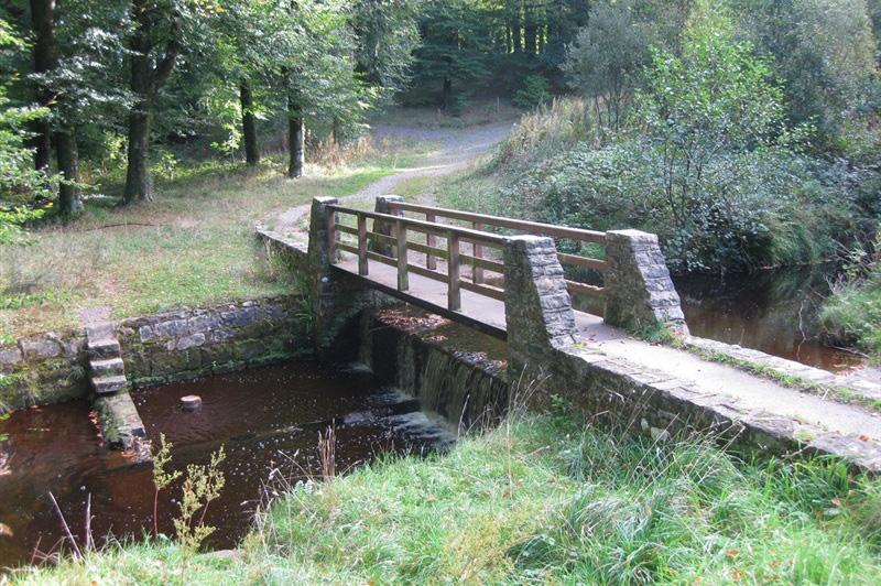
Start in the car park and cross the bridge over the stream and bear right, continue to follow the riverisde trail, crossing over the stream again this time using a series of stepping stones. Continue to follow the path to be lead back to the car park.
TRAIL INFORMATION
Start in the car park and cross the bridge over the stream and bear right, continue to follow the riverisde trail, crossing over the stream again this time using a series of stepping stones. Continue to follow the path to be lead back to the car park.
GETTING TO THE START
- Point of Interest Fardross Stream ASSI
- Facilities Car park, picnic tables
- Dog Policy Dogs are allowed but must be kept under control.
- Accessibility Information
Accessibility Grade: Grade 5 Terrain: Gravel paths Toilet Facility: No Signage: No - Getting to the Start A4 to Clogher, about two miles west of the village turn left into Fardross Road. There is a sign to the Clogher Valley Caravan Park. Drive for about one and a half miles and take a left signposted Fardross Road, parking is about 100m from this junction.
- Public Transport Translink – journeyplanner.translink.co.uk
- Level of Difficulty
 Easy
EasyRelatively flat or gently rolling trails with a mostly smooth surface. You might come across some obstacles like bridges, gates and steps.
Normal clothing and footwear can be worn.