DISTANCE

2.1 miles

ROUTE TYPE

Linear

TRAIL GRADE

Easy

Floodgates Walk

Down

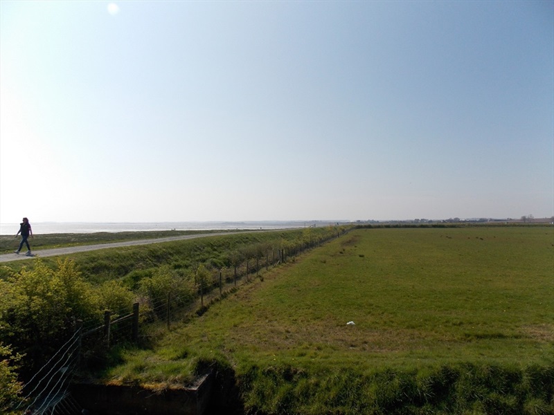
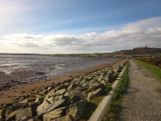
Linear walking route across the northern strand of Strangford Lough. The route crosses the sea defenses that protect reclaimed lands to the south of Newtownards.This is an Ulster Scots walk. Part of the ‘Danders Aroon’ series, the Ards Ulster Scots Walk (also known as Floodgates Walk) is a beautiful coastal walk with rich heritage that you can learn about as you take a stroll.This walk at the top of Strangford Lough leads along the sea wall that protects land, first claimed by Lord Londonderry, and now part of Newtownards town and a small private airport. There are great views out over the water and also of Scrabo Tower, which looms above the town. Time your visit with high tide if possible.Check out the ‘Danders Aroon’ videos in the Route description below to find out more about the Ulster Scots history of the area and this walk. 

DISTANCE

2.1 miles

ROUTE TYPE

Linear

OS MAP

Sheet 21

GRID REFERENCE

J501730

COUNTY

Down

NEAREST TOWN

Newtownards

LANDSCAPE

Coastal

LEVEL OF DIFFICULTY

Easy

TERRAIN

Gravel path

ON/OFF PUBLIC ROAD

null

DIFFICULTY

null

TRAIL INFORMATION

Starting at the car park head west across the footbridge over the floodgates and onto the embankment. The story of the original plan for the embankment is that a Dutch engineer was employed to build it. It was hoped that this would then encourage a Dutch settlement at Newtownards during the reign of William and Mary. The present embankment was built in 1811 by Lord Londonderry of Mount Stewart and reclaimed 200 acres of land from the sea shore. This area was turned into arable farmland. This is the most northerly point of Strangford Lough, at the foot of Scrabo Hill. The flat land was later developed into an airfield. The sea defences were upgraded in 2000 to protect the town of Newtownards. Care was taken to minimise adverse effects on the environment and monitoring is ongoing. There is a story that when the airfield was being constructed local farmers brought carts of stones to provide the hardcore for the runways. There were two entrances to the airfield; one on the Portaferry Road, the other on the Comber Road. Some of the more ingenious would bring their carts to the Portaferry Road get a ticket for their loads and leave by the other gate with the load covered and go around the block for a second ticket which meant they got double the money! Ards has lots of Ulster-Scots heritage, illustrated in these videos from Graham Little’s ‘Danders Aroon’ series. • https://vimeo.com/657553417/0257d272e7 • https://vimeo.com/692186401

GETTING TO THE START

From Newtownards follow the Portaferry Road. Immediately after the junction with the Old Shore Road the car park is on the right.
  • Point of Interest
    Scrabo Hill, Ards Allotments
  • Facilities
    Car parking
  • Dog Policy
    Dogs must be kept under close control
  • Getting to the Start
    From Newtownards follow the Portaferry Road. Immediately after the junction with the Old Shore Road the car park is on the right.
  • Public Transport
  • Level of Difficulty
    Easy TRAIL GRADE DISCLAIMER

    The trail grades shown on OutmoreNI.com and WalkNI.com are based on desk-based assessments of available trail information. The categories—Easy, Moderate, Strenuous, and Very Strenuous—follow the Sustainable Trails Development Guide grading system.

    These grades are provided as a general guide to help users choose trails that may be suitable for them. They are not a substitute for official, on-site grading or safety information provided by the relevant land manager, which may differ from the information on these websites.

    Outdoor activities involve inherent risks, including the risk of injury, death, property damage, and other hazards. By using information from OutmoreNI.com and WalkNI.com, you acknowledge that you do so at your own risk. OutmoreNI.com and WalkNI.com accept no responsibility or liability for any loss, injury, or damage arising from the use of this information.

    Conditions on trails can change, and the actual environment may differ from what is described online. Users should always exercise their own judgment, take appropriate precautions, and remain responsible for their own safety and conduct at all times.

    All information provided on OutmoreNI.com and WalkNI.com is intended as a guide only and should be used alongside your own experience, awareness, and careful decision-making.

    Relatively flat or gently rolling trails with a mostly smooth surface. You might come across some obstacles like bridges, gates and steps.

    Normal clothing and footwear can be worn.

GALLERY

Subscribe to our Newsletter

Subscribe and be the first to hear about new outdoor trails and places or find inspiration to help you plan days out.

No spam. Easy unsubscribe links are provided in every email.

Keep in touch with us

This website has been produced by

Privacy Policy | Cookie Policy | Disclaimer

© 2026 | Outmore NI. All rights reserved. Website designed & developed by SugarProjects