5.5 miles
Loop
Strenuous
Glenariff Forest Park, Scenic Trail
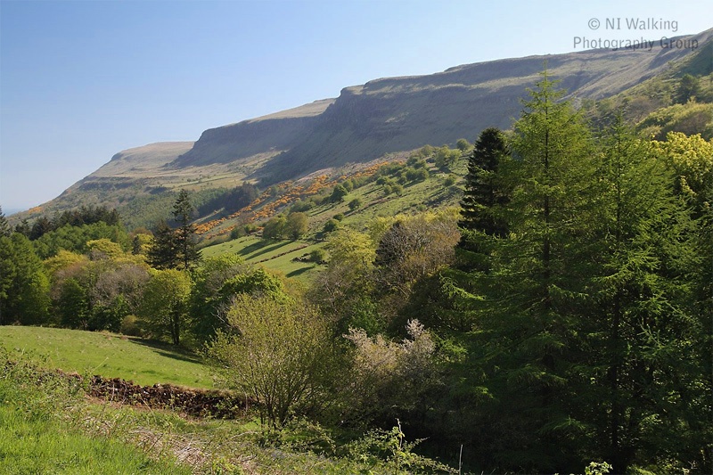
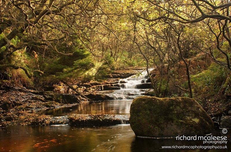
The Trail allows the more able person to enjoy walking through mature woodland, along the edges of steep sided river gorges with waterfalls and open moorland. This trail also takes you past some spectacular features including a steep river gorge and spectacular waterfalls. One of the highlights of this walk is the views of Mull of Kintyre on a clear day.
TRAIL INFORMATION
----------------------------------------------------------------------------------------
Part of the Scenic Walk in Glenariff is currently closed, due to felling works to remove trees that are infected with the disease Phytophthora Ramorum. Diversions are in place. Please refer to the Forest Service NI link below for up-to-date information.
---------------------------------------------------------------------------------------
The route is sign posted from the car park and around the trail.
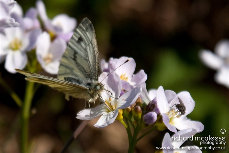
The trail first takes you down the Inver River gorge, nearly to the Ess-na-Crub Waterfall. This part of the trail is set in mature woodland with varied woodland flora including bluebells. Once you cross the river at the bottom of the trail, you begin a long and winding climb from about 60 metres elevation to 260 metres, over about 1.1km.
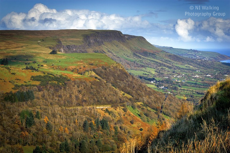
From the upper sections of the route there are views of the Glens and of the Mull of Kintyre across the sea. You ford the upper reaches of the Glenariff river at the top of the trail. At this point you are on peat moorland. Your way back gives spectacular views straight down the Glen to the coast and the sea beyond.
These walks are situated in a working forest environment and may be subject to diversion and closure from time to time.
Up to date information is available on the Forest Service web site - link below.
TRAIL INFORMATION
----------------------------------------------------------------------------------------
Part of the Scenic Walk in Glenariff is currently closed, due to felling works to remove trees that are infected with the disease Phytophthora Ramorum. Diversions are in place. Please refer to the Forest Service NI link below for up-to-date information.
---------------------------------------------------------------------------------------
The route is sign posted from the car park and around the trail.
The trail first takes you down the Inver River gorge, nearly to the Ess-na-Crub Waterfall. This part of the trail is set in mature woodland with varied woodland flora including bluebells. Once you cross the river at the bottom of the trail, you begin a long and winding climb from about 60 metres elevation to 260 metres, over about 1.1km.
From the upper sections of the route there are views of the Glens and of the Mull of Kintyre across the sea. You ford the upper reaches of the Glenariff river at the top of the trail. At this point you are on peat moorland. Your way back gives spectacular views straight down the Glen to the coast and the sea beyond.
These walks are situated in a working forest environment and may be subject to diversion and closure from time to time.
Up to date information is available on the Forest Service web site - link below.
GETTING TO THE START
- Point of Interest Views of Mull of Kintyre, waterfall
- Facilities Car park (fee charged), Picnic areas, Café, Shop, Toilets (disabled access), Camping and Caravaning, Electronic 'In-Touch' Information Kiosk, Way-marked/nature trails, Lecture room/Classroom, Permanent Exhibition, Guided tours available. The following facilities are available for users with limited mobility: – Café (wheelchair accessible) – Shop (wheelchair accessible) – Visitors Centre – Disabled toilets
- Accessibility Information
Accessibility Grade: Grade 5 Terrain: Forest paths, steep in places Toilet Facility: No Signage: No - Getting to the Start Accessed via the A43 - Ballymena to Cushendall Road.
- Public Transport Translink – journeyplanner.translink.co.uk
- Level of Difficulty
 Strenuous TRAIL GRADE DISCLAIMER
 The trail grades shown on OutmoreNI.com and WalkNI.com are based on desk-based assessments of available trail information. The categories—Easy, Moderate, Strenuous, and Very Strenuous—follow the Sustainable Trails Development Guide grading system.
These grades are provided as a general guide to help users choose trails that may be suitable for them. They are not a substitute for official, on-site grading or safety information provided by the relevant land manager, which may differ from the information on these websites.
Outdoor activities involve inherent risks, including the risk of injury, death, property damage, and other hazards. By using information from OutmoreNI.com and WalkNI.com, you acknowledge that you do so at your own risk. OutmoreNI.com and WalkNI.com accept no responsibility or liability for any loss, injury, or damage arising from the use of this information.
Conditions on trails can change, and the actual environment may differ from what is described online. Users should always exercise their own judgment, take appropriate precautions, and remain responsible for their own safety and conduct at all times.
All information provided on OutmoreNI.com and WalkNI.com is intended as a guide only and should be used alongside your own experience, awareness, and careful decision-making.
Physically demanding, narrow trails with steep climbs and descents over short and long distances. Expect the surface to be uneven and changeable throughout with natural surfaces like grass, exposed rock and trodden earth. The surface may change suddenly and be unstable in places. There will be slippery sections when wet and large, frequent obstacles like exposed roots, large boulders, overgrown sections, uneven stiles and long stretches of uneven steps.
Outdoor clothing and sturdy footwear are recommended.