0.5 miles
Loop
Easy
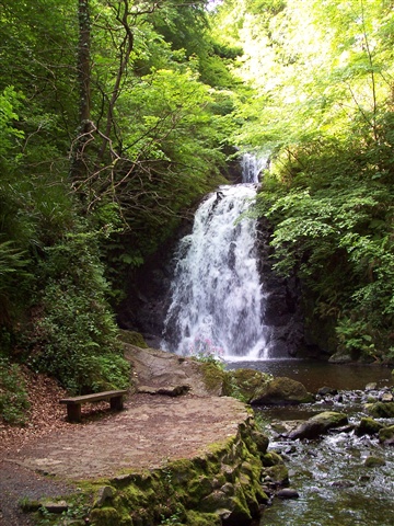
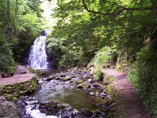
Glenoe Waterfall
One of our lesser known ‘hidden treasures’, Glenoe is a magnificent 30 foot waterfall nestling in the glens of Antrim and owned by the National Trust.
TRAIL INFORMATION
A short stroll from the charming village of Glenoe, steps and paths wind around this small lush glen with one of the most picturesque waterfalls in Northern Ireland tucked into the valley. This walk is well sign-posted and has many steps. The steps meander up and down the sides of this moist valley to enable walkers to get good views of the waterfall with the waterfall looking its best after rainfall. Popular photographic location with visitors coming from near and far. Now part of the official Causeway Coastal Driving Route so be sure to visit next time you are in the area. Route Description: From the car park, the path leads through trees. From here, there is a network of paths and steps which go in many directions across, up and down. Ground is uneven and steep as it is a deep gorge and wet underfoot due to running water and spray..
GETTING TO THE START
- Point of Interest View of waterfall from bridge Short walk from the historic village of Gleno, with its traditional whitewashed houses on the hill.
- Facilities Car park, Picnic tables to enjoy a snack. The Dairy – coffee shop and speciality grocery store on B99.
- Accessibility Information
Accessibility Grade: Grade 5 Terrain: Steep and possibly slippery Toilet Facility: No Signage: No - Getting to the Start On the B99, 4 miles south of Larne.
- Public Transport Translink – journeyplanner.translink.co.uk
- Level of Difficulty
 Easy
EasyRelatively flat or gently rolling trails with a mostly smooth surface. You might come across some obstacles like bridges, gates and steps.
Normal clothing and footwear can be worn.