2.1 miles
Linear
Strenuous
Hare's Gap
The Hare's Gap is the most dramatic mountain pass in the Mournes. Its sharply defined outline indicates that ice once passed this way; using the Gap's convenient north-south alignment to advance and retreat over the entire Mournes range. In more recent times the Hare's Gap marked the exit point for smuggled goods which had crossed the hills from the coast along the Brandy Pad. The contraband (which included soap, leather, spices and coffee) was carried through the mountains on the backs of small ponies which descended by the Hare's Gap to the valley of the Trassey River and on to Hilltown (a favourite distribution centre). Nowadays, the Gap's easily reached central location on the rim of the High Mournes makes it a popular starting point for routes scaling adjoining peaks, or simply for a walk along the gentle contours of the Brandy Pad.
TRAIL INFORMATION
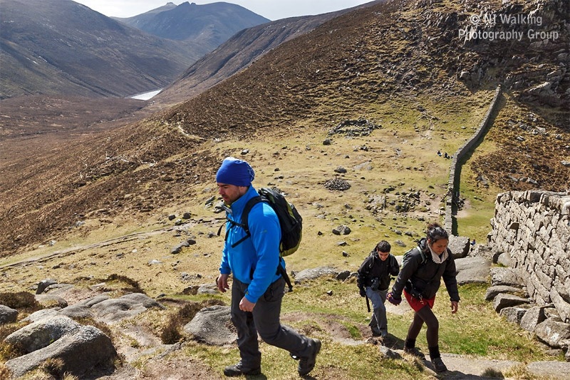
Walk left from the car park entrance to reach a combined gate and stile marking the start of the Trassey Track (75m).
PLEASE USE THE STILE AND KEEP THE GATE CLOSED.
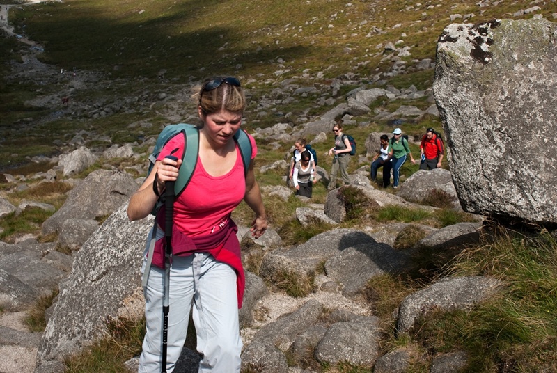
Cross two further stiles to arrive at the forest edge and the beginning of open mountainside (1km). Beyond the third stile the track continues 1.5km to a ford.
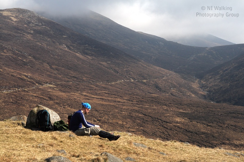
Threading its way uphill, the track approaches the Trassey River along the left hand side. At this point the cliffs of Spellack, the north-east shoulder of Slieve Meelmore flank the opposite bank of the river.
Spellack is reputed to owe its present form to the erosive power of glaciers which swept across an older rock face to leave the granite cliffs freshly steepened. Today its sheer precipices provide challenging rock-climbs.
A point just short of the ford provides a comprehensive view of Slieve Bearnagh: seen here between its neighbouring peaks of Slievenaglogh and Slieve Meelmore, from which the cols at Hare’s Gap and Pollaphuca separate it. Slieve Bearnagh is one of the most picturesque Mourne summits with its combination of height (739m), crags, summit tors and smooth rock slabs.
The mechanised quarry workings on Bearnagh’s north face stem from a temporary post-war revival in the demand for foundation blocks and monumental stone.
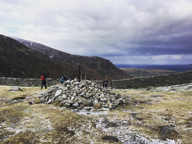
Cross the river and continue 100m to a ‘Y’ junction. Follow the level left fork (right fork climbs to the quarry) and cross a second ford. From here a winding track, commencing over the bare rock pavement and then through a boulder field, leads to the Mourne Wall at the Hare’s Gap (ca 600m).
En route, note the tell-tale wedge marks around the edges of many granite stones. Such evidence of the stone-men’s ‘plug-and-feathers’ method of cutting stone can be seen on boulders large and small throughout the Mournes. The plug (a small iron wedge) was inserted between two thin pieces of steel (feathers) to split the stone along a line of roughly-prepared holes.
From the Hare’s Gap a range of routes can be followed, exploring in a number of directions:
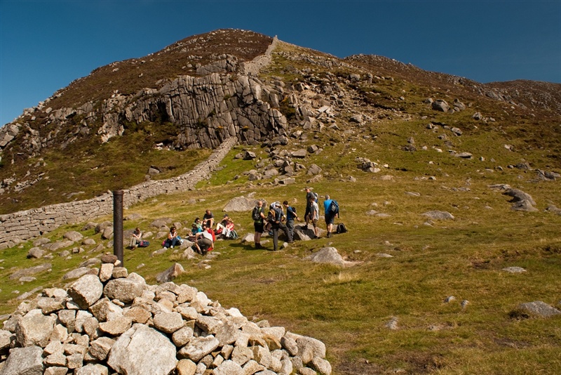
Right - a stiff climb leads up Slieve Bearnagh, considered by some to be the grandest of all Mourne summits.
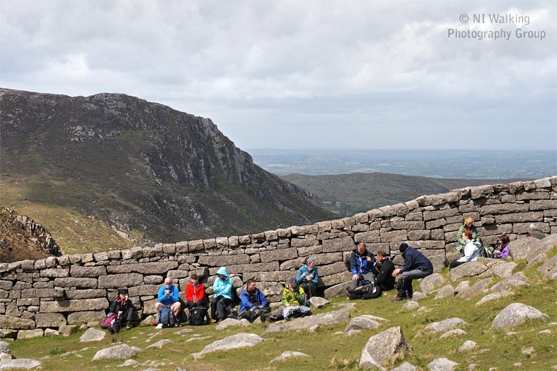
Left - a continuation of the walk follows the Brandy Pad, passing beneath the Diamond Rocks (in 500m) on the side of Commedagh, great weathered granite pillars – likened to a ‘Giant’s Causeway’ high in the mountains.
Whichever option is taken, the views from Bearnagh and along the Brandy Pad are spectacular.
To complete your walk, retrace your steps back to the start.
Please be aware - Although, there are numerous walking routes in the Mournes, the majority of these popular walks are not formally designated public rights of way. Most routes have developed over time due to traditional use. Below 600 feet (180m) most land is privately owned and is farmed or grazed. Many of the traditional access routes cross this land or pass along farm lanes and quarry tracks. Walkers are advised to respect that they may be walking on private land and are encouraged to make themselves aware of and adhere to the principles of 'Leave No Trace' - www.leavenotraceireland.org"
Please remember that much of the land you will cross is private property and access is only available through the goodwill of the landowners. Although some areas of the countryside have been traditionally used for recreation, the public have no general rights to access such land and are only walking with the tolerance of the landowner.
TRAIL INFORMATION
Walk left from the car park entrance to reach a combined gate and stile marking the start of the Trassey Track (75m).
PLEASE USE THE STILE AND KEEP THE GATE CLOSED.
Cross two further stiles to arrive at the forest edge and the beginning of open mountainside (1km). Beyond the third stile the track continues 1.5km to a ford.
Threading its way uphill, the track approaches the Trassey River along the left hand side. At this point the cliffs of Spellack, the north-east shoulder of Slieve Meelmore flank the opposite bank of the river.
Spellack is reputed to owe its present form to the erosive power of glaciers which swept across an older rock face to leave the granite cliffs freshly steepened. Today its sheer precipices provide challenging rock-climbs.
A point just short of the ford provides a comprehensive view of Slieve Bearnagh: seen here between its neighbouring peaks of Slievenaglogh and Slieve Meelmore, from which the cols at Hare’s Gap and Pollaphuca separate it. Slieve Bearnagh is one of the most picturesque Mourne summits with its combination of height (739m), crags, summit tors and smooth rock slabs.
The mechanised quarry workings on Bearnagh’s north face stem from a temporary post-war revival in the demand for foundation blocks and monumental stone.
Cross the river and continue 100m to a ‘Y’ junction. Follow the level left fork (right fork climbs to the quarry) and cross a second ford. From here a winding track, commencing over the bare rock pavement and then through a boulder field, leads to the Mourne Wall at the Hare’s Gap (ca 600m).
En route, note the tell-tale wedge marks around the edges of many granite stones. Such evidence of the stone-men’s ‘plug-and-feathers’ method of cutting stone can be seen on boulders large and small throughout the Mournes. The plug (a small iron wedge) was inserted between two thin pieces of steel (feathers) to split the stone along a line of roughly-prepared holes.
From the Hare’s Gap a range of routes can be followed, exploring in a number of directions:
Right - a stiff climb leads up Slieve Bearnagh, considered by some to be the grandest of all Mourne summits.
Left - a continuation of the walk follows the Brandy Pad, passing beneath the Diamond Rocks (in 500m) on the side of Commedagh, great weathered granite pillars – likened to a ‘Giant’s Causeway’ high in the mountains.
Whichever option is taken, the views from Bearnagh and along the Brandy Pad are spectacular.
To complete your walk, retrace your steps back to the start.
Please be aware - Although, there are numerous walking routes in the Mournes, the majority of these popular walks are not formally designated public rights of way. Most routes have developed over time due to traditional use. Below 600 feet (180m) most land is privately owned and is farmed or grazed. Many of the traditional access routes cross this land or pass along farm lanes and quarry tracks. Walkers are advised to respect that they may be walking on private land and are encouraged to make themselves aware of and adhere to the principles of 'Leave No Trace' - www.leavenotraceireland.org"
Please remember that much of the land you will cross is private property and access is only available through the goodwill of the landowners. Although some areas of the countryside have been traditionally used for recreation, the public have no general rights to access such land and are only walking with the tolerance of the landowner.
GETTING TO THE START
- Point of Interest Mountain views, Mourne Wall
- Facilities Formal car parking area. Further car parking, cafe, toilets, camping and accommodation available at Meelmore Lodge located near Trassey Car Park.
- Dog Policy Dogs must be kept on leads
- Accessibility Information
Accessibility Grade: Grade 5 Terrain: Unsurfaced off road paths Toilet Facility: No Signage: No - Getting to the Start The walk begins from the council car park along Trassey Road at the northern foot of Clonachullion Hill.
- Public Transport Translink – journeyplanner.translink.co.uk
- Level of Difficulty
 Strenuous TRAIL GRADE DISCLAIMER
 The trail grades shown on OutmoreNI.com and WalkNI.com are based on desk-based assessments of available trail information. The categories—Easy, Moderate, Strenuous, and Very Strenuous—follow the Sustainable Trails Development Guide grading system.
These grades are provided as a general guide to help users choose trails that may be suitable for them. They are not a substitute for official, on-site grading or safety information provided by the relevant land manager, which may differ from the information on these websites.
Outdoor activities involve inherent risks, including the risk of injury, death, property damage, and other hazards. By using information from OutmoreNI.com and WalkNI.com, you acknowledge that you do so at your own risk. OutmoreNI.com and WalkNI.com accept no responsibility or liability for any loss, injury, or damage arising from the use of this information.
Conditions on trails can change, and the actual environment may differ from what is described online. Users should always exercise their own judgment, take appropriate precautions, and remain responsible for their own safety and conduct at all times.
All information provided on OutmoreNI.com and WalkNI.com is intended as a guide only and should be used alongside your own experience, awareness, and careful decision-making.
Physically demanding, narrow trails with steep climbs and descents over short and long distances. Expect the surface to be uneven and changeable throughout with natural surfaces like grass, exposed rock and trodden earth. The surface may change suddenly and be unstable in places. There will be slippery sections when wet and large, frequent obstacles like exposed roots, large boulders, overgrown sections, uneven stiles and long stretches of uneven steps.
Outdoor clothing and sturdy footwear are recommended.