6 miles
Loop
Very Strenuous
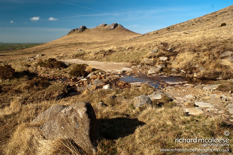
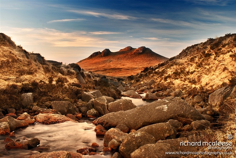
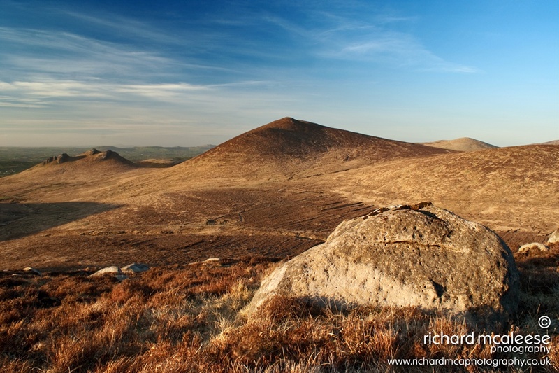
Hen, Cock and Pigeon Rock
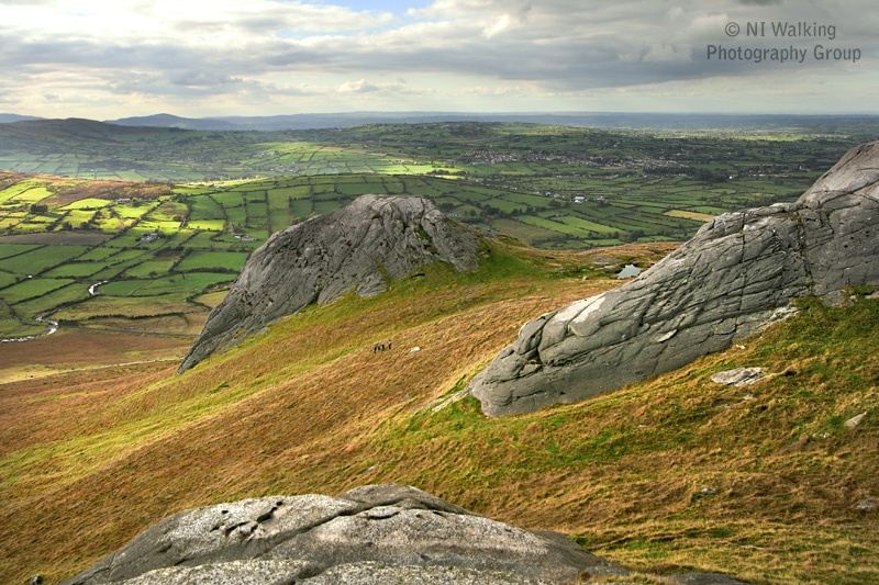
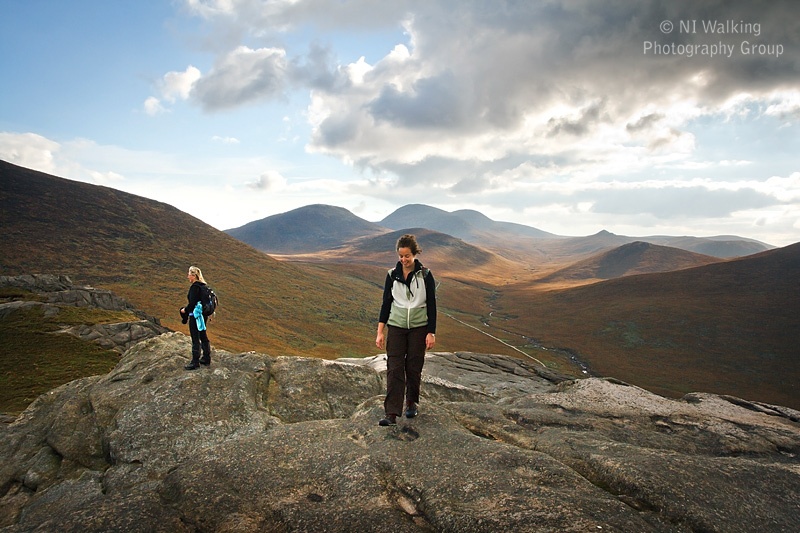
A circular route in the western Mournes giving a taster of views that can be experienced in the region. The walker will ascend Hen, Cock and Pigeon Rock Mountains using open mountain terrain before descending through a valley to the starting car park. Please note, there are no dogs allowed in this area of the Mournes, so we recommend leaving your dog at home or heading to the nearby Kilbroney Forest Park, where dogs are permitted on a lead.
TRAIL INFORMATION
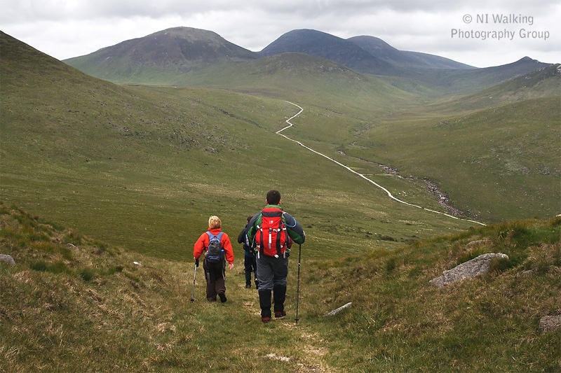
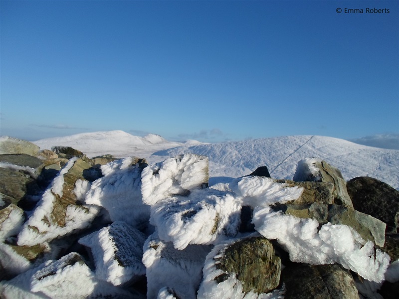
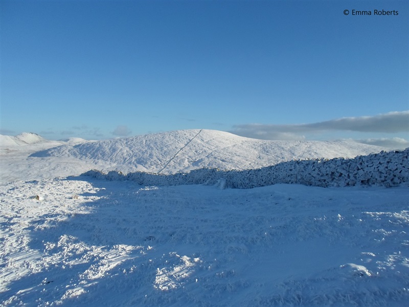
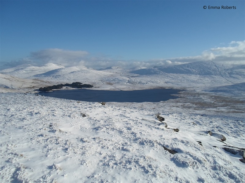
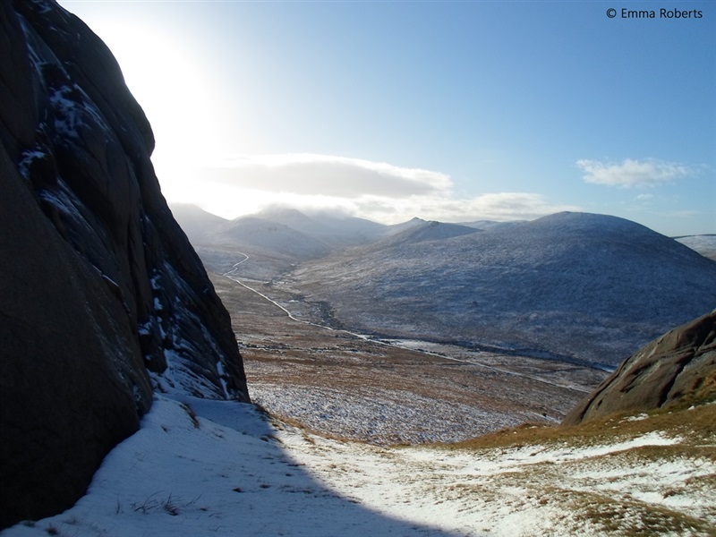
Leave Sandbank Car Park and cross the Sandbank Road to Hen track, directly opposite. Follow Hen track up to the gate. After the stone wall follow the well worn track cross country to ascend Hen Mountain. From here there is no constructed path on the route until the Hen Track is rejoined later at the Rowan Tree River. At the summit, explore the impressive collection of tors popular with rock climbers. From the south tor descend south east before starting the steeper ascent up Cock Mountain. Ascend Cock Mountain from where there are impressive views of Spelga Dam Reservoir to the east. Descend Cock Mountain in a south south easterly direction to flatter ground which can be boggy, before ascending Pigeon Rock Mountain to meet Batts Wall at its summit. Follow Batts Wall initially in a south easterly direction and then in a south westerly direction to the col between Pigeon Rock Mountain and Slievemoughanmore, where you will meet the upper stretch of the Rowan Tree River. Follow the river to join Hen track. Follow the track back to Sandbank Road Car Park.
TRAIL INFORMATION
Leave Sandbank Car Park and cross the Sandbank Road to Hen track, directly opposite. Follow Hen track up to the gate. After the stone wall follow the well worn track cross country to ascend Hen Mountain. From here there is no constructed path on the route until the Hen Track is rejoined later at the Rowan Tree River. At the summit, explore the impressive collection of tors popular with rock climbers. From the south tor descend south east before starting the steeper ascent up Cock Mountain. Ascend Cock Mountain from where there are impressive views of Spelga Dam Reservoir to the east. Descend Cock Mountain in a south south easterly direction to flatter ground which can be boggy, before ascending Pigeon Rock Mountain to meet Batts Wall at its summit. Follow Batts Wall initially in a south easterly direction and then in a south westerly direction to the col between Pigeon Rock Mountain and Slievemoughanmore, where you will meet the upper stretch of the Rowan Tree River. Follow the river to join Hen track. Follow the track back to Sandbank Road Car Park.
GETTING TO THE START
- Point of Interest Hen Mountain, Cock Mountain, Pigeon Rock Mountain
- Facilities Car park and picnic facilities available at Sandbank Road Car Park
- Accessibility Information
Accessibility Grade: Grade 5 Terrain: Loose surface tracks, open mount Toilet Facility: No Signage: No - Getting to the Start The walk starts at the Sandbank Road Car Park. To get here follow the Kilkeel Road out of Hilltown for 2.9 km, turn right at the Sandbank Road crossroads and continue for 1.4 km, Hen car park is on the right hand side.
- Public Transport Translink – journeyplanner.translink.co.uk
- Level of Difficulty
 Very Strenuous TRAIL GRADE DISCLAIMER
 The trail grades shown on OutmoreNI.com and WalkNI.com are based on desk-based assessments of available trail information. The categories—Easy, Moderate, Strenuous, and Very Strenuous—follow the Sustainable Trails Development Guide grading system.
These grades are provided as a general guide to help users choose trails that may be suitable for them. They are not a substitute for official, on-site grading or safety information provided by the relevant land manager, which may differ from the information on these websites.
Outdoor activities involve inherent risks, including the risk of injury, death, property damage, and other hazards. By using information from OutmoreNI.com and WalkNI.com, you acknowledge that you do so at your own risk. OutmoreNI.com and WalkNI.com accept no responsibility or liability for any loss, injury, or damage arising from the use of this information.
Conditions on trails can change, and the actual environment may differ from what is described online. Users should always exercise their own judgment, take appropriate precautions, and remain responsible for their own safety and conduct at all times.
All information provided on OutmoreNI.com and WalkNI.com is intended as a guide only and should be used alongside your own experience, awareness, and careful decision-making.
Physically demanding trails requiring a high level of fitness and experience. Expect sustained steep climbs and descents, rough and uneven terrain, and significant physical effort throughout.
Outdoor clothing and sturdy footwear are essential.