20.9 miles
Loop
Kilkeel Cycle Route
A 28 mile cycle route exploring the South East corner of the Country. The route passes Carlingford Lough and Silent Valley Reservoir. Some hilly sections but your efforts are certainly rewarded with the views that this route offers.
TRAIL INFORMATION
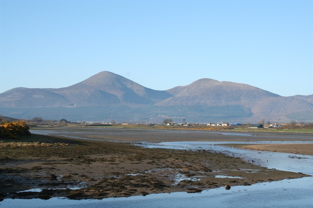
Leaving Kilkeel by the Mill and Aughnahoory Roads you slowly climb past the restored clachan of Hanna’s Close and over the Kilkeel River. After crossing the Brackenagh bridge a left turn is made into Sabbath Road before continuing the slow rise towards the Head Road where you turn left towards the Silent Valley reservoir and associated parkland. From this road cyclists have a magnificent view of the coastal plain, the Irish Sea stretching towards the Isle of Man and the backdrop of the Mourne Mountains. The mountains continue to open up as you swing round the hills before descending on the Attical Road into Attical Village, dominated by its lovely chapel. From Attical, the route descends again, crosses the main Newry road and reaches the shores of Carlingford Lough at Greencastle Castle. Passing close to the many caravan parks, you return to Kilkeel past the site of a former USAF air base near Cranfield. Although 28 miles in length this route can be divided by use of the Carrigenagh Road which links the Silent Valley to Kilkeel.
TRAIL INFORMATION
Leaving Kilkeel by the Mill and Aughnahoory Roads you slowly climb past the restored clachan of Hanna’s Close and over the Kilkeel River. After crossing the Brackenagh bridge a left turn is made into Sabbath Road before continuing the slow rise towards the Head Road where you turn left towards the Silent Valley reservoir and associated parkland. From this road cyclists have a magnificent view of the coastal plain, the Irish Sea stretching towards the Isle of Man and the backdrop of the Mourne Mountains. The mountains continue to open up as you swing round the hills before descending on the Attical Road into Attical Village, dominated by its lovely chapel. From Attical, the route descends again, crosses the main Newry road and reaches the shores of Carlingford Lough at Greencastle Castle. Passing close to the many caravan parks, you return to Kilkeel past the site of a former USAF air base near Cranfield. Although 28 miles in length this route can be divided by use of the Carrigenagh Road which links the Silent Valley to Kilkeel.
GETTING TO THE START
By Bike: National Route 99 traverses the Ards peninsula in Co Down, skirts the southern shores of Strangford Lough and down to Newcastle, Co Down. By Car: From Belfast take the A24 south, signposted Carryduff. Continue on this road through Ballynahinch, Seaforde and Clough. Here the main road becomes the A2, the main road to Newcastle. Continue through Newcastle and follow the A2 to Kilkeel.
- Facilities Toilet facilities and refreshments are available at the start point.
- Getting to the Start By Bike: National Route 99 traverses the Ards peninsula in Co Down, skirts the southern shores of Strangford Lough and down to Newcastle, Co Down. By Car: From Belfast take the A24 south, signposted Carryduff. Continue on this road through Ballynahinch, Seaforde and Clough. Here the main road becomes the A2, the main road to Newcastle. Continue through Newcastle and follow the A2 to Kilkeel.
- Traffic Information Very little traffic on these quiet country roads
- Bike Hire Providers Life Adventure Centre Castlewellan Life Adventure Centre Grange Courtyard Forest Park Castlewellan Email: iwant@onegreatadventure.com Phone: +44 (0)2843770714 http://www.onegreatadventure.com
- Accessible Facilities The route is on tarmac roads. Please contact Armagh and Down Tourist Information for more details.