20.8 miles
Loop
Knockchree Cycle Route
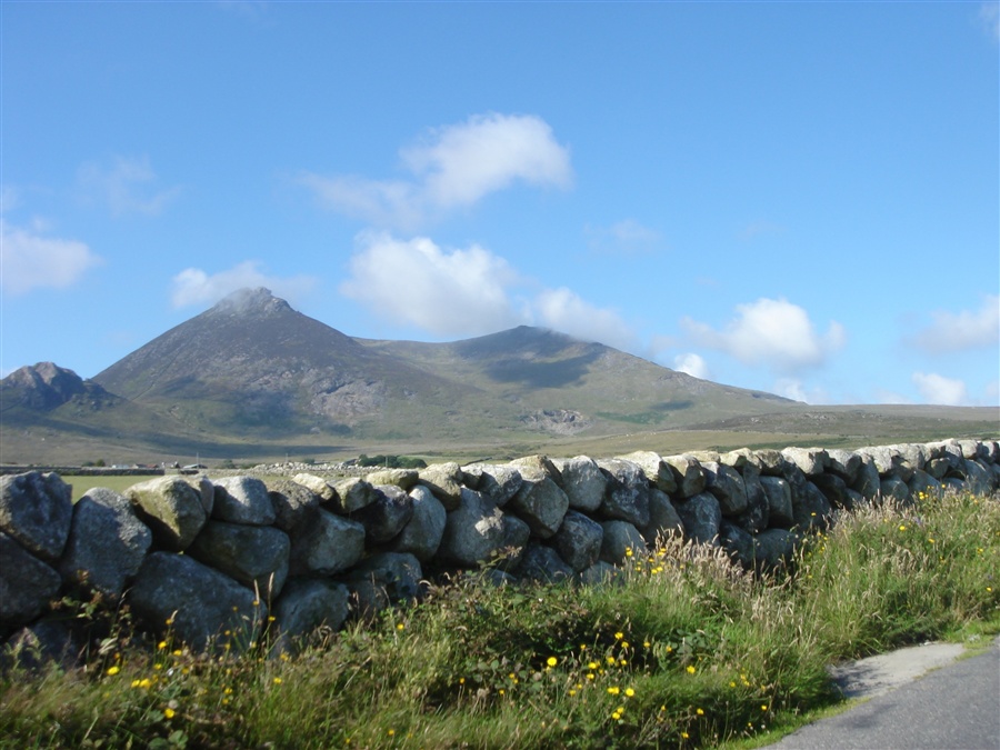
A beautiful circular cycle route between Kilkeel and Attical, passing through some lovely countryside with dramatic view of the Mourne Mountains.
TRAIL INFORMATION
Begin at the Lower Square in Kilkeel Town Centre. Head west out of the square straight across the traffic lights onto Greencastle Street, you pass the Kilmorey Arms Hotel on your left. Keep to this road, it takes you through the townland of Dunaval. After about 2 miles note the large house on your left called Eastwood, shortly afterwards the road divides. Take the right fork and proceed to a T-junction, turn right. Note the many sunken fields which are old sand extractions (high quality building sand) restored to agricultural and recreational use.
At the next junction turn left to pass Grange School and Chapel on your left. The road now meanders through the marshy flood plain of the Whitewater River. You come to a staggered crossroads, turn left. About a mile straight ahead is the Blue Flag Beach of Cranfield with its caravan sites. However your route turns immediately right following the directions to Greencastle about 1.7 miles. The quiet seaside hamlet of Greencastle offers peace, tranquility and several interesting features: a notable Anglo-Norman castle built circa 1260 (subsequently built several times); the ruins of the old Norman Church; the Old Irish Sea Ferry Pier; a row of fine coastguard and lighthouse keeper's houses and the Irish Lights Base on the north quay, which services all the navigational lights in Carlingford Lough and further south (including the picturesque and Haulbowline Lighthouse).
The hamlet offers magnificent views of Mill Bay, the Eastern Mournes, Carlingford Lough and across the water, Greenore and Carlingford on the Cooley peninsula.
Retrace your route back to Greencastle crossroads and turn left to cross the old bridge over the Whitewater River (a fine game fish river). The reed marshes on your left are a nature reserve for wild fowl and are known locally as the 'Bents'. Further along the route you come to Mill Bay with fine views up Carlingford Lough. Follow the Benagh Road along the shore for about 1.75 miles until you come to the Millbay Road on your right.
Your route turns right onto the Millbay Road but if you are interested you can carry straight on for about 0.75 miles to Tamlaght (Plaque Monument) Graveyard, which you will find on the left side of the road. If you visited Tamlaght retrace your route to the Millbay Road and turn left onto it. This road runs straight up the hill to a T-junction and turn left onto the Newry Road. After about 300 metres turn right onto the Glenloughan Road. This road again climbs steeply with wonderful views of the mountains ahead and of Knockchree on your right. Follow this road until you come to the T-junction at the end and turn left.
The Whitewater Brewery is immediately on your left. The small brewery is the only producer of 'Real Beer' in this area, it is highly recommended. Further up this road you again cross the Whitewater River and then note the new Attical Community Centre on your left. Carry on to the centre of Attical village and at the chapel turn left onto the Attical Road. Note the wonderful panorama of mountains and countryside around you.
At the end of this road turn right onto Moyadd Road and after about 0.75 miles turn left onto the Head Road. Again this gives you another wonderful panoramic view of the mountains, countryside and the sea. After about 1 mile turn onto the Leitrim Road. The route is now mostly downhill and takes you through beautiful, yet intensively cultivated, countryside. After about 0.75 miles you cross straight over a crossroads but within 50 metres you need to turn left onto the Aughnaloopy Road. This road takes you downhill to the Ballinran crossroads at which you go straight across once again.
Within 0.5 miles you will see a signpost to Hanna's Close down a lane to your left. It is well worth a visit. After your visit retrace your route back to the road and turn left down the Aughnahoory Road. This takes you back into the town of Kilkeel and at the T-junction at the road end you turn left onto the Mill Road. Down the hill to another T-junction and turn right onto Newcastle Street. This takes you back to the lower square in the town centre. You pass the ancient ruined church on your right which gives the town its name - Kilkeel (the Church of the Narrow Place). There are some very interesting gravestones in the associated graveyard.
GETTING TO THE START
The Lower Square is situated in the centre of Kilkeel Town Centre where there is also a car park.
- Facilities You can purchase refreshments before leaving in Kilkeel. There are also toilets situated in the Square which is the starting point.
- Getting to the Start The Lower Square is situated in the centre of Kilkeel Town Centre where there is also a car park.
- Traffic Information During peak season you will find some roads are quite busy at the start of the journey as they are the only roads accessible to caravan sites at Cranfield so therefore you may encounter cars and perhaps caravans.
- Bike Hire Providers Life Adventure Centre Castlewellan Life Adventure Centre Grange Courtyard Forest Park Castlewellan Email: iwant@onegreatadventure.com Phone: +44 (0)2843770714 http://www.onegreatadventure.com
- Accessible Facilities It is a clear route with no obstacles although some of the country roads can be quite busy at times.