2.2 miles
Loop
Easy
Loughbrickland Walk (Whyte's Estate)
Enjoy a quiet stroll along woodland paths and country lane within this small, family owned estate located on the edge of the pretty village of Loughbrickland.
This route forms part of the Loughbrickland Historic Trail developed by a partnership between the former Banbridge District Council, now Armagh City, Banbridge & Craigavon Borough Council, the former Loughbrickland and District Community Association, Loughbrickland Historical Group and the owner, Dr Jean Whyte - assisted by funding from the Heritage Lottery and Rural Development Fund.
Entry to the estate is free of charge and normally open at all times. However, Ballyvally Archery Club use the woodland at the Whyte's Estate for training and outdoor competitions. For public safety the route is closed on competition days which take place occasionally throughout the year. The Archery Club post advisory notices on site. -
The woodland trail of approx. 0.90 mile (1.45 km) was extended with the opening of the Boundary Trail approx. 1.25 mile (2 km) in 2008. They can be combined to create an approx. 2.5 miles (4.02 km) circular walk.
TRAIL INFORMATION
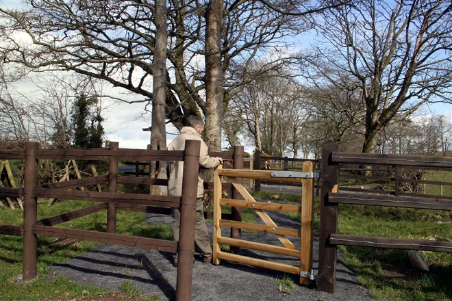
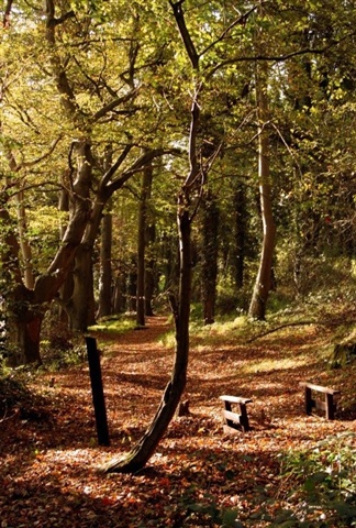
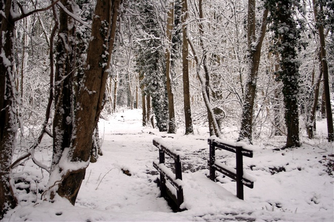
Please note the trail follows woodland trails and country lane and can be uneven and muddy and there are steps at a number of locations along the route. Suitable footwear is recommended.
Public access to the estate is by kind tolerance of the estate owner, Dr Whyte under an agreement between Armagh City, Banbridge and Craigavon Borough Council. If you have any problems with the trail please contact the Council's Countryside Officer on 028 4066 0617. Please respect the privacy of the owner and remain on the designated route as all other areas are private.
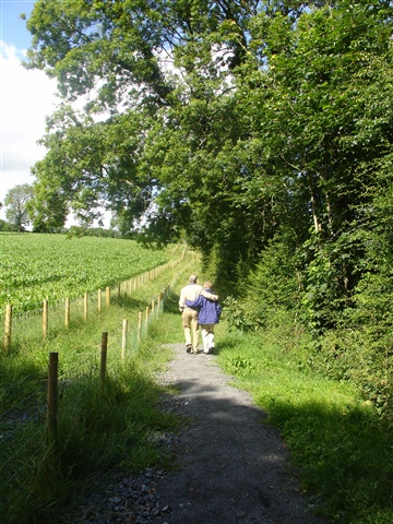
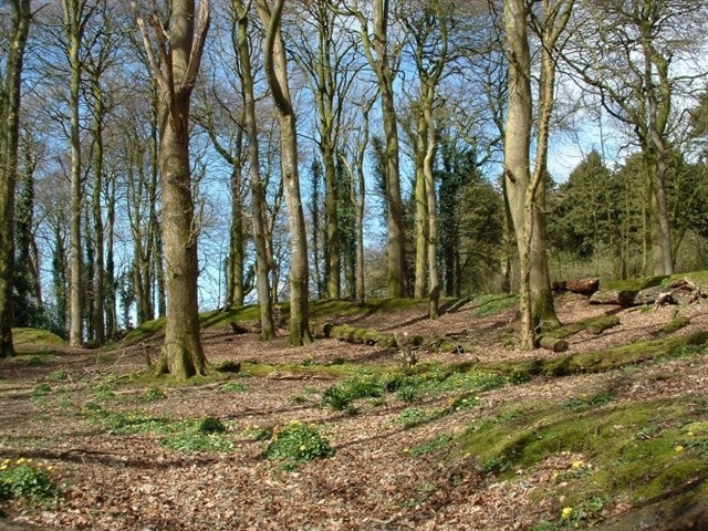
Enter the estate avenue on foot from the Scarva Street entrance. A short distance along the avenue a fingerpost marks the start of walk to the right of the avenue, just beyond the gate lodge. This section of the route runs parallel to the Old Newry Road. The walk travels through a woodland strip with glimpses of the parkland to the left. The surface can be uneven, look out for the sections of concrete - vestiges of an army training camp of up to 2000 troops which was based here during World War II.
At the junction of the path - ignore the entrance to the Boundary Trail for now and follow the Woodland Trail up the hill through the ash plantation and climb 2 sets of steps to Coolnacran Fort, a scheduled historic monument. The owner is carrying out laurel clearance and woodland management in the wood at the time of writing so the trail surroundings are changing with the clearance.
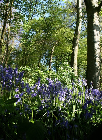
Just beyond the steps you will be pass the original entrance to this ringfort or rath on the eastern downhill side of a drumlin. The current entrance to the fort is further along, near the interpretative board. With its peaceful location surrounded by trees Coolnacran Fort has an almost mystical feel. In spring bluebells transform this area of the walk. The interpretative board features an artistic impression of how the fort might have looked soon after its construction. The fort was nearly completely overgrown with laurels and the laurels were cleared with assistance from volunteers as part of the work to open up the woodland trail c. 2000. This first part of the project was provided with grant assistance from NIEA. Take time to explore the interior of the fort before following the yellow way mark posts out of the wood to an avenue and turn left and walk towards a set of gates. Go through the gap beside the gates turn right onto the back avenue, away from the house and gardens which are strictly private.
You may see grey squirrels scampering from tree to tree here and hear the call of the rooks in spring. To the left of the avenue is a large rookery with reportedly 285 active nests. Walk towards the Coolnacran Road gates at the back entrance to the estate. There is a choice of routes here with the turn to the left (way marked yellow) completing the Woodland Trail and leading back to the Scarva Street entrance. The path to the right is the Boundary Trail and follows an old ride that runs around the perimeter of the estate.
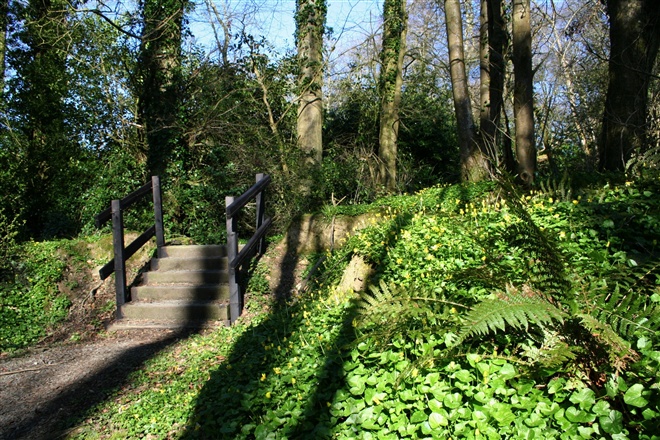
The wide, tree lined lane that forms the Boundary Trail is an old 'ride' - a path made specially for use by the owners of the house and their guests for riding and exercising horses. Over the years this fell into disuse and much of it was impassable. In 2008, with the kind agreement of the owner of the estate, the former Banbridge District Council with assistance from Heritage Lottery funding and assistance with ground works from Probation Service for NI brought the ride back into use as the 'Boundary Trail' walk. This section of the trail follows a rough country lane terrain and the surface can be uneven, wet and muddy with rough crossing places, steps and gates.
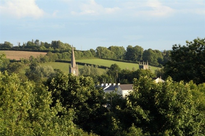
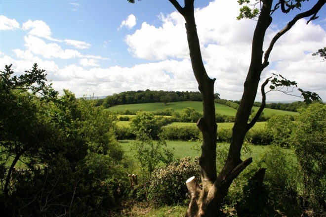
As you approach Johnston's Fort , the second scheduled historic monument along the trail, you will see the 'Boundary Trail' interpretative board to the right. Johnston's Fort, a raised rath, with its elevated position, affords views down to Loughbrickland village and across the fields to the much larger Coolnacran Fort to the south west. This marks the mid-way point of the Boundary Trail. Steps have to be climbed to enter and leave the fort. On leaving Johnston's Fort the trail drops down to run parallel with the Old Newry Road. Often the banks along the trail have good displays of primroses and dog violets in spring. This section, from the fort to the first gate off the Old Newry Road was improved in autumn 2014 with investment from the Down Rural Area Partnership under the Rural Development Programme 2007-2013.
As the trail re-enters the woodland stay on the upper path and look out for the veteran oak on the left estimated from its girth to be about 350 years old. On re-joining the Woodland Trail retrace your steps to Coolnacran Fort and follow the way markers to the back gates of the estate. Take the Woodland Trail to the left and follow the way marked path to return to the starting point.
TRAIL INFORMATION
Please note the trail follows woodland trails and country lane and can be uneven and muddy and there are steps at a number of locations along the route. Suitable footwear is recommended.
Public access to the estate is by kind tolerance of the estate owner, Dr Whyte under an agreement between Armagh City, Banbridge and Craigavon Borough Council. If you have any problems with the trail please contact the Council's Countryside Officer on 028 4066 0617. Please respect the privacy of the owner and remain on the designated route as all other areas are private.
Enter the estate avenue on foot from the Scarva Street entrance. A short distance along the avenue a fingerpost marks the start of walk to the right of the avenue, just beyond the gate lodge. This section of the route runs parallel to the Old Newry Road. The walk travels through a woodland strip with glimpses of the parkland to the left. The surface can be uneven, look out for the sections of concrete - vestiges of an army training camp of up to 2000 troops which was based here during World War II.
At the junction of the path - ignore the entrance to the Boundary Trail for now and follow the Woodland Trail up the hill through the ash plantation and climb 2 sets of steps to Coolnacran Fort, a scheduled historic monument. The owner is carrying out laurel clearance and woodland management in the wood at the time of writing so the trail surroundings are changing with the clearance.
Just beyond the steps you will be pass the original entrance to this ringfort or rath on the eastern downhill side of a drumlin. The current entrance to the fort is further along, near the interpretative board. With its peaceful location surrounded by trees Coolnacran Fort has an almost mystical feel. In spring bluebells transform this area of the walk. The interpretative board features an artistic impression of how the fort might have looked soon after its construction. The fort was nearly completely overgrown with laurels and the laurels were cleared with assistance from volunteers as part of the work to open up the woodland trail c. 2000. This first part of the project was provided with grant assistance from NIEA. Take time to explore the interior of the fort before following the yellow way mark posts out of the wood to an avenue and turn left and walk towards a set of gates. Go through the gap beside the gates turn right onto the back avenue, away from the house and gardens which are strictly private.
You may see grey squirrels scampering from tree to tree here and hear the call of the rooks in spring. To the left of the avenue is a large rookery with reportedly 285 active nests. Walk towards the Coolnacran Road gates at the back entrance to the estate. There is a choice of routes here with the turn to the left (way marked yellow) completing the Woodland Trail and leading back to the Scarva Street entrance. The path to the right is the Boundary Trail and follows an old ride that runs around the perimeter of the estate.
The wide, tree lined lane that forms the Boundary Trail is an old 'ride' - a path made specially for use by the owners of the house and their guests for riding and exercising horses. Over the years this fell into disuse and much of it was impassable. In 2008, with the kind agreement of the owner of the estate, the former Banbridge District Council with assistance from Heritage Lottery funding and assistance with ground works from Probation Service for NI brought the ride back into use as the 'Boundary Trail' walk. This section of the trail follows a rough country lane terrain and the surface can be uneven, wet and muddy with rough crossing places, steps and gates.
As you approach Johnston's Fort , the second scheduled historic monument along the trail, you will see the 'Boundary Trail' interpretative board to the right. Johnston's Fort, a raised rath, with its elevated position, affords views down to Loughbrickland village and across the fields to the much larger Coolnacran Fort to the south west. This marks the mid-way point of the Boundary Trail. Steps have to be climbed to enter and leave the fort. On leaving Johnston's Fort the trail drops down to run parallel with the Old Newry Road. Often the banks along the trail have good displays of primroses and dog violets in spring. This section, from the fort to the first gate off the Old Newry Road was improved in autumn 2014 with investment from the Down Rural Area Partnership under the Rural Development Programme 2007-2013.
As the trail re-enters the woodland stay on the upper path and look out for the veteran oak on the left estimated from its girth to be about 350 years old. On re-joining the Woodland Trail retrace your steps to Coolnacran Fort and follow the way markers to the back gates of the estate. Take the Woodland Trail to the left and follow the way marked path to return to the starting point.
GETTING TO THE START
- Point of Interest Temporary closure of the Woodland Trail at Whyte's Estate - please note that the Woodland Trail is closed to the public as from 27 March 2019 due to tree felling /woodland management operations by the landowner.
- Facilities On street parking only. Public toilets located in Loughbrickland Park, off the Poyntzpass Road in the village, approx. 0.25 mile from start of walk. Shops, garage, pub and food in village. Loughbrickland Park covers just over 9 acres and is set out in informal style with open grass areas, a small wetland wooded area, stream, play area, toilets and paths. The main access and parking area for the park is located off the Poyntzpass Road and the park also has two pedestrian accesses from Main Street/Dublin Road in the village. Surrounding area: The F.E. Mc William Gallery & Studio, 200 Newry Road, Banbridge, County Down, BT32 JNB This facility houses an art gallery, sculpture garden, café and tourist information point. Opened in September 2008, the F.E. McWilliam Gallery and Studio is dedicated to the memory of the successful Banbridge born sculptor Frederick Edward McWilliam (1909 -1992). McWilliam is an internationally known sculptor of eclectic style – described as ‘An inventor of styles’. He was a contemporary of Brancusi, Henry Moore and William Scott. When he died his executors left his London studio and many examples of his work in different stages to the state with a view to it being displayed in his native town. The studio has been lovingly reconstructed by Banbridge District Council in a peaceful sculpture garden at this small modern gallery which houses many examples of his work. It is located approx. 2 mile from Loughbrickland, just off the A1, heading towards Banbridge. Join the A1 for a short distance taking the first exit (A26) to Banbridge. Follow to roundabout and pick up signage for the Gallery & Studio here (it is located next to this roundabout). Free Admission. Monday to Saturday: 10.00am - 5.00pm Sundays (June, July & August only) 1.00pm - 5.00pm. Lisnagade Fort: the only large triple-ringed earthwork recorded in County Down. It is a State Care monument located approx. 200 metres across a field (in agricultural use) off the Lisnagade Road, a couple of miles NW of Loughbrickland. (Grid ref: J087441). Leave the village via Scarva Street. Beyond the village boundary take the 2nd road on the right, the Lisnagade Road – continue north thru x-road for approx. ½ mile, looking for a small lay-by and pedestrian gate on the left. The fort is located towards the junction of the Lisnagade Road with the B3 Scarva/Glenloughan Road. To visit Scarva continue along the road to its junction with the B3, turn left onto this road and follow to the village. Scarva Village & Newry Canal Towpath: The small village of Scarva is located along the former Newry Portadown Canal. It is located about 3.7 miles or 10 minutes drive west of Loughbrickland along the B3. The towpath forms part of the Newry Canal Way and provides an excellent flat cycle or walking route. The village also has an attractive park located next to Scarva Primary School, off Main Street.
- Dog Policy Dogs should be under close control at all times. Please clean up after your dog.
- Accessibility Information
Accessibility Grade: Grade 4 Terrain: Woodland trail & rough lane. Toilet Facility: No Signage: No - Getting to the Start The walk starts at the entrance to the Whyte Estate (Loughrickland House) at the junction of Scarva Street and the Old Newry Road, Loughbrickland. Please park with due care and consideration along Scarva Street as the small car park next to the estate Gate Lodge is private and was provided by the owner to serve the gate lodge which is available for hire. The walk starts to the right of the avenue - just past the gate lodge. You will see a wooden fingerpost indicating the start of the walk.
- Public Transport Translink – journeyplanner.translink.co.uk
- Level of Difficulty
 Easy TRAIL GRADE DISCLAIMER
 The trail grades shown on OutmoreNI.com and WalkNI.com are based on desk-based assessments of available trail information. The categories—Easy, Moderate, Strenuous, and Very Strenuous—follow the Sustainable Trails Development Guide grading system.
These grades are provided as a general guide to help users choose trails that may be suitable for them. They are not a substitute for official, on-site grading or safety information provided by the relevant land manager, which may differ from the information on these websites.
Outdoor activities involve inherent risks, including the risk of injury, death, property damage, and other hazards. By using information from OutmoreNI.com and WalkNI.com, you acknowledge that you do so at your own risk. OutmoreNI.com and WalkNI.com accept no responsibility or liability for any loss, injury, or damage arising from the use of this information.
Conditions on trails can change, and the actual environment may differ from what is described online. Users should always exercise their own judgment, take appropriate precautions, and remain responsible for their own safety and conduct at all times.
All information provided on OutmoreNI.com and WalkNI.com is intended as a guide only and should be used alongside your own experience, awareness, and careful decision-making.
Relatively flat or gently rolling trails with a mostly smooth surface. You might come across some obstacles like bridges, gates and steps.
Normal clothing and footwear can be worn.