1.5 miles
Loop
Easy
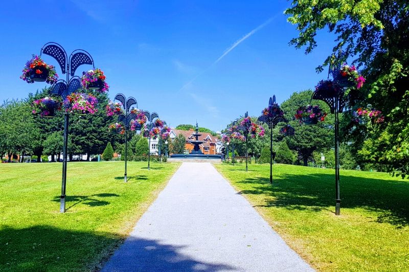
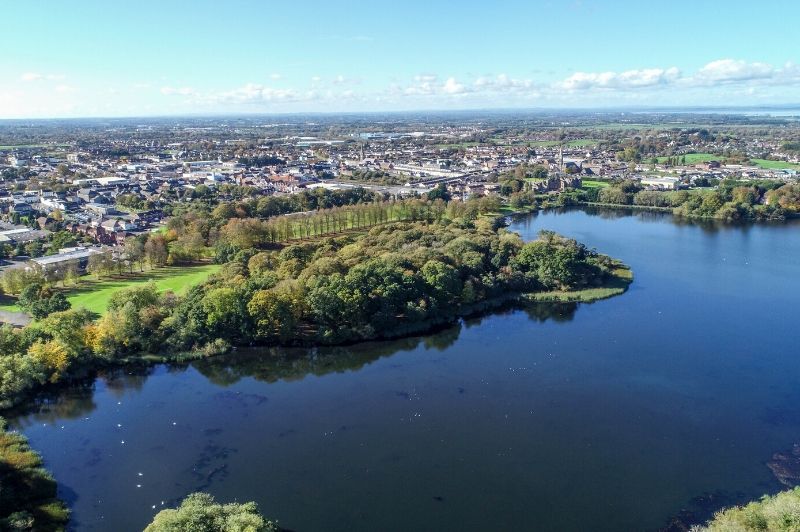
Lurgan Park
Northern Ireland's largest and most beautiful urban park, the second largest public park in Ireland.
Various walks can be enjoyed in and around Lurgan Park, a full lap of the park and lake and park boundary is 2 miles while a walk around the woodland area is 0.8
TRAIL INFORMATION
Enter park via the Waves Park Gates,
Turn Left, walk towrads fountain,
(may take a left at tenneis courts and follow path round to fountain for a longer walk - boundrys)
Turn right leave park by gate
Follow park fence via footpath until Brownlow House,
Re Enter park at golf club gates,
Follow path along lake edge and piers,
Take uphill left follow path round past demise avenue gate Alternatibely at this point take a right and follow the path round into the woodland area past play park close to opposite side of the lake - loops back round to fountain.
alternatively continue to avenue road park gate,
turn right and continue back to starting point.
GETTING TO THE START
- Point of Interest Brownlow House, Lurgan Lake & Colebrookdale Fountain
- Facilities "Waves Leisure Comples has disabled parking space, a small restaurant and public toilets, Also a shop, chip shop etc can be found just opposte the Avenue Road park gate (the PArk Gate service station)"
- Getting to the Start "From Belfast etc. Follow Motorway towards Craigavon and take the Oxford Island / Lurgan turn off. Follow the Lough road/William (A76) straight into Lurgan From the centre of Lurgan head through Lurgan towards Belfast/Banbridge along the Avenue Road (A3). Just as you leave Lurgans main shoppng area take the left towards Waves Leisure Complex. This is at the toip of the Mourne Road at the first set of junction traffic lights leaving Lurgan in this Direction (Almost a cross roads.) A short distance down there is plenty of car parking."
- Public Transport Translink – journeyplanner.translink.co.uk
- Level of Difficulty
 Easy TRAIL GRADE DISCLAIMER
 The trail grades shown on OutmoreNI.com and WalkNI.com are based on desk-based assessments of available trail information. The categories—Easy, Moderate, Strenuous, and Very Strenuous—follow the Sustainable Trails Development Guide grading system.
These grades are provided as a general guide to help users choose trails that may be suitable for them. They are not a substitute for official, on-site grading or safety information provided by the relevant land manager, which may differ from the information on these websites.
Outdoor activities involve inherent risks, including the risk of injury, death, property damage, and other hazards. By using information from OutmoreNI.com and WalkNI.com, you acknowledge that you do so at your own risk. OutmoreNI.com and WalkNI.com accept no responsibility or liability for any loss, injury, or damage arising from the use of this information.
Conditions on trails can change, and the actual environment may differ from what is described online. Users should always exercise their own judgment, take appropriate precautions, and remain responsible for their own safety and conduct at all times.
All information provided on OutmoreNI.com and WalkNI.com is intended as a guide only and should be used alongside your own experience, awareness, and careful decision-making.
Relatively flat or gently rolling trails with a mostly smooth surface. You might come across some obstacles like bridges, gates and steps.
Normal clothing and footwear can be worn.