19.5 miles
Linear
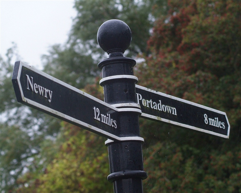
Newry Canal Way (Cycle)
This cycle and walking route from the Bann Bridge in Portadown to the Town Hall in Newry is a 20 mile trip on part of route 9 of the National Cycle Network. The route follows the towpath on the western bank of the Newry Canal.
TRAIL INFORMATION
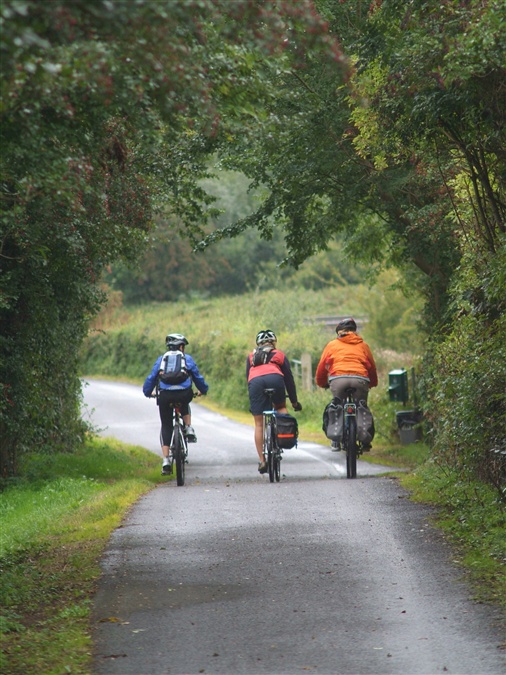
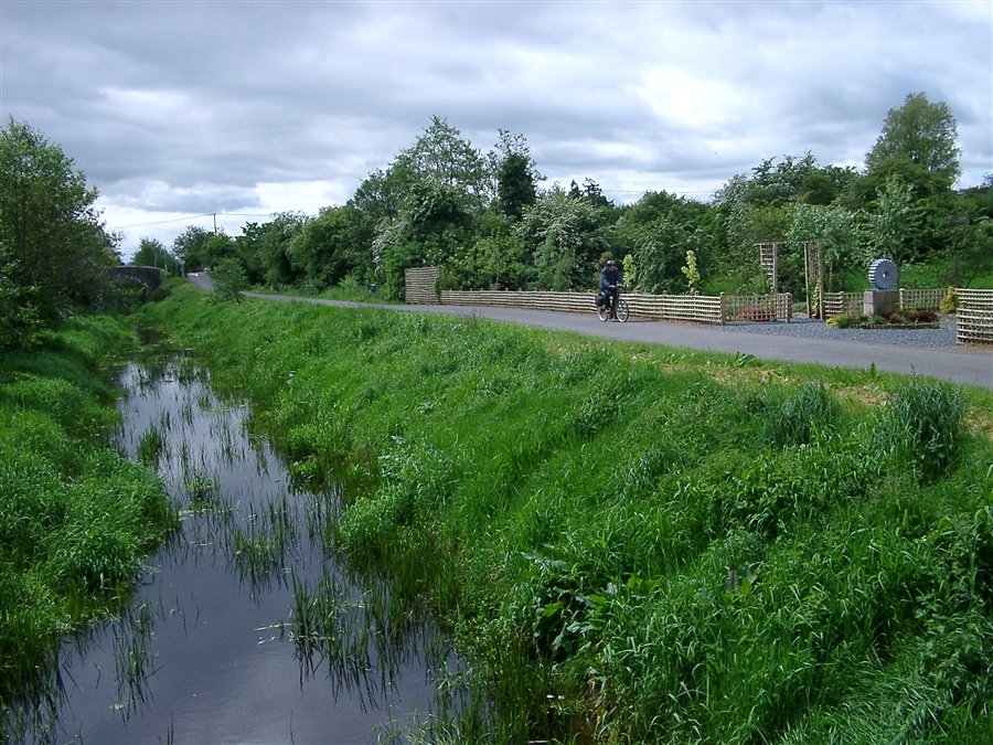
Start the Route in Portadown at The Bann Bridge on Bridge Street. This track has an average gradient along gravel paths with some boggy areas. After one mile you will meet the Point of Whitecoat, which marks the end of the Canal and the point where the River Bann meets the River Cusher. Continue for approximately 1 mile to visit Moneypenny’s Lock and Museum, which highlights the magnificent flora and fauna that brings the Canal and towpath to life. Pass Knock Bridge and continue to the next landmark of Terryhoogan Lock. Approximately one mile further along, you will enter the village of Scarva. Halfway between Scarva and Poyntzpass is the Acton Interpretive Centre. Just after the 10 mile point you will find Poyntzpass. The next landmark is Gambles Bridge, also known as the Crack Bridge due partly to the crack in its wall and partly to its use as a meeting place to share a bit of craic! After approximately 15 miles, you will enter Jerrettspass, another small village. Between there and Newry you will cross Steenson's Bridge, a picturesque stone bridge incorporating three arches. At the end of the route is Newry Town Hall which was designed by William Batt and constructed in 1893. Art pieces can be seen along the route including some Millennium Mileposts and a series of specially commissioned pieces which reflect the former work and nature of the Newry Canal.
TRAIL INFORMATION
Start the Route in Portadown at The Bann Bridge on Bridge Street. This track has an average gradient along gravel paths with some boggy areas. After one mile you will meet the Point of Whitecoat, which marks the end of the Canal and the point where the River Bann meets the River Cusher. Continue for approximately 1 mile to visit Moneypenny’s Lock and Museum, which highlights the magnificent flora and fauna that brings the Canal and towpath to life. Pass Knock Bridge and continue to the next landmark of Terryhoogan Lock. Approximately one mile further along, you will enter the village of Scarva. Halfway between Scarva and Poyntzpass is the Acton Interpretive Centre. Just after the 10 mile point you will find Poyntzpass. The next landmark is Gambles Bridge, also known as the Crack Bridge due partly to the crack in its wall and partly to its use as a meeting place to share a bit of craic! After approximately 15 miles, you will enter Jerrettspass, another small village. Between there and Newry you will cross Steenson's Bridge, a picturesque stone bridge incorporating three arches. At the end of the route is Newry Town Hall which was designed by William Batt and constructed in 1893. Art pieces can be seen along the route including some Millennium Mileposts and a series of specially commissioned pieces which reflect the former work and nature of the Newry Canal.
GETTING TO THE START
There is a train station at both Portadown and Newry, so you could get the train to either Portadown or Newry and then cycle to the other town. Alternatively by car take the Craigavon (Armagh) junction on the M1 and follow signs to Portadown, you can start the trail just behind Tescos car park in Portadown and work your way towards Newry.
- Facilities Refreshments available in Portadown, Tandragee, Scarva Visitor Centre, Poyntzpass, Jerretspass and Newry.
- Getting to the Start There is a train station at both Portadown and Newry, so you could get the train to either Portadown or Newry and then cycle to the other town. Alternatively by car take the Craigavon (Armagh) junction on the M1 and follow signs to Portadown, you can start the trail just behind Tescos car park in Portadown and work your way towards Newry.
- Traffic Information The Newry Canal Towpath is a shared usse path and can be busy at times. Please give way to pedestrians and be prepared to dismount if necessary.
- Bike Hire Providers Craigavon Watersports Centre 1 Lake Road Craigavon www.getactiveabc.com Email: golfskiwatersports@armaghbanbridgecraigavon.gov.uk Phone: 028 3834 2669 http://www.getactiveabc.com
- Accessible Facilities Slight inclines in some places, and uneven terrain but generally flat.