1.2 miles
Loop
Ormeau Park
This route explores an historic parkland overlooking the River Lagan.
TRAIL INFORMATION
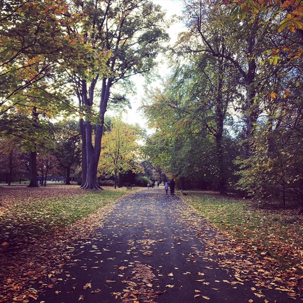
Beginning at the car park beside Ormeau Recreation Centre, take the tree-lined path to the right of the recreation centre, past the all weather pitches.
Keep right at the next two junctions. Continue along this path past mature trees and woodland copses. You will reach a crossroads. Go straight on. You will pass the former Superintendent’s House within a garden on your left.
Continue on until you pass a small shelter. Ahead will be two roads, take the second one on the right. This leads to the outside of the former walled garden.
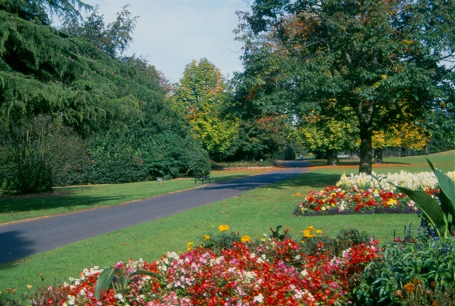
Turn left, keeping the wall on your right, and then left again on to the main path leading from the entrance to the service yard. Follow this path. You will see the bandstand on your right. Follow the path to the right which leads past a second shelter, some flower beds and mature conifer trees. Just beyond these on your right is a small wildflower meadow.
Continue past a triangular rose bed on your left, but veer left at the next triangular flower bed, in which there stands a bell on a post.
Take the next right and then left to return to the car park.
This walk is also suitable for people with limited mobility, please see link below for Disabled Ramblers NI in Ormeau Park.
TRAIL INFORMATION
Beginning at the car park beside Ormeau Recreation Centre, take the tree-lined path to the right of the recreation centre, past the all weather pitches.
Keep right at the next two junctions. Continue along this path past mature trees and woodland copses. You will reach a crossroads. Go straight on. You will pass the former Superintendent’s House within a garden on your left.
Continue on until you pass a small shelter. Ahead will be two roads, take the second one on the right. This leads to the outside of the former walled garden.
Turn left, keeping the wall on your right, and then left again on to the main path leading from the entrance to the service yard. Follow this path. You will see the bandstand on your right. Follow the path to the right which leads past a second shelter, some flower beds and mature conifer trees. Just beyond these on your right is a small wildflower meadow.
Continue past a triangular rose bed on your left, but veer left at the next triangular flower bed, in which there stands a bell on a post.
Take the next right and then left to return to the car park.
This walk is also suitable for people with limited mobility, please see link below for Disabled Ramblers NI in Ormeau Park.
GETTING TO THE START
- Point of Interest Trees, ecotrail, flower beds, bandstand
- Facilities Toilets at Ormeau Embankment and Recreation Centre. Refreshments available locally. The following facilities are available for users with limited mobility: – Disabled toilets – Disabled parking
- Accessibility Information
Accessibility Grade: Grade 3 Terrain: Tarmac paths, gradual hills Toilet Facility: No Signage: No - Getting to the Start Car park at Ozone recreation centre – entrance off Ormeau Embankment.
- Public Transport Translink – journeyplanner.translink.co.uk