1.4 miles
Loop
Easy
Peatlands Parkside Walk
The main park gates and the gates at Derryadd Lough are open daily from 9.00am to 9.00pm Easter Sunday until the end of September and from 9.00am to 5.00pm during the winter months. Please check the signs for closing times on your arrival. Admission into the park is FREE all year round.
The Information Centre and Railway operate daily from 12.00pm to 5.00pm during June, July and August and at Weekends and Bank Holidays from Easter Sunday until the end of September.
TRAIL INFORMATION
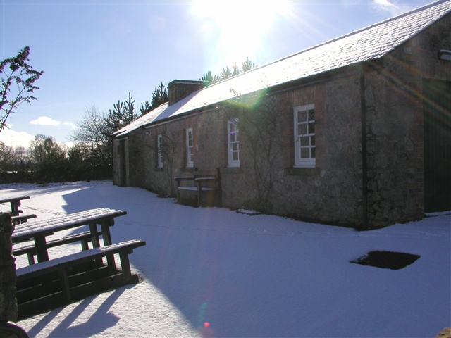
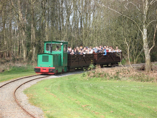
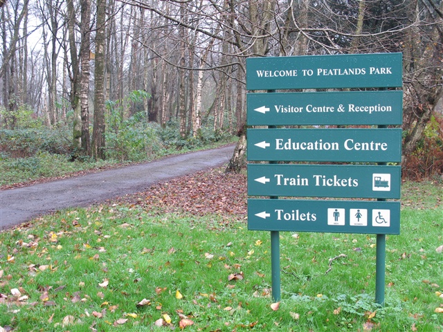
Follow the path marked with brown arrows. This route takes you past the Visitor Centre where you can pick up information and purchase tickets (when operational) for the narrow gauge railway has been associated with the area since the 1950's. Two of the carriages have been specially adapted to take wheelchairs.
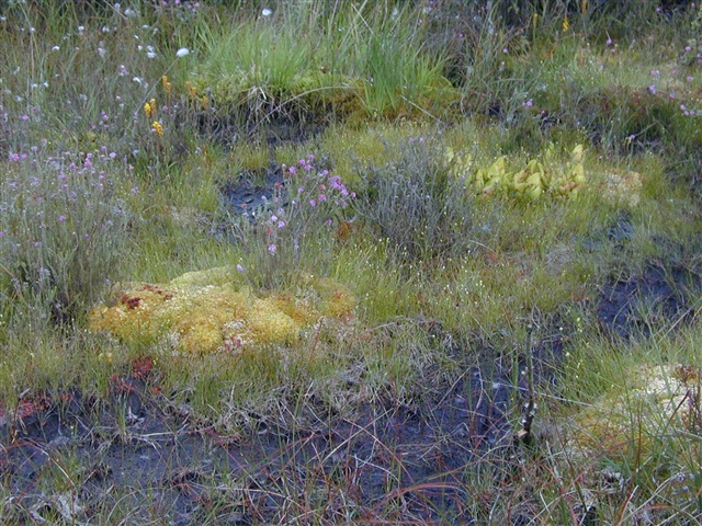
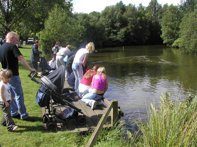
Close by the railway platform, a short stroll around the Bog Garden will provide the visitor with a chance to see virtually all the flora species associated with the peatland habitat.
There are four other routes in the Park of various lengths and marked with different coloured arrows.
This walk is also suitable for people with limited mobility - please link below to Disabled Ramblers NI - Peatlands Park.
TRAIL INFORMATION
Follow the path marked with brown arrows. This route takes you past the Visitor Centre where you can pick up information and purchase tickets (when operational) for the narrow gauge railway has been associated with the area since the 1950's. Two of the carriages have been specially adapted to take wheelchairs.
Close by the railway platform, a short stroll around the Bog Garden will provide the visitor with a chance to see virtually all the flora species associated with the peatland habitat.
There are four other routes in the Park of various lengths and marked with different coloured arrows.
This walk is also suitable for people with limited mobility - please link below to Disabled Ramblers NI - Peatlands Park.
GETTING TO THE START
- Point of Interest Duck pond, Railway, Bog Garden
- Facilities Free parking is available for 200 cars or 20 coaches including 12 disabled parking bays. There is also a smaller Car Park at Derryadd Lough on the eastern margin of the park. FACILITIES INCLUDE Visitor Centre Education Centre (school groups) Toilets Access for disabled visitors Railway (carriages adapted for wheelchairs) Scooters for Shopmobility members Car/bus parking Souvenir shop Picnic areas
- Dog Policy Dogs must be kept under control at all times. Please clean up after your dog.
- Accessibility Information
Accessibility Grade: Grade 4 Terrain: Tarmac roads and boardwalk paths Toilet Facility: No Signage: No - Getting to the Start Peatlands Park is located at Junction 13 off the M1. You can also get to Peatlands Park via the national cycling network however, please note that cycling/mountainbiking is not permitted in the park except for on vehicular roads. All Waymarked walks start at the Information Triangle adjacent to the main car park.
- Public Transport Translink – journeyplanner.translink.co.uk
- Level of Difficulty
 Easy TRAIL GRADE DISCLAIMER
 The trail grades shown on OutmoreNI.com and WalkNI.com are based on desk-based assessments of available trail information. The categories—Easy, Moderate, Strenuous, and Very Strenuous—follow the Sustainable Trails Development Guide grading system.
These grades are provided as a general guide to help users choose trails that may be suitable for them. They are not a substitute for official, on-site grading or safety information provided by the relevant land manager, which may differ from the information on these websites.
Outdoor activities involve inherent risks, including the risk of injury, death, property damage, and other hazards. By using information from OutmoreNI.com and WalkNI.com, you acknowledge that you do so at your own risk. OutmoreNI.com and WalkNI.com accept no responsibility or liability for any loss, injury, or damage arising from the use of this information.
Conditions on trails can change, and the actual environment may differ from what is described online. Users should always exercise their own judgment, take appropriate precautions, and remain responsible for their own safety and conduct at all times.
All information provided on OutmoreNI.com and WalkNI.com is intended as a guide only and should be used alongside your own experience, awareness, and careful decision-making.
Relatively flat or gently rolling trails with a mostly smooth surface. You might come across some obstacles like bridges, gates and steps.
Normal clothing and footwear can be worn.