2.8 miles
Loop
Portstewart Strand - Sand Dune & Estuary Trail
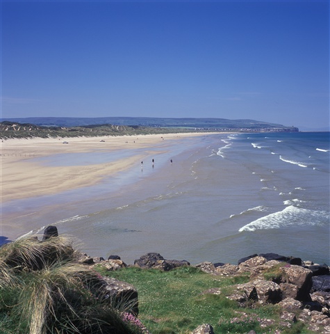
Portstewart Strand, locally known as ‘The Strand’, has long welcomed visitors to its golden sands. It has the European Blue Flag award for its water quality and beach/dune management & is very popular with families in the summer months and with walkers throughout the year. Car parking is restricted to certain sections of the beach.
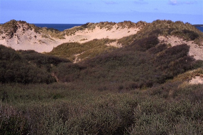
What is less known about Portstewart Strand, are the towering sand dunes (containing some of Ireland’s tallest dunes) and declared as an Area of Special Scientific Interest, together with the adjoining Bann Estuary. From here the River Bann (N Ireland’s longest river) ends its journey, on entering the North Atlantic.
TRAIL INFORMATION
TRAIL INFORMATION
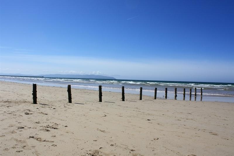
Starting from the beach entrance, where parking is permitted on the sand – the first section of the walk is a 1 mile stroll along the magnificent strand, heading in the direction of distant Mussenden Temple (a folly perched on the cliff edge). After 1 mile you will arrive at a line of wooden posts strung out across the beach, and at this point the walk heads into the sand dunes. The exact point of entry into the dunes, is marked by a lifebuoy station with a No. 10 highlighted on it – head for this & climb the wooden sand ladder.
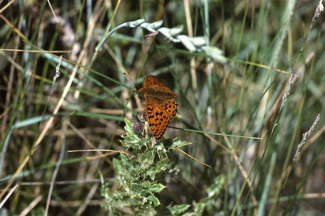
At the top of the sand ladder take the right forked sandy path (narrow) & keep an eye for white waymarker posts – these posts will lead walkers through the dunes to the estuary. Points of interest will include an active rabbit warren, with closely nibbled dune grasslands rich in wild flowers. What will you see? Look out for marram grass, as well as rare pyramidal & bee orchids during the summer months, along with colourful ‘carpet displays’ of plants such as bird’s-foot trefoil, wild pansy and thyme.
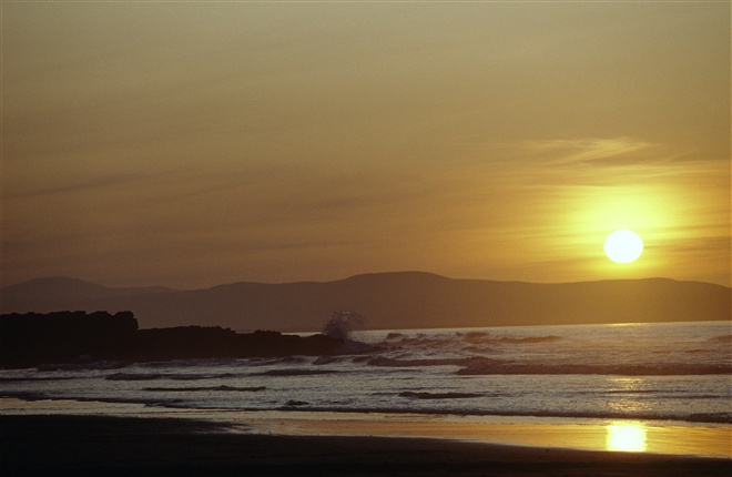
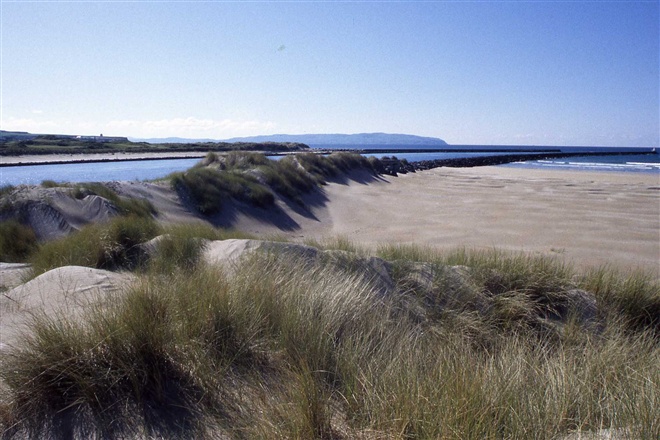
Fairly quickly, you will then come out at the river edge and a different world of the Bann Estuary awaits – where birds will now feature (an identification book would be handy). One to look for is the handsome shelduck. After turning right onto the estuary you will eventually come to two gates. you take the gate on the left and walk the length of a small beach, then climb up onto the path at the end, this takes you to the end of the strand.After about a quarter of a mile the path leaves the river edge very briefly and climbs onto an old railway line embankment – walk along this old disused railway track for another quarter mile, until reaching the river edge again. At this point the path follows a small sandy embayment for about 200 yards (still going right), before climbing up a number of stone steps (still close to the river edge). From here the path continues along the river edge, only with a bit more height, due to the towering sand dunes rising up. Views really start to open up of the Barmouth, where the River Bann enters into the Atlantic, with the headlands of Donegal in the background. Look out for the relatively unspoilt Victorian seaside resort of Castlerock across the river. After a short distance the undulating path returns once again to the same beach where you first started on…the only difference being – you now have to walk the entire length of Portstewart Strand to get back to your start point…a tough life walking on a beach! To assist your return stroll, a system of numbered lifebuoy stations from 15 to 1 will count you down, in 200 yard intervals…Go enjoy!
* Please note that National Trust entrance pricing applies for this walk. Please see the link below for details *
GETTING TO THE START
- Point of Interest Beach Visitor Centre & Sand Dune/Estuary trail
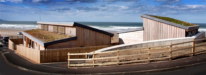
- Facilities Beach Visitor Centre including toilets and disabled toilets, showers, refreshments and retail, beach parking; pedestrian access path ramp; events & staff on duty (March to Oct). The following facilities are available for users with limited mobility: – Café – (Open March to October) – Café (wheelchair accessible) – Disabled toilets – Disabled parking
- Accessibility Information
Accessibility Grade: Grade 5 Terrain: Sandy beach paths Toilet Facility: No Signage: No - Getting to the Start ‘The Strand’ is 1 mile west of the resort town of Portstewart and well sign posted with brown tourist road signs. Parking is permitted on the beach in a designated car parking zone, close to the Beach Visitor Centre.
- Public Transport Translink – journeyplanner.translink.co.uk