1.3 miles
Loop
Rathlin Ballyconaghan Trail
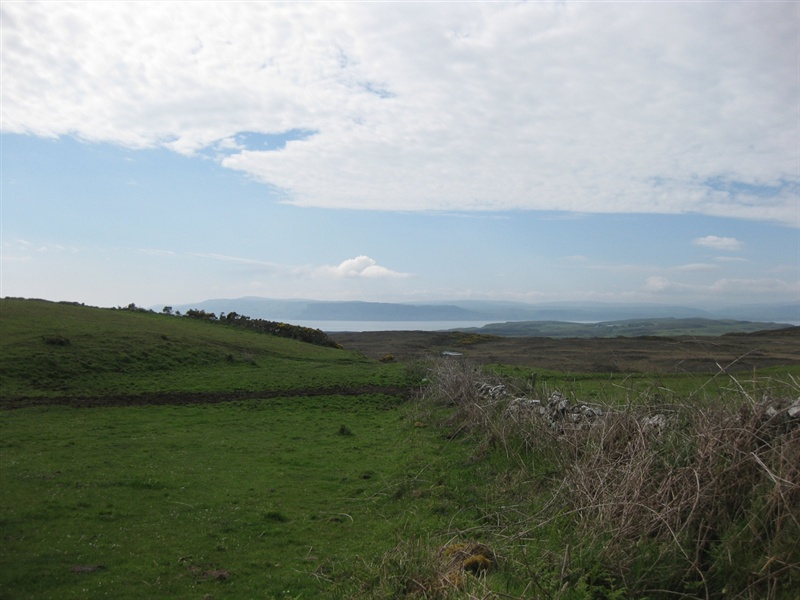
A waymarked route on National Trust Land taking in the north of the island, stunning views out to the Atlantic and Scotland
TRAIL INFORMATION
TRAIL INFORMATION
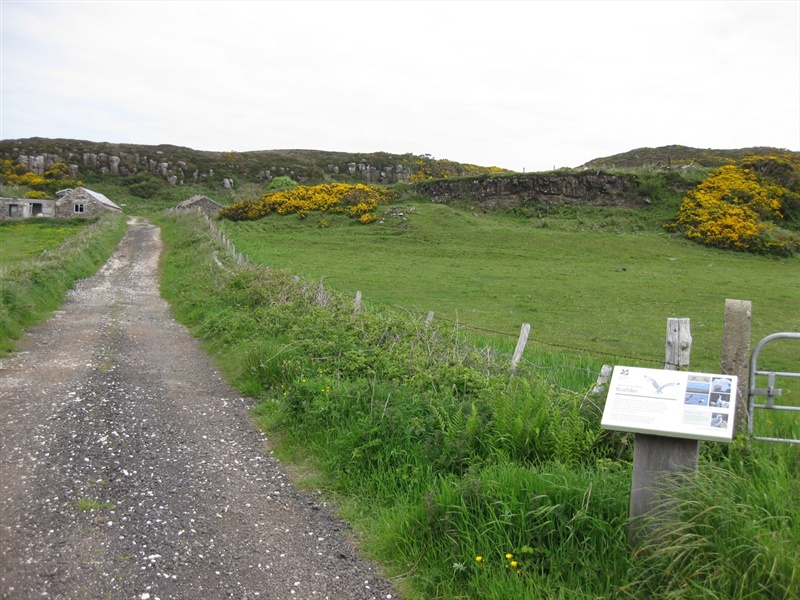
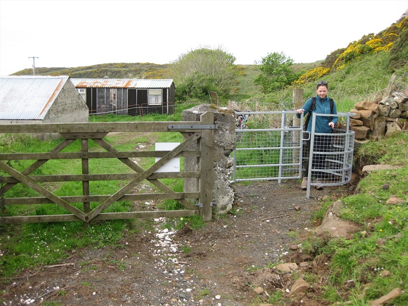
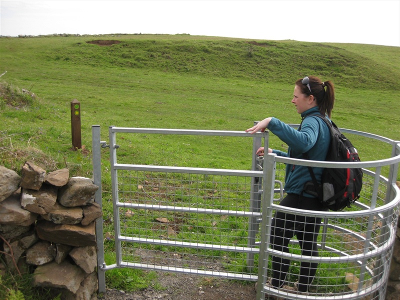
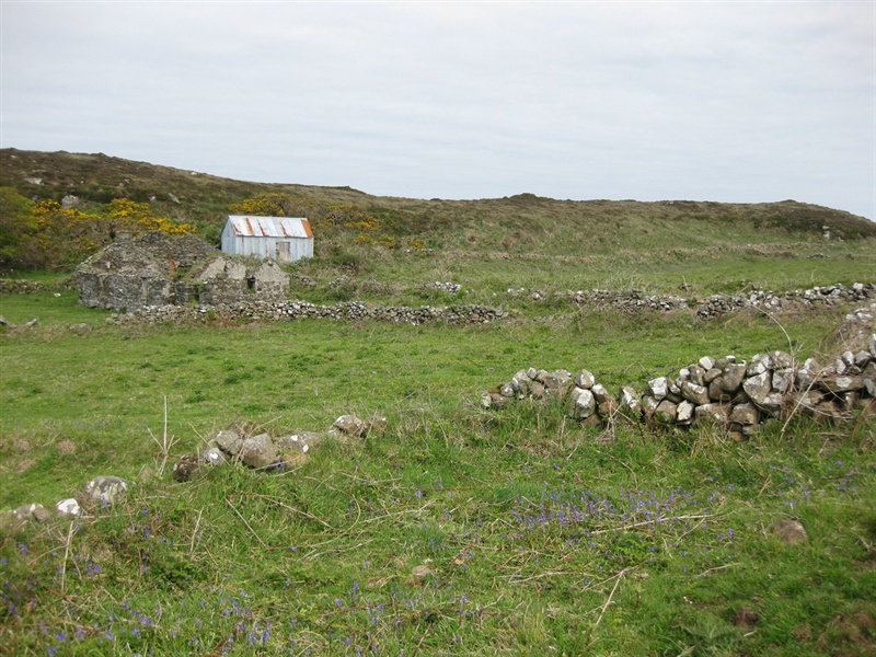
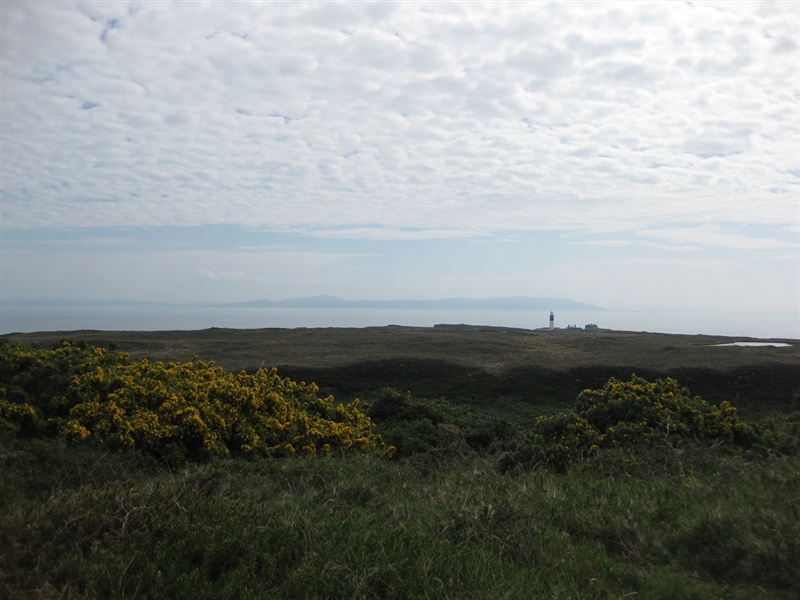
Follow the road to your left leading west from the harbour. Turn right by the church and up the Church Brae to the chapel. Take the road bearing right passing the chapel and follow this for 300m until reaching a lane on your left hand side with a National Trust information panel. Follow this lane for 200m until you reach a metal kissing gate on your right hand side. Follow the waymarked posts (green arrows) straight on before bearing round to the left. This route travels in an anti clockwise direction and leads across open countryside, with views of the East Lighthouse and Scotland further beyond this. The arrows direct you to the top of the cliffs on the northern side of the island, before directing you back to a farm track which winds its way back through the hillside to the metal kissing gate at the start of the route. An optional diversion includes going to visit the old Coast Guard Station, so when you reach the farm track, bear right rather than left to wind your way up the hill to the station. Retrace your steps to rejoin the trail.
Please note that there may be livestock present on this trail.
GETTING TO THE START
- Point of Interest Coastguard station, Church quarter
- Facilities Toilets, pub, cafe and small shop available at Rathlin Harbour. The following facilities are available for users with limited mobility: – Disabled toilets
- Dog Policy Must be kept on lead, livestock may be present
- Accessibility Information
Accessibility Grade: Grade 5 Terrain: open hillside and farm track Toilet Facility: No Signage: No - Getting to the Start Take the ferry from Ballycastle harbour to Rathlin. The ferry goes several times throughout the day in the summer and winter. The ferry is operated by Rathlin Island Ferries, for travel times call 028 2076 9299 or visit the website below.
- Public Transport Translink – journeyplanner.translink.co.uk