1.1 miles
Linear
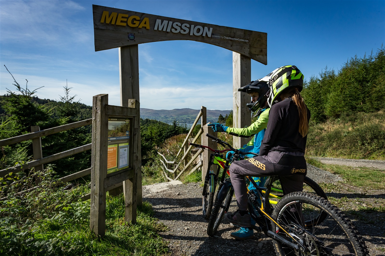
Rostrevor Downhill Mega Mission
Mega Mission sits as one of the fastest paced, jumpiest trails in Northern Ireland. With an uplift service available, it is part of the Rostrevor Mountain Bike Trail Centre, on the shore of the Carlingford Lough.
With a mouth watering 27km red trail and a hair raising 19km black trail Rostrevor is believed by many to be the top spot for mountain biking in Ireland.
When you add not just one but two purpose-built downhill trails to the mix, there’s no denying it… Rostrevor is a mountain bikers’ haven!
TRAIL INFORMATION
This trail has been designed to put the fun factor right off the richter scale! Starting on the southern slopes of Slievebane, this lightning quick Downhill route will push your bike handling skills right to the limit.
TRAIL INFORMATION
This trail has been designed to put the fun factor right off the richter scale! Starting on the southern slopes of Slievebane, this lightning quick Downhill route will push your bike handling skills right to the limit.
GETTING TO THE START
Located approximately 46 miles from Belfast, 75 miles from Dublin, the Rostrevor Mountain Bike Trails can be found on the Shore Road between Rostrevor and Kilkeel. The trailhead is only half a mile outside Rostrevor village; signposted Rostrevor Forest/Kilbroney Park. TRAILHEAD POST CODE: BT34 3AA
- Facilities Please note parking fees apply.
- Getting to the Start Located approximately 46 miles from Belfast, 75 miles from Dublin, the Rostrevor Mountain Bike Trails can be found on the Shore Road between Rostrevor and Kilkeel. The trailhead is only half a mile outside Rostrevor village; signposted Rostrevor Forest/Kilbroney Park. TRAILHEAD POST CODE: BT34 3AA
- Traffic Information N/A
- Bike Hire Providers East Coast Adventure Centre 34 Lower Knockbarragh Road Rostrevor Newry Email: info@eastcoastadventure.com Phone: +44(0)28 417 39923 / 417 38516 http://www.eastcoastadventure.com/
- Accessible Facilities N/A