2.9 miles
Loop
Moderate
Slievenacloy - Boundary
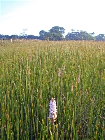
Combining elements of all three trails at Slievenacloy, this walk takes you around the entire reserve. Experience the amazing panoramic views over Northern Ireland and explore the sheltered valley along the banks of the Stoneyford River. Due to grazing livestock dogs must be kept on a lead.
TRAIL INFORMATION
Enter Slievenacloy through the double gates & then climb over the field gate to your right & walk through the lowland meadow, following the fenceline on your right, parallel to the road. At the intersecting fenceline, use the stile, then cross over the Stonyford stream.
Follow the earth bank up the slope ahead & then through the rush pasture, watching out for wet & boggy areas! At the next fenceline, turn left following the waymarker posts north until you drop down & cross over the stile onto the surfaced track. Turn left & follow the surfaced track west, taking a right turn at the junction & following the track up the hill.
At the end of the track is Viewpoint 2. From here head left though the kissing gate & follow the fenceline until you reach a pedestrian gate on your right. Go through this & continue to follow the fenceline right, around the edge of the reserve, looking out for views across Lough Neagh to the Sperrins. The fenceline will bring you down the slope to a surfaced track & Viewpoint 1.
At Viewpoint 1 follow the surfaced track down the hill. At the bottom of the hill go through the kissing gate, turn left & follow the road for a short distance until you are able to cross over & enter the far side of the reserve through a pedestrian gate. Follow the rough track towards the field gate, pausing to read about the enigmatic earth ring that lies within this field.
Once through the gate follow the waymarker posts across the hillside & down the slope to the bridge. Cross the Stoneyford river & follow the waymarker posts up the far slope to the fenceline. Follow the fenceline east, watching out for wet & boggy areas. Waymarker posts will again guide you down the slopes & back over the Stoneyford river.
Follow the rough track up the slope to the Flowbog Road, crossing through a pedestrian gate. You will see the main entrance to your left.
GETTING TO THE START
- Point of Interest Protected habitats and species, views
- Facilities Visitors should park where they can find a safe spot, for example across one of the double gates at the start of the path leading to the derelict farmhouse, leaving space for tractor access. Refreshments can be bought from the Glen Colin filling station
- Dog Policy Dogs must be kept on leads
- Accessibility Information
Accessibility Grade: Grade 5 Terrain: Off-road paths, rough pasture Toilet Facility: No Signage: No - Getting to the Start Found off the Flowbog Road with parking available. Ring the Ulster Wildlife for further details 028 4483 0282 or see link below to Ulster Wildlife website.
- Level of Difficulty
 Moderate
Moderately challenging trails of varying widths with some short, steep climbs and descents. The surface may vary throughout, be slippery and uneven in places. Expect there to be obstacles like exposed roots, narrow gates, stiles and long sets of steps.
Outdoor clothing and sturdy footwear are recommended.