1.2 miles
Linear
Easy
Strabane Towpath
A walk along a canal in the process of being restored. Excellent views of the River Foyle and across to Donegal can be gained from the most northern point of the walk.
TRAIL INFORMATION
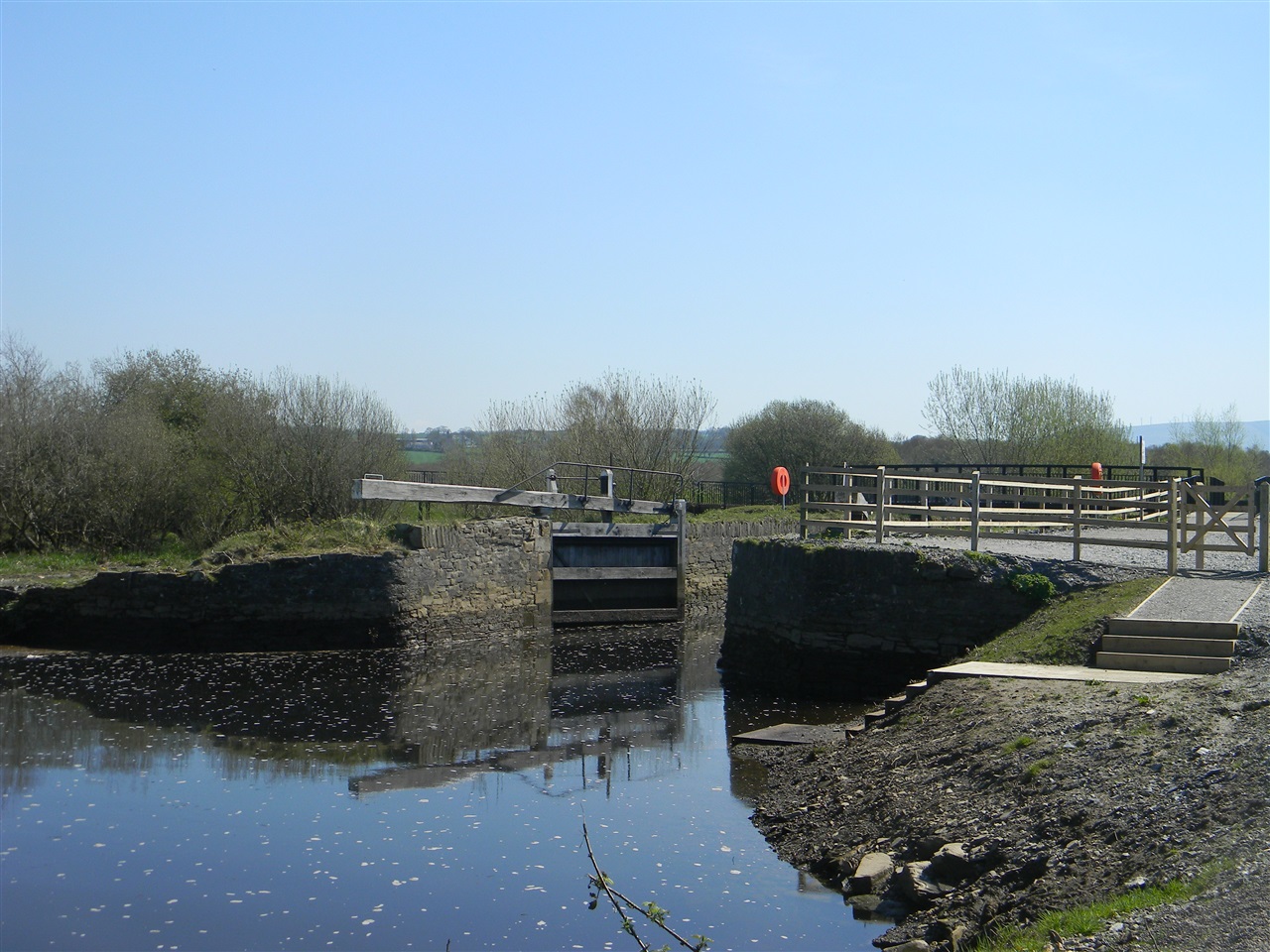
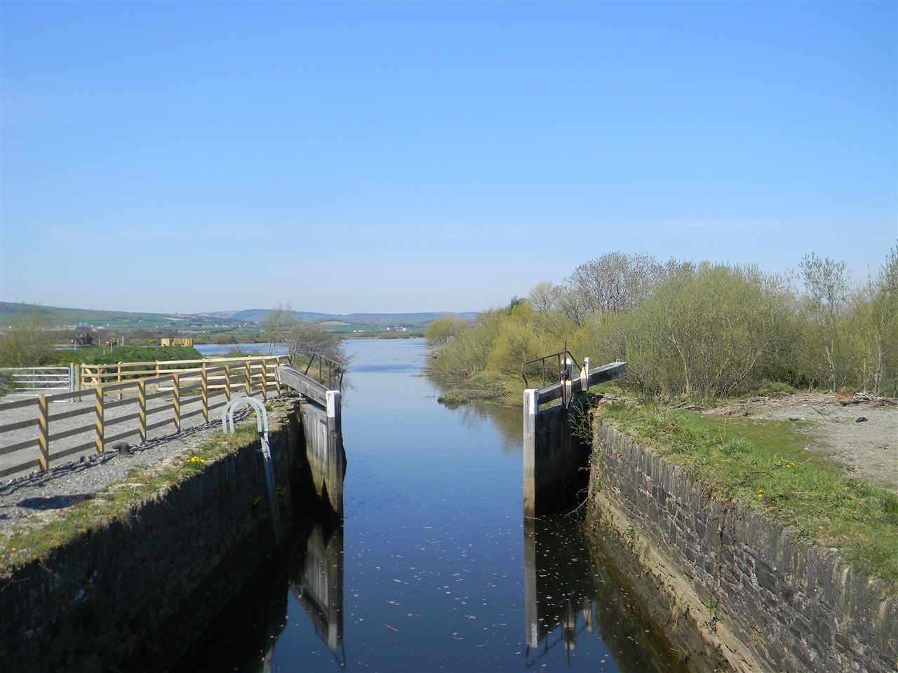
Pass through the kissing gate immediately to right of the vehicle entrance gate. On the right at Devine’s Lock is an interpretative panel briefly outlining the canal`s history. From here follow the trail north as it leads along the canal edge, passing two footbridges which cross the canal, before arriving at Crampsie`s Lock (immediately after the second bridge) . Continue and pass through the kissing gate onto the earth track and follow this to its end at the bird hide. From here stunning views of the River Foyle and East Donegal can be enjoyed. Retrace your steps until reaching the second bridge crossing which features interpretation on the bio- diversity of the Foyle River System. Cross to the opposite bank and continue your walk back to the car park.
History Snapshot:
Strabane canal was officially opened on the 21st March 1796, a report in the Londonderry Journal announced: “Early that morning all the boats on the river assembled at the mouth of the canal to try their skills on the still water and see which would have the great honour of arriving at Strabane first. Almost all the inhabitants of Strabane and the surrounding countryside assembled on the occasion”. The boat with the honour of arriving first at the quay in the town centre was the ‘Captain Quigley’. Its owner was a Mr Fleming.
TRAIL INFORMATION
Pass through the kissing gate immediately to right of the vehicle entrance gate. On the right at Devine’s Lock is an interpretative panel briefly outlining the canal`s history. From here follow the trail north as it leads along the canal edge, passing two footbridges which cross the canal, before arriving at Crampsie`s Lock (immediately after the second bridge) . Continue and pass through the kissing gate onto the earth track and follow this to its end at the bird hide. From here stunning views of the River Foyle and East Donegal can be enjoyed. Retrace your steps until reaching the second bridge crossing which features interpretation on the bio- diversity of the Foyle River System. Cross to the opposite bank and continue your walk back to the car park.
History Snapshot:
Strabane canal was officially opened on the 21st March 1796, a report in the Londonderry Journal announced: “Early that morning all the boats on the river assembled at the mouth of the canal to try their skills on the still water and see which would have the great honour of arriving at Strabane first. Almost all the inhabitants of Strabane and the surrounding countryside assembled on the occasion”. The boat with the honour of arriving first at the quay in the town centre was the ‘Captain Quigley’. Its owner was a Mr Fleming.
GETTING TO THE START
- Point of Interest The Foyle Special Area of Conservation and canal locks.
- Facilities Car parking, interpretation, bird hide, and canoe steps
- Dog Policy Dogs must be kept on leads
- Accessibility Information
Accessibility Grade: Grade 2 Terrain: Compacted gravel track Toilet Facility: No Signage: No - Getting to the Start Follow the A5 Strabane Londonderry Road, north from Strabane for 2.5 miles. Turn left onto the Greenlaw Road in the village of Ballymagorry. Dedicated parking on left hand side opposite entrance.
- Level of Difficulty
 Easy TRAIL GRADE DISCLAIMER
 The trail grades shown on OutmoreNI.com and WalkNI.com are based on desk-based assessments of available trail information. The categories—Easy, Moderate, Strenuous, and Very Strenuous—follow the Sustainable Trails Development Guide grading system.
These grades are provided as a general guide to help users choose trails that may be suitable for them. They are not a substitute for official, on-site grading or safety information provided by the relevant land manager, which may differ from the information on these websites.
Outdoor activities involve inherent risks, including the risk of injury, death, property damage, and other hazards. By using information from OutmoreNI.com and WalkNI.com, you acknowledge that you do so at your own risk. OutmoreNI.com and WalkNI.com accept no responsibility or liability for any loss, injury, or damage arising from the use of this information.
Conditions on trails can change, and the actual environment may differ from what is described online. Users should always exercise their own judgment, take appropriate precautions, and remain responsible for their own safety and conduct at all times.
All information provided on OutmoreNI.com and WalkNI.com is intended as a guide only and should be used alongside your own experience, awareness, and careful decision-making.
Relatively flat or gently rolling trails with a mostly smooth surface. You might come across some obstacles like bridges, gates and steps.
Normal clothing and footwear can be worn.