0.2 miles
Linear
Topped Mountain
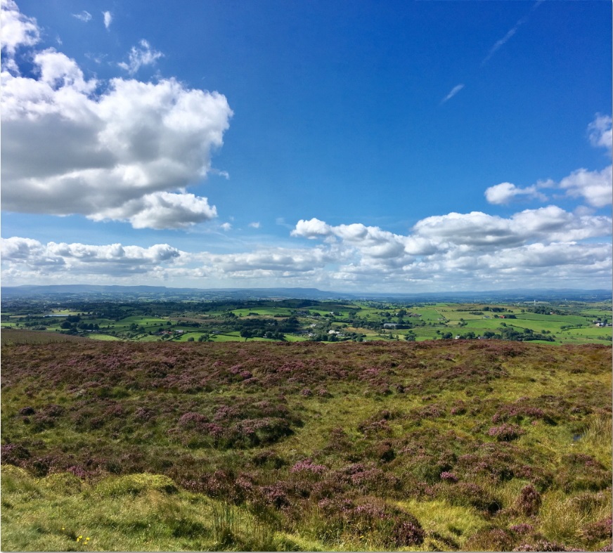
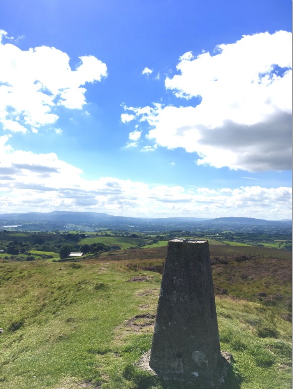
Topped Mountain, standing at only 277metres is technically a hill, however, a short, sharp climb from the car park leads to the summit which provides extensive 360 degree vistas over Upper and Lower Lough Erne and the west of the province. On a clear day the Sperrins can be seen to the north, Clogher Valley to the east and all of Fermanagh lies before you to the west. On the summit you will find a 'trig' point and an ancient cairn. The ancient cairn is a protected monument while the trig point was originally erected by Ordnance Survey to assist with the remapping of Britain.
TRAIL INFORMATION
Topped Mountain is signposted from main Enniskillen to Tempo Road. Gravel Car Park is on sharp bend beside small lough. Path starts at the car park and leads directly to summit.
TRAIL INFORMATION
Topped Mountain is signposted from main Enniskillen to Tempo Road. Gravel Car Park is on sharp bend beside small lough. Path starts at the car park and leads directly to summit.
GETTING TO THE START
- Point of Interest Trip point, viewpoint
- Facilities Car Park. Nearest facilities in nearby Lisbellaw.
- Dog Policy Dogs are not permitted at this is a working farm
- Accessibility Information
Accessibility Grade: Grade 5 Terrain: Gravel path, steep gradient Toilet Facility: No Signage: No - Getting to the Start Topped Mountain is signposted from main Enniskillen to Tempo Road. Gravel Car Park is on sharp bend beside small lough.