1.2 miles
Loop
Easy
Tully Castle Loughshore Walk
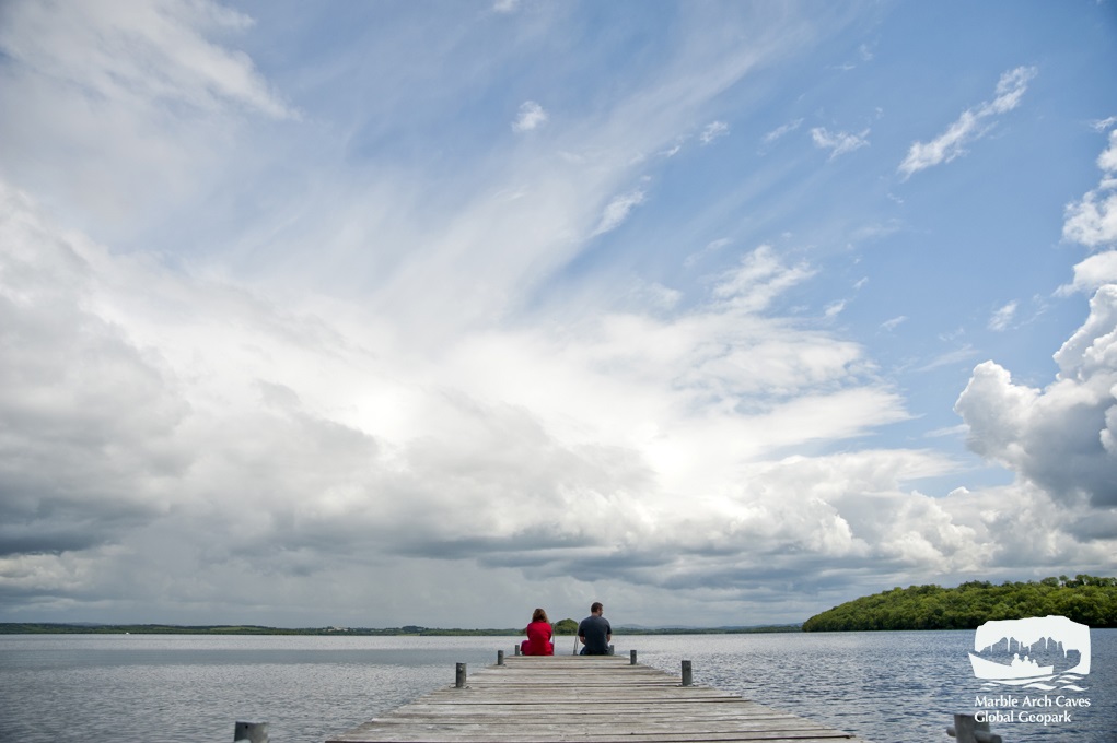
Part of the Marble Arch Caves Global Geopark, this charming walk takes in the castle grounds with commanding views of the castle ruins and the surrounding countryside. The walk continues into a mixed woodland area before breaking out into views across Lough Erne; Heron Island, Gay Island and Inishmakill Island can all be seen directly opposite the shoreline. These islands and surrounding shore are important for a variety of wild birds.
TRAIL INFORMATION
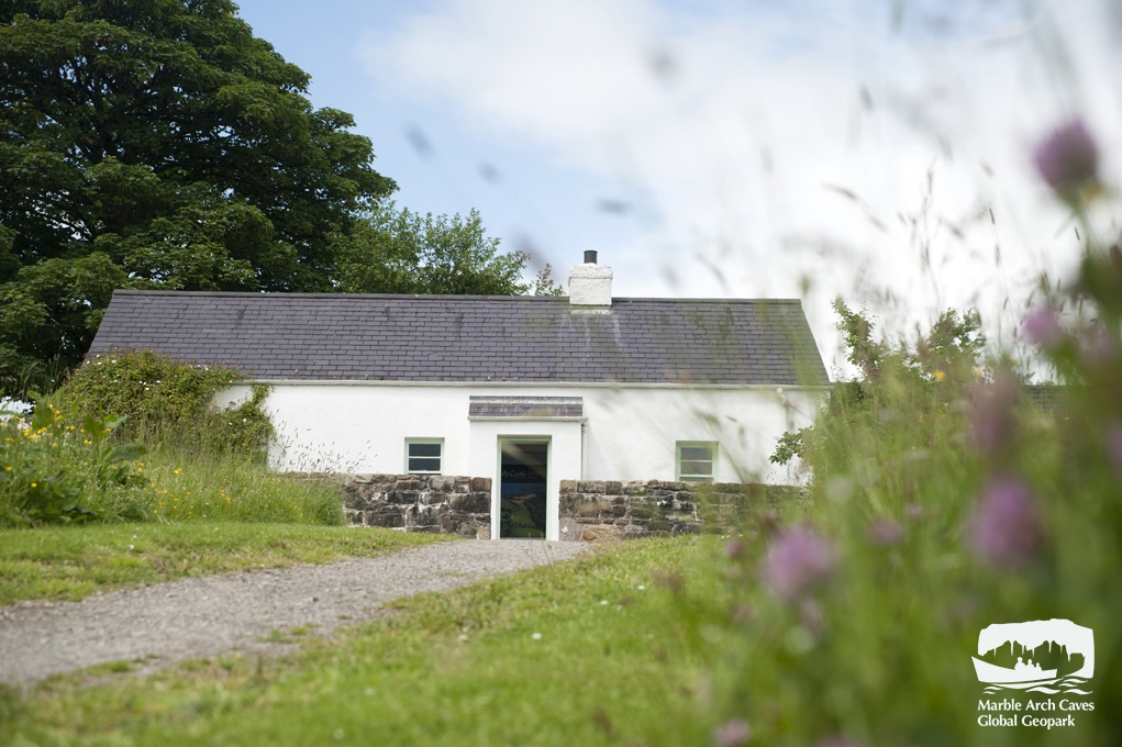
Tully Castle Lough Shore Walk is part of the Marble Arch Caves Global Geopark. The walk is located on a small headland jutting into Lower Lough Erne. Tully Castle stands at the top of a south-facing slope on Tully Point. During the Castles occupation in the early 17th Century, Lough Erne was a transport highway of the time. The start of the walk takes in the impressive remains of Tully Castle, situated in the townland of Tully. The fortified house and bawn built during the plantation era in the early 17th century stands on top of a south facing slope on Tully Point, which commands views around the immediate countryside and across the lough. Historically the castle is a “time capsule” as it was lived in for only thirty years. For over 350 years it lay ruined and desolate until 1974 when a programme of restoration and consolidation was undertaken to the castle, garden and footpaths. The path goes around the headland through deep woodland with a delightful mixture of broadleaved trees dominated by ash and beech. The undergrowth glows a vibrant green with mosses, lichen, wood sorrel, orchids, blue bells and ferns carpeting the ground in different seasons. Added to these surroundings are views where the woodland opens to provide glimpses of Lower Lough Erne and its surroundings. Take a moment to look at Heron Island, Gay Island and Inishmakill Island which are directly opposite the shoreline. These islands and the surrounding shore, are an important area for a variety of wild birds. Tully Castle, the gardens and cottage are managed by the Department of the Environment, Historic Environment Division and the shoreline is managed by the Marble Arch Caves Global Geopark and by Waterways Ireland. The highlights of the walk are the remains of the Plantation castle Tully Castle built in 1613 for Sir John Hume and the 19th-century cottage that has been transformed into an exhibition space outlining the history of the castle and surrounding area.
TRAIL INFORMATION
Tully Castle Lough Shore Walk is part of the Marble Arch Caves Global Geopark. The walk is located on a small headland jutting into Lower Lough Erne. Tully Castle stands at the top of a south-facing slope on Tully Point. During the Castles occupation in the early 17th Century, Lough Erne was a transport highway of the time. The start of the walk takes in the impressive remains of Tully Castle, situated in the townland of Tully. The fortified house and bawn built during the plantation era in the early 17th century stands on top of a south facing slope on Tully Point, which commands views around the immediate countryside and across the lough. Historically the castle is a “time capsule” as it was lived in for only thirty years. For over 350 years it lay ruined and desolate until 1974 when a programme of restoration and consolidation was undertaken to the castle, garden and footpaths. The path goes around the headland through deep woodland with a delightful mixture of broadleaved trees dominated by ash and beech. The undergrowth glows a vibrant green with mosses, lichen, wood sorrel, orchids, blue bells and ferns carpeting the ground in different seasons. Added to these surroundings are views where the woodland opens to provide glimpses of Lower Lough Erne and its surroundings. Take a moment to look at Heron Island, Gay Island and Inishmakill Island which are directly opposite the shoreline. These islands and the surrounding shore, are an important area for a variety of wild birds. Tully Castle, the gardens and cottage are managed by the Department of the Environment, Historic Environment Division and the shoreline is managed by the Marble Arch Caves Global Geopark and by Waterways Ireland. The highlights of the walk are the remains of the Plantation castle Tully Castle built in 1613 for Sir John Hume and the 19th-century cottage that has been transformed into an exhibition space outlining the history of the castle and surrounding area.
GETTING TO THE START
- Point of Interest Plantation castle Tully Castle built in 1613
- Facilities Toilets are picnic benches are available on site
- Getting to the Start From Enniskillen, travel north along the A46 Shore road towards Belleek. Approximately 15km from Enniskillen, Tully Castle is signed and located on the right.
- Level of Difficulty
 Easy TRAIL GRADE DISCLAIMER
 The trail grades shown on OutmoreNI.com and WalkNI.com are based on desk-based assessments of available trail information. The categories—Easy, Moderate, Strenuous, and Very Strenuous—follow the Sustainable Trails Development Guide grading system.
These grades are provided as a general guide to help users choose trails that may be suitable for them. They are not a substitute for official, on-site grading or safety information provided by the relevant land manager, which may differ from the information on these websites.
Outdoor activities involve inherent risks, including the risk of injury, death, property damage, and other hazards. By using information from OutmoreNI.com and WalkNI.com, you acknowledge that you do so at your own risk. OutmoreNI.com and WalkNI.com accept no responsibility or liability for any loss, injury, or damage arising from the use of this information.
Conditions on trails can change, and the actual environment may differ from what is described online. Users should always exercise their own judgment, take appropriate precautions, and remain responsible for their own safety and conduct at all times.
All information provided on OutmoreNI.com and WalkNI.com is intended as a guide only and should be used alongside your own experience, awareness, and careful decision-making.
Relatively flat or gently rolling trails with a mostly smooth surface. You might come across some obstacles like bridges, gates and steps.
Normal clothing and footwear can be worn.